Holsapple Dam Reservoir Report
Nearby: Trachsel Dam Sels Dam
Last Updated: February 2, 2026
Holsapple Dam, located in Mt.
°F
°F
mph
Wind
%
Humidity
15-Day Weather Outlook
Summary
Sterling, Iowa, was completed in 2000 by the USDA NRCS and serves as a private earth dam with a height of 30 feet and a length of 545 feet. The dam's primary purpose is for fire protection, stock, or as a small fish pond, with a storage capacity of 126 acre-feet and a surface area of 8.7 acres. It is regulated by the Iowa DNR and is in a low hazard potential category.
The dam, situated on the TR- FOX RIVER, falls under the jurisdiction of the Kansas City District of the US Army Corps of Engineers. Although it has not been rated for condition assessment, the risk level is moderate. The dam does not have any associated structures and does not feature a controlled spillway. Despite its low hazard potential, the dam plays a crucial role in providing water resources for the local area, highlighting the importance of proper maintenance and monitoring to ensure its continued functionality and safety.
Year Completed |
2000 |
Dam Length |
545 |
Dam Height |
30 |
River Or Stream |
TR- FOX RIVER |
Primary Dam Type |
Earth |
Surface Area |
8.7 |
Drainage Area |
0.34 |
Nid Storage |
126 |
Hazard Potential |
Low |
Foundations |
Soil |
Nid Height |
30 |
Seasonal Comparison
Hourly Weather Forecast
Nearby Streamflow Levels
 Des Moines River At Keosauqua
|
1800cfs |
 Fox River At Bloomfield
|
7cfs |
 Cedar Creek Near Oakland Mills
|
10cfs |
 Des Moines River At Ottumwa
|
1090cfs |
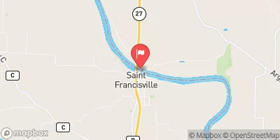
 Des Moines River At St. Francisville
|
1620cfs |
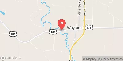
 Fox River At Wayland
|
8cfs |
Dam Data Reference
Condition Assessment
SatisfactoryNo existing or potential dam safety deficiencies are recognized. Acceptable performance is expected under all loading conditions (static, hydrologic, seismic) in accordance with the minimum applicable state or federal regulatory criteria or tolerable risk guidelines.
Fair
No existing dam safety deficiencies are recognized for normal operating conditions. Rare or extreme hydrologic and/or seismic events may result in a dam safety deficiency. Risk may be in the range to take further action. Note: Rare or extreme event is defined by the regulatory agency based on their minimum
Poor A dam safety deficiency is recognized for normal operating conditions which may realistically occur. Remedial action is necessary. POOR may also be used when uncertainties exist as to critical analysis parameters which identify a potential dam safety deficiency. Investigations and studies are necessary.
Unsatisfactory
A dam safety deficiency is recognized that requires immediate or emergency remedial action for problem resolution.
Not Rated
The dam has not been inspected, is not under state or federal jurisdiction, or has been inspected but, for whatever reason, has not been rated.
Not Available
Dams for which the condition assessment is restricted to approved government users.
Hazard Potential Classification
HighDams assigned the high hazard potential classification are those where failure or mis-operation will probably cause loss of human life.
Significant
Dams assigned the significant hazard potential classification are those dams where failure or mis-operation results in no probable loss of human life but can cause economic loss, environment damage, disruption of lifeline facilities, or impact other concerns. Significant hazard potential classification dams are often located in predominantly rural or agricultural areas but could be in areas with population and significant infrastructure.
Low
Dams assigned the low hazard potential classification are those where failure or mis-operation results in no probable loss of human life and low economic and/or environmental losses. Losses are principally limited to the owner's property.
Undetermined
Dams for which a downstream hazard potential has not been designated or is not provided.
Not Available
Dams for which the downstream hazard potential is restricted to approved government users.
Area Campgrounds
| Location | Reservations | Toilets |
|---|---|---|
 Waubonsie Trail Park
|
||
 Lake Sugema County Park
|
||
 Lacey - Keosauqua State Park
|
||
 Lacey-Keosauqua State Park Campground
|
||
 Austin County Park
|

 Holsapple Dam