Good Lake Dam

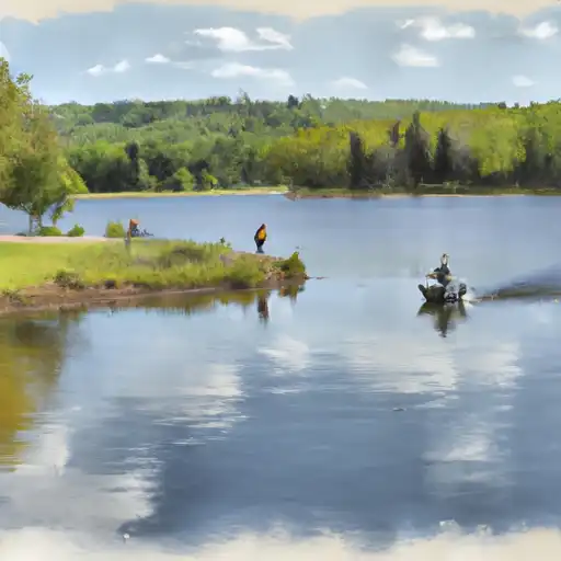
Good Lake
Good Lake in Clearwater, Minnesota, is a man-made reservoir managed by the Department of the Interior's Bureau of Indian Affairs. Completed in 1992, this dam stands at a height of 14 feet and has a storage capacity of 10,000 acre-feet, with a normal storage level of 5,000 acre-feet. Despite its low hazard potential, the condition assessment of Good Lake is currently not available, and it has not been inspected recently.
Located in the Omaha District and overseen by Collin Peterson (D), Good Lake serves as a vital water resource for the region. While its primary purpose and associated structures are not specified, the reservoir offers a glimpse into the intricate network of dams and water infrastructure that shapes our landscape. With its serene surroundings and essential role in water management, Good Lake is a testament to the intersection of human ingenuity and environmental stewardship in the face of changing climate patterns.
For water resource and climate enthusiasts, Good Lake represents a unique opportunity to explore the intersection of infrastructure, ecology, and conservation. As we strive to adapt to a rapidly changing climate, understanding the role of dams like Good Lake in water management and resilience efforts becomes increasingly crucial. By delving into the details of this structure and its management, enthusiasts can gain insights into the complexities of water resource management in a changing world and the importance of sustainable practices for safeguarding our natural resources for future generations.
Plan around the weather
Same NOAA / yr.no feed Snoflo's iOS app uses. Watch the precipitation column on the meteogram -- rain on the basin upstream typically lifts inflow 24-72 hours later.
Next 5 days, hour by hour
Temperature line with weather symbols on top, snow + rain accumulation as columns, humidity as a dotted line.
5-day forecast table
Every 3 hours, broken out across temperature, snow, rain, humidity, and wind. Each cell is colour-coded relative to the column min/max.
| Time | Condition | Temp (°F) | Snow (in) | Rain (in) | Humidity (%) | Wind (mps) | Wind dir |
|---|---|---|---|---|---|---|---|
| Loading detailed forecast… | |||||||
15-day temperature & precipitation
Daily temperatures, snow, and rain projected over the next two weeks.
Nearby streamflow gauges
USGS streamgauges around Good Lake -- inflows here typically show up in storage 24-72 hours later.
| Streamgauge | Discharge | View |
|---|---|---|
| Red Lake River At High Landing Nr Goodridge | 257 cfs | → |
| Red Lake River Near Red Lake | 137 cfs | → |
| Lost River At Oklee | 10 cfs | → |
| Clearwater River At Plummer | 80 cfs | → |
| Thief River Near Thief River Falls | 342 cfs | → |
| Clearwater River At Red Lake Falls | 92 cfs | → |


About Good Lake
Where does the data for Good Lake come from?
Structural and regulatory data come from the U.S. Army Corps of Engineers' National Inventory of Dams (NID). Weather forecast comes from NOAA / yr.no -- the same feed Snoflo's iOS app uses.
How often is the report updated?
NID structural data refreshes annually as the Corps publishes updated assessments. The weather forecast refreshes throughout the day.
What does the Low hazard rating mean?
The Corps of Engineers' hazard potential classification grades probable consequences if the dam fails: High = probable loss of human life; Significant = no probable loss of human life but possible economic loss / environmental damage; Low = no probable loss of human life, only minor economic / environmental losses. See the Dam Data Reference card below for the full definitions.
What's "% of normal"?
The current storage value compared to the historical average storage on this calendar day. 100% = right on average; values above 100% mean above-normal storage (wet year); values below mean below-normal (dry year or drought).
Can I get alerts when storage crosses a threshold?
Yes -- alerts are managed in the Snoflo iOS app. Favorite this dam, set a threshold, and you'll get a push the moment conditions cross.
Dam data reference
Condition Assessment
- Satisfactory
- No existing or potential dam safety deficiencies are recognized. Acceptable performance is expected under all loading conditions (static, hydrologic, seismic) in accordance with the minimum applicable state or federal regulatory criteria or tolerable risk guidelines.
- Fair
- No existing dam safety deficiencies are recognized for normal operating conditions. Rare or extreme hydrologic and/or seismic events may result in a dam safety deficiency. Risk may be in the range to take further action.
- Poor
- A dam safety deficiency is recognized for normal operating conditions which may realistically occur. Remedial action is necessary. POOR may also be used when uncertainties exist as to critical analysis parameters which identify a potential dam safety deficiency.
- Unsatisfactory
- A dam safety deficiency is recognized that requires immediate or emergency remedial action for problem resolution.
- Not Rated
- The dam has not been inspected, is not under state or federal jurisdiction, or has been inspected but, for whatever reason, has not been rated.
Hazard Potential Classification
- High
- Dams assigned the high hazard potential classification are those where failure or mis-operation will probably cause loss of human life.
- Significant
- Dams assigned the significant hazard potential classification are those dams where failure or mis-operation results in no probable loss of human life but can cause economic loss, environmental damage, disruption of lifeline facilities, or impact other concerns. Significant hazard potential classification dams are often located in predominantly rural or agricultural areas but could be in areas with population and significant infrastructure.
- Low
- Dams assigned the low hazard potential classification are those where failure or mis-operation results in no probable loss of human life and low economic and/or environmental losses. Losses are principally limited to the owner's property.
- Undetermined
- Dams for which a downstream hazard potential has not been designated or is not provided.