


Bull Shoals Dam Reservoir Report
Last Updated: May 2, 2026
Nearby: Ozark Acres Lake Dam Gardner Lake Dam
°F
°F
mph
Wind
%
Humidity
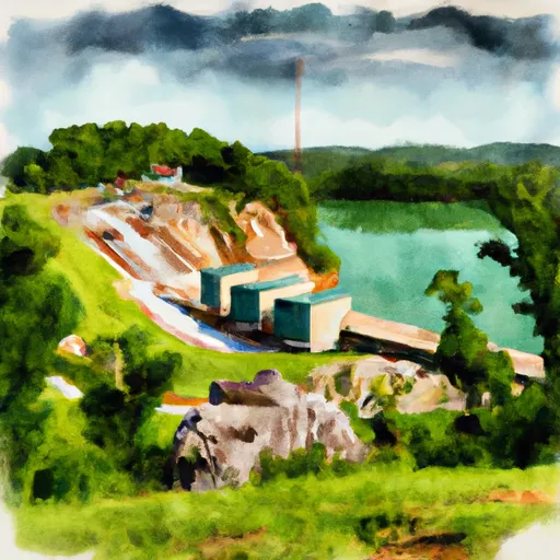
Bull Shoals Dam, also known as Bull Shoals Lake, is a concrete gravity dam located in Cotter, Baxter County, Arkansas.
Summary
Completed in 1951 by the US Army Corps of Engineers, the dam stands at a height of 256 feet and has a structural height of 282 feet. The primary purpose of Bull Shoals Dam is flood risk reduction, with additional benefits including hydroelectric power generation, recreational opportunities, and water supply for the surrounding area.
With a maximum storage capacity of 5,408,000 acre-feet and a drainage area of 6,063 square miles, Bull Shoals Dam plays a crucial role in reducing the risk of flooding to downstream communities along the White River. However, despite its successful history, extreme rainfall events can still pose a threat to the area. The US Army Corps of Engineers implements ongoing risk management measures, including regular inspections, maintenance, and monitoring activities, as well as the development and updating of emergency action plans to ensure the dam's integrity and reduce the risk to surrounding communities. Despite the moderate risk assessment, the dam's Emergency Action Plan and Risk Reduction Plan aim to minimize potential life loss in case of unforeseen flooding events.
Regional Streamflow Levels
 White River Near Norfork
|
4000cfs |
 Buffalo River Near Harriet
|
1850cfs |
 Bryant Creek Near Tecumseh
|
626cfs |
 North Fork River Near Tecumseh
|
1060cfs |
 Buffalo River Near St. Joe
|
1440cfs |
 White River At Calico Rock
|
5990cfs |
15-Day Long Term Forecast
Year Completed |
1951 |
Dam Length |
2256 |
Dam Height |
256 |
River Or Stream |
WHITE |
Primary Dam Type |
Concrete |
Surface Area |
454400 |
Hydraulic Height |
238 |
Drainage Area |
6063 |
Nid Storage |
5408000 |
Structural Height |
282 |
Hazard Potential |
High |
Foundations |
Rock |
Nid Height |
282 |
Seasonal Comparison
5-Day Hourly Forecast Detail
Dam Data Reference
Condition Assessment
SatisfactoryNo existing or potential dam safety deficiencies are recognized. Acceptable performance is expected under all loading conditions (static, hydrologic, seismic) in accordance with the minimum applicable state or federal regulatory criteria or tolerable risk guidelines.
Fair
No existing dam safety deficiencies are recognized for normal operating conditions. Rare or extreme hydrologic and/or seismic events may result in a dam safety deficiency. Risk may be in the range to take further action. Note: Rare or extreme event is defined by the regulatory agency based on their minimum
Poor A dam safety deficiency is recognized for normal operating conditions which may realistically occur. Remedial action is necessary. POOR may also be used when uncertainties exist as to critical analysis parameters which identify a potential dam safety deficiency. Investigations and studies are necessary.
Unsatisfactory
A dam safety deficiency is recognized that requires immediate or emergency remedial action for problem resolution.
Not Rated
The dam has not been inspected, is not under state or federal jurisdiction, or has been inspected but, for whatever reason, has not been rated.
Not Available
Dams for which the condition assessment is restricted to approved government users.
Hazard Potential Classification
HighDams assigned the high hazard potential classification are those where failure or mis-operation will probably cause loss of human life.
Significant
Dams assigned the significant hazard potential classification are those dams where failure or mis-operation results in no probable loss of human life but can cause economic loss, environment damage, disruption of lifeline facilities, or impact other concerns. Significant hazard potential classification dams are often located in predominantly rural or agricultural areas but could be in areas with population and significant infrastructure.
Low
Dams assigned the low hazard potential classification are those where failure or mis-operation results in no probable loss of human life and low economic and/or environmental losses. Losses are principally limited to the owner's property.
Undetermined
Dams for which a downstream hazard potential has not been designated or is not provided.
Not Available
Dams for which the downstream hazard potential is restricted to approved government users.
 Bull Shoals State Park
 Lakeview - Bull Shoals Lake
 Dam Site - Bull Shoals Lake
 Point Return City Park
 Oakland - Bull Shoals Lake
 Ozark Isle - Bull Shoals Lake
 Lake Taneycomo At Ozark Beach Dam
 Lake Taneycomo At School Of The Ozarks
 Bull Shoals Dam Boulevard Bull Shoals
 Hebron Access Site To Southern Forest Boundary In Sec 33, T24N, R11W
 North Fork Illinois Bayou To Headwaters Below Pedestal Rock
 Little North Fork White River
 Trimble Creek
 Bull Shoals Lake
 Gunner Creek
 Langston Lake