


West Fork Big Creek Watershed Site B-51 Reservoir Report
Last Updated: April 26, 2026
°F
°F
mph
Wind
%
Humidity
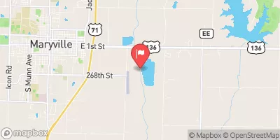
West Fork Big Creek Watershed Site B-51 is a vital structure located in Ringgold County, Iowa, designed by the USDA NRCS for fire protection, stock, or small fish pond purposes as well as flood risk reduction.
Summary
Completed in 1992, this earthen dam stands at 24 feet in height, with a length of 415 feet, and a storage capacity of 78 acre-feet. With a low hazard potential and a moderate risk assessment rating, this site is owned by the local government and regulated by the Iowa DNR, ensuring its safety and compliance with state regulations.
Situated along the TR- West Fork Big Creek, this watershed site plays a crucial role in managing water resources in the region, with a drainage area of 0.26 square miles and a surface area of 3.6 acres. Despite not being rated for condition assessment, the dam's design and construction by the Natural Resources Conservation Service highlight its resilience and effectiveness in mitigating flood risks and protecting the surrounding environment. The presence of an uncontrolled spillway and its strategic location in a high-risk flood area make it a key asset for water resource and climate enthusiasts to monitor and study.
As part of the Rock Island District, West Fork Big Creek Watershed Site B-51's significance extends beyond its primary purposes, serving as a valuable resource for the community and wildlife. With its location in a state-regulated area and the involvement of federal agencies like the USDA NRCS, this site exemplifies collaborative efforts to manage and protect water resources in Iowa. Its history, design features, and risk assessment provide a fascinating case study for those interested in sustainable water management practices and climate resilience strategies in the Midwest.
Regional Streamflow Levels
 Thompson River At Davis City
|
375cfs |
 East Fork Big Creek Near Bethany
|
22cfs |
 East Fork 102 River At Bedford
|
58cfs |
 Thompson River At Trenton
|
1560cfs |
 Grand River Near Gallatin
|
412cfs |
 One Hundred And Two River At Maryville
|
365cfs |
15-Day Long Term Forecast
Year Completed |
1992 |
Dam Length |
415 |
Dam Height |
24 |
River Or Stream |
TR- WEST FORK BIG CREEK |
Primary Dam Type |
Earth |
Surface Area |
3.6 |
Drainage Area |
0.26 |
Nid Storage |
78 |
Hazard Potential |
Low |
Foundations |
Soil |
Nid Height |
24 |
Seasonal Comparison
5-Day Hourly Forecast Detail
Dam Data Reference
Condition Assessment
SatisfactoryNo existing or potential dam safety deficiencies are recognized. Acceptable performance is expected under all loading conditions (static, hydrologic, seismic) in accordance with the minimum applicable state or federal regulatory criteria or tolerable risk guidelines.
Fair
No existing dam safety deficiencies are recognized for normal operating conditions. Rare or extreme hydrologic and/or seismic events may result in a dam safety deficiency. Risk may be in the range to take further action. Note: Rare or extreme event is defined by the regulatory agency based on their minimum
Poor A dam safety deficiency is recognized for normal operating conditions which may realistically occur. Remedial action is necessary. POOR may also be used when uncertainties exist as to critical analysis parameters which identify a potential dam safety deficiency. Investigations and studies are necessary.
Unsatisfactory
A dam safety deficiency is recognized that requires immediate or emergency remedial action for problem resolution.
Not Rated
The dam has not been inspected, is not under state or federal jurisdiction, or has been inspected but, for whatever reason, has not been rated.
Not Available
Dams for which the condition assessment is restricted to approved government users.
Hazard Potential Classification
HighDams assigned the high hazard potential classification are those where failure or mis-operation will probably cause loss of human life.
Significant
Dams assigned the significant hazard potential classification are those dams where failure or mis-operation results in no probable loss of human life but can cause economic loss, environment damage, disruption of lifeline facilities, or impact other concerns. Significant hazard potential classification dams are often located in predominantly rural or agricultural areas but could be in areas with population and significant infrastructure.
Low
Dams assigned the low hazard potential classification are those where failure or mis-operation results in no probable loss of human life and low economic and/or environmental losses. Losses are principally limited to the owner's property.
Undetermined
Dams for which a downstream hazard potential has not been designated or is not provided.
Not Available
Dams for which the downstream hazard potential is restricted to approved government users.