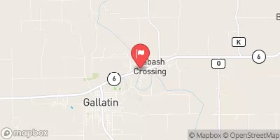
Cannon Dam Reservoir Report
Last Updated: February 5, 2026
Cannon Dam, located in Decatur County, Iowa, was completed in 1988 and is primarily used for fire protection, stock, and small fish pond purposes.
°F
°F
mph
Wind
%
Humidity
15-Day Weather Outlook
Summary
The earth dam stands at a height of 28 feet and spans a length of 280 feet, with a storage capacity of 62 acre-feet. The dam is regulated by the Iowa Department of Natural Resources and is deemed to have a low hazard potential and a moderate risk level.
Situated on TR-Shane Creek, a tributary to the Missouri River, Cannon Dam plays a crucial role in managing water resources in the area. The dam's location in a rural setting underscores its importance for agricultural and environmental purposes. Despite not having a spillway, the dam's design by the Soil Conservation Service ensures its structural integrity and functionality for maintaining water levels in the surrounding area.
With its efficient operation, Cannon Dam contributes to the overall water management efforts in Iowa. The dam's moderate risk level signifies the need for ongoing monitoring and maintenance to uphold its functionality and safety standards. As a key water resource infrastructure in the region, Cannon Dam serves as a testament to the importance of sustainable water management practices in the face of changing climate conditions.
Year Completed |
1988 |
Dam Length |
280 |
Dam Height |
28 |
River Or Stream |
TR-SHANE CREEK |
Primary Dam Type |
Earth |
Surface Area |
3.9 |
Drainage Area |
0.21 |
Nid Storage |
62 |
Hazard Potential |
Low |
Foundations |
Soil |
Nid Height |
28 |
Seasonal Comparison
Hourly Weather Forecast
Nearby Streamflow Levels
Dam Data Reference
Condition Assessment
SatisfactoryNo existing or potential dam safety deficiencies are recognized. Acceptable performance is expected under all loading conditions (static, hydrologic, seismic) in accordance with the minimum applicable state or federal regulatory criteria or tolerable risk guidelines.
Fair
No existing dam safety deficiencies are recognized for normal operating conditions. Rare or extreme hydrologic and/or seismic events may result in a dam safety deficiency. Risk may be in the range to take further action. Note: Rare or extreme event is defined by the regulatory agency based on their minimum
Poor A dam safety deficiency is recognized for normal operating conditions which may realistically occur. Remedial action is necessary. POOR may also be used when uncertainties exist as to critical analysis parameters which identify a potential dam safety deficiency. Investigations and studies are necessary.
Unsatisfactory
A dam safety deficiency is recognized that requires immediate or emergency remedial action for problem resolution.
Not Rated
The dam has not been inspected, is not under state or federal jurisdiction, or has been inspected but, for whatever reason, has not been rated.
Not Available
Dams for which the condition assessment is restricted to approved government users.
Hazard Potential Classification
HighDams assigned the high hazard potential classification are those where failure or mis-operation will probably cause loss of human life.
Significant
Dams assigned the significant hazard potential classification are those dams where failure or mis-operation results in no probable loss of human life but can cause economic loss, environment damage, disruption of lifeline facilities, or impact other concerns. Significant hazard potential classification dams are often located in predominantly rural or agricultural areas but could be in areas with population and significant infrastructure.
Low
Dams assigned the low hazard potential classification are those where failure or mis-operation results in no probable loss of human life and low economic and/or environmental losses. Losses are principally limited to the owner's property.
Undetermined
Dams for which a downstream hazard potential has not been designated or is not provided.
Not Available
Dams for which the downstream hazard potential is restricted to approved government users.


 Cannon Dam