


Mississippi River Lock And Dam 10 Reservoir Report
Last Updated: May 1, 2026
Nearby: Pattison Dam Camp Klaus Dam
°F
°F
mph
Wind
%
Humidity
Mississippi River Lock and Dam 10, located in Guttenberg, Iowa, is a vital water resource structure managed by the US Army Corps of Engineers.
Summary
Completed in 1937, this concrete dam stands at 20 feet high with a hydraulic height of 33 feet and a structural height of 43 feet. The dam serves the primary purpose of navigation on the Mississippi River, with recreational activities also supported in the area.
Lock & Dam 10 features a controlled spillway that regulates the water level for navigation purposes, with a maximum discharge capacity of 308,000 cubic feet per second. Despite being classified as a significant hazard potential structure, the risk assessment conducted in 2015 deemed it a low-risk dam due to ongoing risk management measures implemented by USACE. Regular maintenance and repairs are conducted to ensure the dam's functionality and to address potential risks such as aging infrastructure and navigation accidents.
USACE remains committed to reducing risks associated with Lock & Dam 10, engaging with the public to raise awareness and coordinating with emergency managers during flood events. With a focus on safety and effective risk management, this dam continues to play a crucial role in maintaining river traffic while safeguarding the surrounding environment and communities.
Regional Streamflow Levels
 Turkey River At Garber
|
1980cfs |
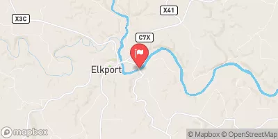
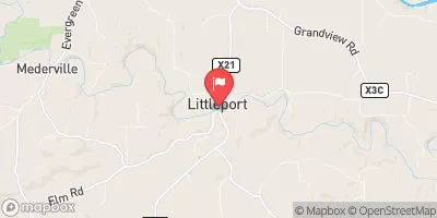 Volga River At Littleport
|
384cfs |
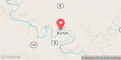 Grant River At Burton
|
352cfs |
 Turkey River Above French Hollow Cr At Elkader
|
1310cfs |
 Mississippi River At Mcgregor
|
21700cfs |
 Bloody Run Creek Near Marquette
|
32cfs |
15-Day Long Term Forecast
Year Completed |
1937 |
Dam Length |
6788 |
Dam Height |
20 |
River Or Stream |
MISSISSIPPI RIVER |
Primary Dam Type |
Concrete |
Surface Area |
17070 |
Length Of Locks |
600 |
Hydraulic Height |
33 |
Drainage Area |
79370 |
Nid Storage |
212000 |
Structural Height |
43 |
Outlet Gates |
Roller - 4, Tainter (radial) - 8, Uncontrolled - 0 |
Hazard Potential |
Significant |
Foundations |
Soil |
Nid Height |
43 |
Seasonal Comparison
5-Day Hourly Forecast Detail
Dam Data Reference
Condition Assessment
SatisfactoryNo existing or potential dam safety deficiencies are recognized. Acceptable performance is expected under all loading conditions (static, hydrologic, seismic) in accordance with the minimum applicable state or federal regulatory criteria or tolerable risk guidelines.
Fair
No existing dam safety deficiencies are recognized for normal operating conditions. Rare or extreme hydrologic and/or seismic events may result in a dam safety deficiency. Risk may be in the range to take further action. Note: Rare or extreme event is defined by the regulatory agency based on their minimum
Poor A dam safety deficiency is recognized for normal operating conditions which may realistically occur. Remedial action is necessary. POOR may also be used when uncertainties exist as to critical analysis parameters which identify a potential dam safety deficiency. Investigations and studies are necessary.
Unsatisfactory
A dam safety deficiency is recognized that requires immediate or emergency remedial action for problem resolution.
Not Rated
The dam has not been inspected, is not under state or federal jurisdiction, or has been inspected but, for whatever reason, has not been rated.
Not Available
Dams for which the condition assessment is restricted to approved government users.
Hazard Potential Classification
HighDams assigned the high hazard potential classification are those where failure or mis-operation will probably cause loss of human life.
Significant
Dams assigned the significant hazard potential classification are those dams where failure or mis-operation results in no probable loss of human life but can cause economic loss, environment damage, disruption of lifeline facilities, or impact other concerns. Significant hazard potential classification dams are often located in predominantly rural or agricultural areas but could be in areas with population and significant infrastructure.
Low
Dams assigned the low hazard potential classification are those where failure or mis-operation results in no probable loss of human life and low economic and/or environmental losses. Losses are principally limited to the owner's property.
Undetermined
Dams for which a downstream hazard potential has not been designated or is not provided.
Not Available
Dams for which the downstream hazard potential is restricted to approved government users.
 Frenchtown Park
 C
C
 B
B
 29E
29E
 28E
28E
 27E
27E
 Guttenberg Public Landing
 Western Boundary Of Effigy Mounds National Monument To Boundary Of Effigy Mounds National Monument
 The Big Green River
To The River'S Mouth At The Mississippi River
The Big Green River
To The River'S Mouth At The Mississippi River
 The "Lower" Dam, Near The Confluence Of Coon Creek To Lane'S Bridge
 Lone Rock
To The Confluence Of The Green And Wisconsin Rivers
Lone Rock
To The Confluence Of The Green And Wisconsin Rivers
 Buck Creek
 Little Turkey River
 Paint Creek
 Hickory Creek
 Little Paint Creek