Weppler #1 Dam

Weppler #1
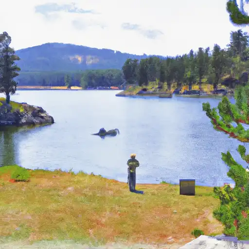
Weppler #1, located in Stillwater, Montana, is a privately owned earth dam completed in 1950 by the USDA NRCS for fire protection, stock, and small fish pond purposes. With a height of 35 feet and a length of 350 feet, the dam has a storage capacity of 264 acre-feet and covers a surface area of 22 acres. It is situated on TR-BIG COULEE CREEK and is regulated by the Montana Department of Natural Resources and Conservation (DNRC) for permitting, inspection, and enforcement.
Despite being classified as low hazard potential and not yet rated for its condition, Weppler #1 serves as a vital water resource infrastructure for the surrounding area, offering protection against fires and supporting agricultural activities. While lacking certain safety assessments and emergency preparedness measures, the dam remains an integral component of the local water management system. As climate change continues to impact water resources, monitoring and maintaining structures like Weppler #1 will be crucial for ensuring water security and resilience in the face of evolving conditions.
Given its location in a congressional district represented by Greg Gianforte, Weppler #1 highlights the intersection of water resource management, infrastructure development, and climate adaptation efforts in Montana. As water resource and climate enthusiasts, monitoring the condition and regulatory oversight of dams like Weppler #1 can provide valuable insights into the challenges and opportunities associated with ensuring sustainable water management practices in the region.
Plan around the weather
Same NOAA / yr.no feed Snoflo's iOS app uses. Watch the precipitation column on the meteogram -- rain on the basin upstream typically lifts inflow 24-72 hours later.
Next 5 days, hour by hour
Temperature line with weather symbols on top, snow + rain accumulation as columns, humidity as a dotted line.
5-day forecast table
Every 3 hours, broken out across temperature, snow, rain, humidity, and wind. Each cell is colour-coded relative to the column min/max.
| Time | Condition | Temp (°F) | Snow (in) | Rain (in) | Humidity (%) | Wind (mps) | Wind dir |
|---|---|---|---|---|---|---|---|
| Loading detailed forecast… | |||||||
15-day temperature & precipitation
Daily temperatures, snow, and rain projected over the next two weeks.
Nearby streamflow gauges
USGS streamgauges around Weppler #1 -- inflows here typically show up in storage 24-72 hours later.
| Streamgauge | Discharge | View |
|---|---|---|
| Musselshell River Ab Mud Cr Nr Shawmut Mt | 41 cfs | → |
| Musselshell River At Harlowton Mt | 34 cfs | → |
| Boulder River At Big Timber Mt | 274 cfs | → |
| Stillwater River Near Absarokee Mt | 1,430 cfs | → |
| Musselshell River Near Roundup Mt | 169 cfs | → |
| Red Lodge Cr Ab Cooney Re Nr Boyd Mt | 39 cfs | → |


About Weppler #1
Where does the data for Weppler #1 come from?
Structural and regulatory data come from the U.S. Army Corps of Engineers' National Inventory of Dams (NID). Weather forecast comes from NOAA / yr.no -- the same feed Snoflo's iOS app uses.
How often is the report updated?
NID structural data refreshes annually as the Corps publishes updated assessments. The weather forecast refreshes throughout the day.
What does the Low hazard rating mean?
The Corps of Engineers' hazard potential classification grades probable consequences if the dam fails: High = probable loss of human life; Significant = no probable loss of human life but possible economic loss / environmental damage; Low = no probable loss of human life, only minor economic / environmental losses. See the Dam Data Reference card below for the full definitions.
What's "% of normal"?
The current storage value compared to the historical average storage on this calendar day. 100% = right on average; values above 100% mean above-normal storage (wet year); values below mean below-normal (dry year or drought).
Can I get alerts when storage crosses a threshold?
Yes -- alerts are managed in the Snoflo iOS app. Favorite this dam, set a threshold, and you'll get a push the moment conditions cross.
Dam data reference
Condition Assessment
- Satisfactory
- No existing or potential dam safety deficiencies are recognized. Acceptable performance is expected under all loading conditions (static, hydrologic, seismic) in accordance with the minimum applicable state or federal regulatory criteria or tolerable risk guidelines.
- Fair
- No existing dam safety deficiencies are recognized for normal operating conditions. Rare or extreme hydrologic and/or seismic events may result in a dam safety deficiency. Risk may be in the range to take further action.
- Poor
- A dam safety deficiency is recognized for normal operating conditions which may realistically occur. Remedial action is necessary. POOR may also be used when uncertainties exist as to critical analysis parameters which identify a potential dam safety deficiency.
- Unsatisfactory
- A dam safety deficiency is recognized that requires immediate or emergency remedial action for problem resolution.
- Not Rated
- The dam has not been inspected, is not under state or federal jurisdiction, or has been inspected but, for whatever reason, has not been rated.
Hazard Potential Classification
- High
- Dams assigned the high hazard potential classification are those where failure or mis-operation will probably cause loss of human life.
- Significant
- Dams assigned the significant hazard potential classification are those dams where failure or mis-operation results in no probable loss of human life but can cause economic loss, environmental damage, disruption of lifeline facilities, or impact other concerns. Significant hazard potential classification dams are often located in predominantly rural or agricultural areas but could be in areas with population and significant infrastructure.
- Low
- Dams assigned the low hazard potential classification are those where failure or mis-operation results in no probable loss of human life and low economic and/or environmental losses. Losses are principally limited to the owner's property.
- Undetermined
- Dams for which a downstream hazard potential has not been designated or is not provided.