
Jappe Reservoir Report
Nearby: Chip Dipper Moes
Last Updated: December 23, 2025
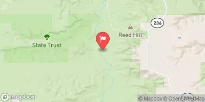
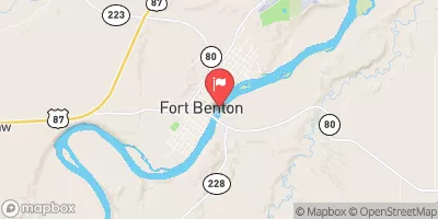
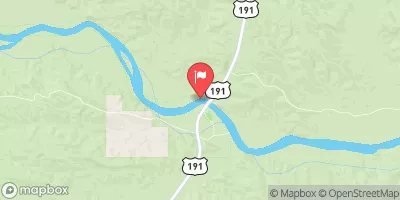
Jappe is a privately owned irrigation dam located in Chouteau, Montana, along the Eightmile Coulee.
°F
°F
mph
Wind
%
Humidity
Summary
Built in 1956 by the USDA NRCS, this Earth dam stands at 36 feet high with a hydraulic height of 32 feet and a length of 600 feet. With a storage capacity of 500 acre-feet and a drainage area of 7.03 square miles, Jappe serves the primary purpose of irrigation for the surrounding area.
Despite its age, Jappe has a low hazard potential and is currently rated as "Not Rated" in terms of its condition assessment. The dam is regulated and inspected by the Montana Department of Natural Resources and Conservation, ensuring that it meets state permitting and enforcement regulations. While there is no emergency action plan in place for Jappe, the risk assessment and management measures for potential hazards are yet to be determined.
Located in a remote area with no town nearby, Jappe stands as a testament to the importance of water resource management in Montana. With its historic significance and vital role in irrigation, this dam represents a crucial piece of infrastructure that contributes to the sustainability of agriculture in the region. For water resource and climate enthusiasts, Jappe serves as a fascinating example of how human intervention can shape and impact the natural landscape.
Year Completed |
1956 |
Dam Length |
600 |
Dam Height |
36 |
River Or Stream |
EIGHTMILE COULEE |
Primary Dam Type |
Earth |
Hydraulic Height |
32 |
Drainage Area |
7.03 |
Nid Storage |
500 |
Hazard Potential |
Low |
Nid Height |
36 |
Seasonal Comparison
Weather Forecast
Nearby Streamflow Levels
 Judith River Nr Mouth
|
368cfs |
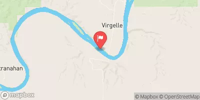 Missouri River At Virgelle Mt
|
4290cfs |
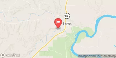 Teton River At Loma Mt
|
48cfs |
 Marias River Near Loma Mt
|
335cfs |
 Missouri River At Fort Benton Mt
|
4360cfs |
 Missouri River Near Landusky Mt
|
9100cfs |
Dam Data Reference
Condition Assessment
SatisfactoryNo existing or potential dam safety deficiencies are recognized. Acceptable performance is expected under all loading conditions (static, hydrologic, seismic) in accordance with the minimum applicable state or federal regulatory criteria or tolerable risk guidelines.
Fair
No existing dam safety deficiencies are recognized for normal operating conditions. Rare or extreme hydrologic and/or seismic events may result in a dam safety deficiency. Risk may be in the range to take further action. Note: Rare or extreme event is defined by the regulatory agency based on their minimum
Poor A dam safety deficiency is recognized for normal operating conditions which may realistically occur. Remedial action is necessary. POOR may also be used when uncertainties exist as to critical analysis parameters which identify a potential dam safety deficiency. Investigations and studies are necessary.
Unsatisfactory
A dam safety deficiency is recognized that requires immediate or emergency remedial action for problem resolution.
Not Rated
The dam has not been inspected, is not under state or federal jurisdiction, or has been inspected but, for whatever reason, has not been rated.
Not Available
Dams for which the condition assessment is restricted to approved government users.
Hazard Potential Classification
HighDams assigned the high hazard potential classification are those where failure or mis-operation will probably cause loss of human life.
Significant
Dams assigned the significant hazard potential classification are those dams where failure or mis-operation results in no probable loss of human life but can cause economic loss, environment damage, disruption of lifeline facilities, or impact other concerns. Significant hazard potential classification dams are often located in predominantly rural or agricultural areas but could be in areas with population and significant infrastructure.
Low
Dams assigned the low hazard potential classification are those where failure or mis-operation results in no probable loss of human life and low economic and/or environmental losses. Losses are principally limited to the owner's property.
Undetermined
Dams for which a downstream hazard potential has not been designated or is not provided.
Not Available
Dams for which the downstream hazard potential is restricted to approved government users.
Area Campgrounds
| Location | Reservations | Toilets |
|---|---|---|
 THE WALL
|
||
 SLAUGHTER RIVER
|
||
 PABLO RAPIDS (LOWER SITE)
|
||
 Judith Landing
|
||
 DARK BUTTE
|
 Jappe
Jappe
 THE WALL
 SLAUGHTER RIVER
 PABLO RAPIDS (LOWER SITE)
 MT-236 Chouteau County
 JUDITH LANDING