Camp Creek Dam Reservoir Report
Nearby: Fairchild Dam Policky Dam
Last Updated: December 14, 2025
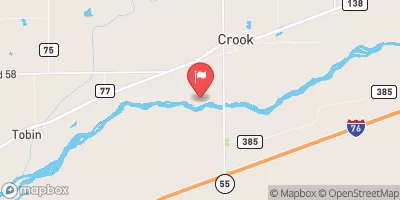
Camp Creek Dam, located in Morrill, Nebraska, is a privately owned structure designed by the USDA NRCS and regulated by the Nebraska Department of Natural Resources.
°F
°F
mph
Wind
%
Humidity
Summary
Completed in 1964, this earth dam stands at a height of 34 feet and serves the primary purpose of flood risk reduction along Camp Creek. With a storage capacity of 381 acre-feet, the dam plays a crucial role in managing water resources in the area.
The dam's low hazard potential and satisfactory condition assessment highlight its effectiveness in mitigating flood risks. The structure spans 797 feet in length and has a drainage area of 4.2 square miles, with a maximum discharge capacity of 3440 cubic feet per second. Despite its age, Camp Creek Dam has undergone regular inspections, with the most recent assessment conducted in October 2020, ensuring its continued functionality in safeguarding the surrounding community from potential flooding events.
Water resource and climate enthusiasts will appreciate Camp Creek Dam for its role in flood risk reduction and water management in the region. With its strategic location and design, this earth dam stands as a testament to effective infrastructure that balances the needs of water resource management and environmental protection. As climate change continues to impact water systems, structures like Camp Creek Dam play a crucial role in ensuring the resilience and sustainability of our water resources for future generations.
Year Completed |
1964 |
Dam Length |
797 |
Dam Height |
34 |
River Or Stream |
CAMP CREEK |
Primary Dam Type |
Earth |
Surface Area |
10 |
Hydraulic Height |
33 |
Drainage Area |
4.2 |
Nid Storage |
381 |
Structural Height |
38 |
Hazard Potential |
Low |
Foundations |
Soil |
Nid Height |
38 |
Seasonal Comparison
Weather Forecast
Nearby Streamflow Levels
 South Platte River Near Crook
|
173cfs |
 S. Platte R. At Julesburg
|
-999cfs |
 Lodgepole Creek At Bushnell
|
2cfs |
Dam Data Reference
Condition Assessment
SatisfactoryNo existing or potential dam safety deficiencies are recognized. Acceptable performance is expected under all loading conditions (static, hydrologic, seismic) in accordance with the minimum applicable state or federal regulatory criteria or tolerable risk guidelines.
Fair
No existing dam safety deficiencies are recognized for normal operating conditions. Rare or extreme hydrologic and/or seismic events may result in a dam safety deficiency. Risk may be in the range to take further action. Note: Rare or extreme event is defined by the regulatory agency based on their minimum
Poor A dam safety deficiency is recognized for normal operating conditions which may realistically occur. Remedial action is necessary. POOR may also be used when uncertainties exist as to critical analysis parameters which identify a potential dam safety deficiency. Investigations and studies are necessary.
Unsatisfactory
A dam safety deficiency is recognized that requires immediate or emergency remedial action for problem resolution.
Not Rated
The dam has not been inspected, is not under state or federal jurisdiction, or has been inspected but, for whatever reason, has not been rated.
Not Available
Dams for which the condition assessment is restricted to approved government users.
Hazard Potential Classification
HighDams assigned the high hazard potential classification are those where failure or mis-operation will probably cause loss of human life.
Significant
Dams assigned the significant hazard potential classification are those dams where failure or mis-operation results in no probable loss of human life but can cause economic loss, environment damage, disruption of lifeline facilities, or impact other concerns. Significant hazard potential classification dams are often located in predominantly rural or agricultural areas but could be in areas with population and significant infrastructure.
Low
Dams assigned the low hazard potential classification are those where failure or mis-operation results in no probable loss of human life and low economic and/or environmental losses. Losses are principally limited to the owner's property.
Undetermined
Dams for which a downstream hazard potential has not been designated or is not provided.
Not Available
Dams for which the downstream hazard potential is restricted to approved government users.

 Camp Creek Dam