Hamburg Flood Control (Pa-477) Reservoir Report
Last Updated: February 23, 2026
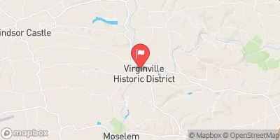
Hamburg Flood Control (Pa-477) is a vital infrastructure project located in Windsor Township, Berks County, Pennsylvania, designed by the USDA NRCS to mitigate flood risks along the TR Mill Creek.
Summary
Completed in 1965, this earth dam stands at a height of 52 feet and spans 1550 feet, providing a significant storage capacity of 371 acre-feet. Owned and regulated by the local government, this structure is subject to state permitting, inspection, and enforcement by the Pennsylvania Department of Environmental Protection.
The primary purpose of Hamburg Flood Control is flood risk reduction, serving as a critical defense against high hazard potential in the area. Despite being assessed as in fair condition, with a relatively small surface area of 3 acres and drainage area of 1.6 square miles, this dam plays a crucial role in protecting the surrounding community from potential inundation. With a last inspection date in November 2020 and an emergency action plan status unknown, ongoing maintenance and risk management measures are essential to ensure the continued effectiveness of this flood control structure in safeguarding the region against water-related disasters.
°F
°F
mph
Wind
%
Humidity
15-Day Weather Outlook
Year Completed |
1965 |
Dam Length |
1550 |
Dam Height |
52 |
River Or Stream |
TR MILL CREEK |
Primary Dam Type |
Earth |
Surface Area |
3 |
Drainage Area |
1.6 |
Nid Storage |
371 |
Hazard Potential |
High |
Foundations |
Unlisted/Unknown |
Nid Height |
52 |
Seasonal Comparison
5-Day Hourly Forecast Detail
Nearby Streamflow Levels
Dam Data Reference
Condition Assessment
SatisfactoryNo existing or potential dam safety deficiencies are recognized. Acceptable performance is expected under all loading conditions (static, hydrologic, seismic) in accordance with the minimum applicable state or federal regulatory criteria or tolerable risk guidelines.
Fair
No existing dam safety deficiencies are recognized for normal operating conditions. Rare or extreme hydrologic and/or seismic events may result in a dam safety deficiency. Risk may be in the range to take further action. Note: Rare or extreme event is defined by the regulatory agency based on their minimum
Poor A dam safety deficiency is recognized for normal operating conditions which may realistically occur. Remedial action is necessary. POOR may also be used when uncertainties exist as to critical analysis parameters which identify a potential dam safety deficiency. Investigations and studies are necessary.
Unsatisfactory
A dam safety deficiency is recognized that requires immediate or emergency remedial action for problem resolution.
Not Rated
The dam has not been inspected, is not under state or federal jurisdiction, or has been inspected but, for whatever reason, has not been rated.
Not Available
Dams for which the condition assessment is restricted to approved government users.
Hazard Potential Classification
HighDams assigned the high hazard potential classification are those where failure or mis-operation will probably cause loss of human life.
Significant
Dams assigned the significant hazard potential classification are those dams where failure or mis-operation results in no probable loss of human life but can cause economic loss, environment damage, disruption of lifeline facilities, or impact other concerns. Significant hazard potential classification dams are often located in predominantly rural or agricultural areas but could be in areas with population and significant infrastructure.
Low
Dams assigned the low hazard potential classification are those where failure or mis-operation results in no probable loss of human life and low economic and/or environmental losses. Losses are principally limited to the owner's property.
Undetermined
Dams for which a downstream hazard potential has not been designated or is not provided.
Not Available
Dams for which the downstream hazard potential is restricted to approved government users.


 Hamburg Flood Control (Pa-477)
 Kaercher Creek