D.O.E. Savannah River H Area Ash Basin Reservoir Report
Last Updated: February 22, 2026
The D.O.E.
Summary
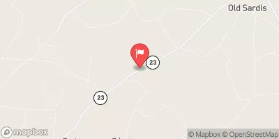
Savannah River H Area Ash Basin is a federal-owned structure located in Barnwell, South Carolina, with a primary purpose of "other." Built in 1954, this Earth-type dam stands at a height of 14 feet and has a hydraulic height of 7 feet. The dam has a normal storage capacity of 49 acre-feet and a maximum storage capacity of 98 acre-feet, with a surface area of 12 acres.
With a low hazard potential and a moderate risk assessment rating, the D.O.E. Savannah River H Area Ash Basin is considered to be in fair condition according to the last inspection date in 1995. The dam does not have an Emergency Action Plan (EAP) in place, and there is limited information available on risk management measures. Despite these challenges, the structure serves a crucial function in water resource management for the area, and its maintenance and monitoring are essential for the surrounding environment and community.
°F
°F
mph
Wind
%
Humidity
15-Day Weather Outlook
Year Completed |
1954 |
Dam Length |
3400 |
Dam Height |
14 |
River Or Stream |
FOURMILE BR-TR |
Primary Dam Type |
Earth |
Surface Area |
12 |
Hydraulic Height |
7 |
Nid Storage |
98 |
Structural Height |
14 |
Outlet Gates |
None |
Hazard Potential |
Low |
Foundations |
Rock |
Nid Height |
14 |
Seasonal Comparison
5-Day Hourly Forecast Detail
Nearby Streamflow Levels
 Savannah River At Augusta
|
4110cfs |
 Brier Creek Near Waynesboro
|
413cfs |
 Brier Creek At Millhaven
|
460cfs |
 Savannah R At Burtons Ferry Br Nr Millhaven
|
6110cfs |
 Beaverdam Creek Near Sardis
|
14cfs |
 Augusta Canal Nr Augusta (Upper)
|
1510cfs |
Dam Data Reference
Condition Assessment
SatisfactoryNo existing or potential dam safety deficiencies are recognized. Acceptable performance is expected under all loading conditions (static, hydrologic, seismic) in accordance with the minimum applicable state or federal regulatory criteria or tolerable risk guidelines.
Fair
No existing dam safety deficiencies are recognized for normal operating conditions. Rare or extreme hydrologic and/or seismic events may result in a dam safety deficiency. Risk may be in the range to take further action. Note: Rare or extreme event is defined by the regulatory agency based on their minimum
Poor A dam safety deficiency is recognized for normal operating conditions which may realistically occur. Remedial action is necessary. POOR may also be used when uncertainties exist as to critical analysis parameters which identify a potential dam safety deficiency. Investigations and studies are necessary.
Unsatisfactory
A dam safety deficiency is recognized that requires immediate or emergency remedial action for problem resolution.
Not Rated
The dam has not been inspected, is not under state or federal jurisdiction, or has been inspected but, for whatever reason, has not been rated.
Not Available
Dams for which the condition assessment is restricted to approved government users.
Hazard Potential Classification
HighDams assigned the high hazard potential classification are those where failure or mis-operation will probably cause loss of human life.
Significant
Dams assigned the significant hazard potential classification are those dams where failure or mis-operation results in no probable loss of human life but can cause economic loss, environment damage, disruption of lifeline facilities, or impact other concerns. Significant hazard potential classification dams are often located in predominantly rural or agricultural areas but could be in areas with population and significant infrastructure.
Low
Dams assigned the low hazard potential classification are those where failure or mis-operation results in no probable loss of human life and low economic and/or environmental losses. Losses are principally limited to the owner's property.
Undetermined
Dams for which a downstream hazard potential has not been designated or is not provided.
Not Available
Dams for which the downstream hazard potential is restricted to approved government users.

 D.O.E. Savannah River H Area Ash Basin