Mongiove Reservoir Report
Nearby: Lake Buena Vista Hidden Mtn Lake#2
Last Updated: January 8, 2026
Mongiove is a privately owned Earth dam located in Sevier, Tennessee, along the Mill Creek.
°F
°F
mph
Wind
%
Humidity
Summary
Completed in 1987, this structure stands at a height of 30 feet and has a length of 100 feet, providing a storage capacity of 48 acre-feet. Despite not being state regulated or permitted, Mongiove poses a high hazard potential due to its condition assessment being labeled as "Not Rated" and its moderate risk assessment level.
With a spillway type described as "Uncontrolled" and a spillway width of 30 feet, Mongiove's emergency action plan and risk management measures are currently lacking key information, raising concerns among water resource and climate enthusiasts. The dam is situated within the Nashville District of the US Army Corps of Engineers and falls under the jurisdiction of the state of Tennessee. Although the dam has not been modified in recent years and has no associated locks or outlet gates, its high hazard potential and moderate risk level highlight the importance of regular inspections and proper maintenance to ensure the safety of downstream communities.
In the event of an emergency, Mongiove's last inspection took place in February 2019 with a scheduled inspection frequency of 5 years. Despite the lack of inundation maps, updated emergency contacts, and a comprehensive emergency action plan, the dam's risk assessment of "Moderate (3)" underscores the need for proactive measures to mitigate potential hazards and safeguard the surrounding area from the impacts of a dam failure. As enthusiasts in water resources and climate monitoring, attention to Mongiove's condition and risk management strategies is crucial to prevent any adverse consequences and promote the sustainable management of this vital water infrastructure.
Year Completed |
1987 |
Dam Length |
100 |
River Or Stream |
MILL CREEK |
Primary Dam Type |
Earth |
Surface Area |
3 |
Drainage Area |
0.06 |
Nid Storage |
48 |
Structural Height |
30 |
Outlet Gates |
None |
Hazard Potential |
High |
Nid Height |
30 |
Seasonal Comparison
Weather Forecast
Nearby Streamflow Levels
 Little Pigeon River At Sevierville
|
112cfs |
 Little River Above Townsend
|
84cfs |
 Little River Near Maryville
|
120cfs |
 Little River Near Alcoa
|
118cfs |
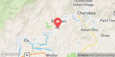 Oconaluftee River At Birdtown
|
181cfs |
 Tuckasegee River At Bryson City
|
798cfs |
Dam Data Reference
Condition Assessment
SatisfactoryNo existing or potential dam safety deficiencies are recognized. Acceptable performance is expected under all loading conditions (static, hydrologic, seismic) in accordance with the minimum applicable state or federal regulatory criteria or tolerable risk guidelines.
Fair
No existing dam safety deficiencies are recognized for normal operating conditions. Rare or extreme hydrologic and/or seismic events may result in a dam safety deficiency. Risk may be in the range to take further action. Note: Rare or extreme event is defined by the regulatory agency based on their minimum
Poor A dam safety deficiency is recognized for normal operating conditions which may realistically occur. Remedial action is necessary. POOR may also be used when uncertainties exist as to critical analysis parameters which identify a potential dam safety deficiency. Investigations and studies are necessary.
Unsatisfactory
A dam safety deficiency is recognized that requires immediate or emergency remedial action for problem resolution.
Not Rated
The dam has not been inspected, is not under state or federal jurisdiction, or has been inspected but, for whatever reason, has not been rated.
Not Available
Dams for which the condition assessment is restricted to approved government users.
Hazard Potential Classification
HighDams assigned the high hazard potential classification are those where failure or mis-operation will probably cause loss of human life.
Significant
Dams assigned the significant hazard potential classification are those dams where failure or mis-operation results in no probable loss of human life but can cause economic loss, environment damage, disruption of lifeline facilities, or impact other concerns. Significant hazard potential classification dams are often located in predominantly rural or agricultural areas but could be in areas with population and significant infrastructure.
Low
Dams assigned the low hazard potential classification are those where failure or mis-operation results in no probable loss of human life and low economic and/or environmental losses. Losses are principally limited to the owner's property.
Undetermined
Dams for which a downstream hazard potential has not been designated or is not provided.
Not Available
Dams for which the downstream hazard potential is restricted to approved government users.
Area Campgrounds
| Location | Reservations | Toilets |
|---|---|---|
 KOA Holiday
|
||
 Elkmont Group Campground
|
||
 Elkmont Campground
|
||
 Elkmont - Great Smoky Mountains National Park
|
||
 20 King Branch
|
||
 21 Mile 53
|

 Mongiove