Sulphur Creek Ws Scs Site 5 Dam Dam

Sulphur Creek Ws Scs Site 5 Dam
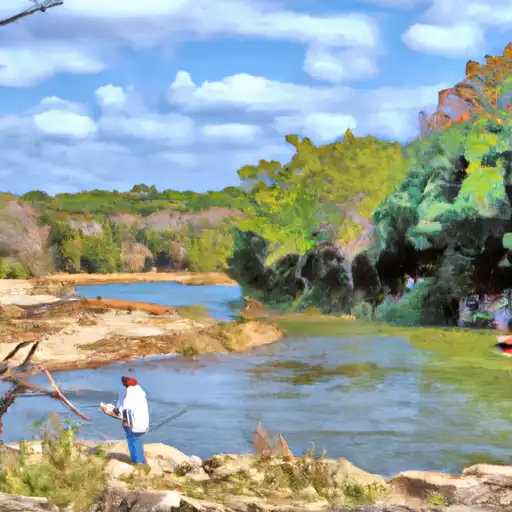
Sulphur Creek WS SCS Site 5 Dam in Lampasas, Texas, stands as a crucial flood risk reduction structure along the Burleson Creek, designed by the USDA NRCS in 1958. This earth-type dam, with a height of 54 feet and a length of 1050 feet, plays a vital role in mitigating flood risks and supporting irrigation in the region. Managed by the local government and regulated by the TCEQ, this dam has a normal storage capacity of 161 acre-feet and a maximum discharge of 11,392 cubic feet per second.
With a fair condition assessment as of September 2017, Sulphur Creek WS SCS Site 5 Dam boasts a storage capacity of 2,237 acre-feet and a surface area of 29 acres. The spillway, with a width of 452 feet, helps control water flow during high levels, ensuring the safety and stability of the dam structure. Despite its moderate risk assessment level, the dam continues to meet regulatory standards, with inspections conducted every five years to maintain its structural integrity and functionality.
As a vital component of the local water resource management infrastructure, Sulphur Creek WS SCS Site 5 Dam serves as a testament to effective flood risk reduction practices and sustainable water utilization in Lampasas, Texas. Its role in safeguarding the community against potential hazards underscores the importance of proactive dam maintenance and regulatory oversight in ensuring reliable water resources for both flood control and irrigation purposes in the region.
Plan around the weather
Same NOAA / yr.no feed Snoflo's iOS app uses. Watch the precipitation column on the meteogram -- rain on the basin upstream typically lifts inflow 24-72 hours later.
Next 5 days, hour by hour
Temperature line with weather symbols on top, snow + rain accumulation as columns, humidity as a dotted line.
5-day forecast table
Every 3 hours, broken out across temperature, snow, rain, humidity, and wind. Each cell is colour-coded relative to the column min/max.
| Time | Condition | Temp (°F) | Snow (in) | Rain (in) | Humidity (%) | Wind (mps) | Wind dir |
|---|---|---|---|---|---|---|---|
| Loading detailed forecast… | |||||||
15-day temperature & precipitation
Daily temperatures, snow, and rain projected over the next two weeks.
Nearby streamflow gauges
USGS streamgauges around Sulphur Creek Ws Scs Site 5 Dam -- inflows here typically show up in storage 24-72 hours later.
| Streamgauge | Discharge | View |
|---|---|---|
| Lampasas Rv Nr Kempner | 96 cfs | → |
| S Fk Rocky Ck Nr Briggs | 7 cfs | → |
| Colorado Rv Nr San Saba | 827 cfs | → |
| Cowhouse Ck At Pidcoke | 109 cfs | → |
| Lampasas Rv At Ding Dong | 415 cfs | → |
| San Saba Rv At San Saba | 69 cfs | → |


About Sulphur Creek Ws Scs Site 5 Dam
Where does the data for Sulphur Creek Ws Scs Site 5 Dam come from?
Structural and regulatory data come from the U.S. Army Corps of Engineers' National Inventory of Dams (NID). Weather forecast comes from NOAA / yr.no -- the same feed Snoflo's iOS app uses.
How often is the report updated?
NID structural data refreshes annually as the Corps publishes updated assessments. The weather forecast refreshes throughout the day.
What does the Not Available hazard rating mean?
The Corps of Engineers' hazard potential classification grades probable consequences if the dam fails: High = probable loss of human life; Significant = no probable loss of human life but possible economic loss / environmental damage; Low = no probable loss of human life, only minor economic / environmental losses. See the Dam Data Reference card below for the full definitions.
What's "% of normal"?
The current storage value compared to the historical average storage on this calendar day. 100% = right on average; values above 100% mean above-normal storage (wet year); values below mean below-normal (dry year or drought).
Can I get alerts when storage crosses a threshold?
Yes -- alerts are managed in the Snoflo iOS app. Favorite this dam, set a threshold, and you'll get a push the moment conditions cross.
Dam data reference
Condition Assessment
- Satisfactory
- No existing or potential dam safety deficiencies are recognized. Acceptable performance is expected under all loading conditions (static, hydrologic, seismic) in accordance with the minimum applicable state or federal regulatory criteria or tolerable risk guidelines.
- Fair
- No existing dam safety deficiencies are recognized for normal operating conditions. Rare or extreme hydrologic and/or seismic events may result in a dam safety deficiency. Risk may be in the range to take further action.
- Poor
- A dam safety deficiency is recognized for normal operating conditions which may realistically occur. Remedial action is necessary. POOR may also be used when uncertainties exist as to critical analysis parameters which identify a potential dam safety deficiency.
- Unsatisfactory
- A dam safety deficiency is recognized that requires immediate or emergency remedial action for problem resolution.
- Not Rated
- The dam has not been inspected, is not under state or federal jurisdiction, or has been inspected but, for whatever reason, has not been rated.
Hazard Potential Classification
- High
- Dams assigned the high hazard potential classification are those where failure or mis-operation will probably cause loss of human life.
- Significant
- Dams assigned the significant hazard potential classification are those dams where failure or mis-operation results in no probable loss of human life but can cause economic loss, environmental damage, disruption of lifeline facilities, or impact other concerns. Significant hazard potential classification dams are often located in predominantly rural or agricultural areas but could be in areas with population and significant infrastructure.
- Low
- Dams assigned the low hazard potential classification are those where failure or mis-operation results in no probable loss of human life and low economic and/or environmental losses. Losses are principally limited to the owner's property.
- Undetermined
- Dams for which a downstream hazard potential has not been designated or is not provided.