Simon Freese Dam Dam

Simon Freese Dam
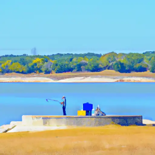
Nestled along the Colorado River in Texas, the Simon Freese Dam stands as a testament to engineering excellence and environmental stewardship. Designed by FREESE AND NICHOLS, this concrete structure was completed in 1989 with a primary purpose of recreation while also serving as a vital water supply source for the region. With a height of 149 feet and a length of 9950 feet, the dam boasts a storage capacity of over 1.2 million acre-feet, providing essential water resources for the surrounding communities.
Managed by the local government and regulated by the Texas Commission on Environmental Quality (TCEQ), the Simon Freese Dam has been inspected regularly to ensure its structural integrity and safety. With a satisfactory condition assessment as of April 2021, the dam continues to meet the necessary guidelines for emergency preparedness and risk management. Featuring a spillway width of 8300 feet and a maximum discharge capacity of 1,947,001 cubic feet per second, the dam is equipped to handle potential flood events while maintaining its recreational and water supply functions.
For water resource and climate enthusiasts, the Simon Freese Dam offers a fascinating glimpse into the intersection of human innovation and natural resource management. With its strategic location along the Colorado River and its significant impact on the surrounding ecosystem, this concrete marvel serves as a vital lifeline for both recreational enjoyment and water security in Coleman, Texas. As a symbol of responsible water stewardship, the Simon Freese Dam stands as a beacon of sustainability in a rapidly changing climate landscape.
Plan around the weather
Same NOAA / yr.no feed Snoflo's iOS app uses. Watch the precipitation column on the meteogram -- rain on the basin upstream typically lifts inflow 24-72 hours later.
Next 5 days, hour by hour
Temperature line with weather symbols on top, snow + rain accumulation as columns, humidity as a dotted line.
5-day forecast table
Every 3 hours, broken out across temperature, snow, rain, humidity, and wind. Each cell is colour-coded relative to the column min/max.
| Time | Condition | Temp (°F) | Snow (in) | Rain (in) | Humidity (%) | Wind (mps) | Wind dir |
|---|---|---|---|---|---|---|---|
| Loading detailed forecast… | |||||||
15-day temperature & precipitation
Daily temperatures, snow, and rain projected over the next two weeks.
Nearby streamflow gauges
USGS streamgauges around Simon Freese Dam -- inflows here typically show up in storage 24-72 hours later.
| Streamgauge | Discharge | View |
|---|---|---|
| Colorado Rv Nr Stacy | 7 cfs | → |
| Concho Rv At Paint Rock | 19 cfs | → |
| Elm Ck At Ballinger | 3 cfs | → |
| Colorado Rv Nr Ballinger | 1 cfs | → |
| Hords Ck Nr Coleman | · | → |
| Brady Ck At Brady | 0 cfs | → |


About Simon Freese Dam
Where does the data for Simon Freese Dam come from?
Structural and regulatory data come from the U.S. Army Corps of Engineers' National Inventory of Dams (NID). Weather forecast comes from NOAA / yr.no -- the same feed Snoflo's iOS app uses.
How often is the report updated?
NID structural data refreshes annually as the Corps publishes updated assessments. The weather forecast refreshes throughout the day.
What does the Not Available hazard rating mean?
The Corps of Engineers' hazard potential classification grades probable consequences if the dam fails: High = probable loss of human life; Significant = no probable loss of human life but possible economic loss / environmental damage; Low = no probable loss of human life, only minor economic / environmental losses. See the Dam Data Reference card below for the full definitions.
What's "% of normal"?
The current storage value compared to the historical average storage on this calendar day. 100% = right on average; values above 100% mean above-normal storage (wet year); values below mean below-normal (dry year or drought).
Can I get alerts when storage crosses a threshold?
Yes -- alerts are managed in the Snoflo iOS app. Favorite this dam, set a threshold, and you'll get a push the moment conditions cross.
Dam data reference
Condition Assessment
- Satisfactory
- No existing or potential dam safety deficiencies are recognized. Acceptable performance is expected under all loading conditions (static, hydrologic, seismic) in accordance with the minimum applicable state or federal regulatory criteria or tolerable risk guidelines.
- Fair
- No existing dam safety deficiencies are recognized for normal operating conditions. Rare or extreme hydrologic and/or seismic events may result in a dam safety deficiency. Risk may be in the range to take further action.
- Poor
- A dam safety deficiency is recognized for normal operating conditions which may realistically occur. Remedial action is necessary. POOR may also be used when uncertainties exist as to critical analysis parameters which identify a potential dam safety deficiency.
- Unsatisfactory
- A dam safety deficiency is recognized that requires immediate or emergency remedial action for problem resolution.
- Not Rated
- The dam has not been inspected, is not under state or federal jurisdiction, or has been inspected but, for whatever reason, has not been rated.
Hazard Potential Classification
- High
- Dams assigned the high hazard potential classification are those where failure or mis-operation will probably cause loss of human life.
- Significant
- Dams assigned the significant hazard potential classification are those dams where failure or mis-operation results in no probable loss of human life but can cause economic loss, environmental damage, disruption of lifeline facilities, or impact other concerns. Significant hazard potential classification dams are often located in predominantly rural or agricultural areas but could be in areas with population and significant infrastructure.
- Low
- Dams assigned the low hazard potential classification are those where failure or mis-operation results in no probable loss of human life and low economic and/or environmental losses. Losses are principally limited to the owner's property.
- Undetermined
- Dams for which a downstream hazard potential has not been designated or is not provided.