Forsyth Reservoir Report
Nearby: Mill Meadow Neffs
Last Updated: February 11, 2026
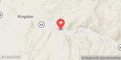
Forsyth is a private irrigation dam located in Sevier, Utah, along U M Creek.
Summary
Constructed in 1922 by the USDA NRCS, this earth dam stands at a structural height of 65 feet and has a hydraulic height of 55 feet. With a storage capacity of 5,670 acre-feet, Forsyth serves the primary purpose of irrigation for the surrounding area. The dam is state-regulated by the Utah Division of Water Rights, ensuring proper inspection, enforcement, and permitting processes are in place.
Despite its age, Forsyth is in satisfactory condition and has a high hazard potential, highlighting the importance of regular inspections and maintenance. The dam spans 355 feet in length and has a drainage area of 73.9 square miles, with a maximum discharge of 209 cubic feet per second. The dam's spillway width is 44 feet, providing a crucial safety feature in case of overflow events. With its location in a region prone to climate variability and water resource challenges, Forsyth plays a vital role in supporting agricultural activities and water management efforts in the area.
As a key infrastructure for irrigation in Sevier, Utah, Forsyth represents a crucial piece of the water resource management system in the region. With its historical significance and ongoing regulatory oversight, the dam serves as a symbol of the intersection between human intervention in natural water systems and the need for sustainable water use practices. For water resource and climate enthusiasts, Forsyth offers a fascinating case study in the development, regulation, and maintenance of essential water infrastructure in an arid environment like Utah.
°F
°F
mph
Wind
%
Humidity
15-Day Weather Outlook
Year Completed |
1922 |
Dam Length |
355 |
River Or Stream |
U M CREEK |
Primary Dam Type |
Earth |
Hydraulic Height |
55 |
Drainage Area |
73.9 |
Nid Storage |
5670 |
Structural Height |
65 |
Hazard Potential |
High |
Nid Height |
65 |
Seasonal Comparison
5-Day Hourly Forecast Detail
Nearby Streamflow Levels
Dam Data Reference
Condition Assessment
SatisfactoryNo existing or potential dam safety deficiencies are recognized. Acceptable performance is expected under all loading conditions (static, hydrologic, seismic) in accordance with the minimum applicable state or federal regulatory criteria or tolerable risk guidelines.
Fair
No existing dam safety deficiencies are recognized for normal operating conditions. Rare or extreme hydrologic and/or seismic events may result in a dam safety deficiency. Risk may be in the range to take further action. Note: Rare or extreme event is defined by the regulatory agency based on their minimum
Poor A dam safety deficiency is recognized for normal operating conditions which may realistically occur. Remedial action is necessary. POOR may also be used when uncertainties exist as to critical analysis parameters which identify a potential dam safety deficiency. Investigations and studies are necessary.
Unsatisfactory
A dam safety deficiency is recognized that requires immediate or emergency remedial action for problem resolution.
Not Rated
The dam has not been inspected, is not under state or federal jurisdiction, or has been inspected but, for whatever reason, has not been rated.
Not Available
Dams for which the condition assessment is restricted to approved government users.
Hazard Potential Classification
HighDams assigned the high hazard potential classification are those where failure or mis-operation will probably cause loss of human life.
Significant
Dams assigned the significant hazard potential classification are those dams where failure or mis-operation results in no probable loss of human life but can cause economic loss, environment damage, disruption of lifeline facilities, or impact other concerns. Significant hazard potential classification dams are often located in predominantly rural or agricultural areas but could be in areas with population and significant infrastructure.
Low
Dams assigned the low hazard potential classification are those where failure or mis-operation results in no probable loss of human life and low economic and/or environmental losses. Losses are principally limited to the owner's property.
Undetermined
Dams for which a downstream hazard potential has not been designated or is not provided.
Not Available
Dams for which the downstream hazard potential is restricted to approved government users.


 Elkhorn
 Cathedral Valley - Capitol Reef National Park
 Cathedral Valley Campsite
 Cathedral Valley Primitive Campground
 PAIUTE CAMPGROUND
 BOWERY CREEK CAMPGROUND
 Forsyth
 MILL MEADOW RESERVOIR BOAT RAMP REC SITE
 JOHNSON RESERVOIR REC SITE
 JOE BUSH FISHERMAN PARKING REC SITE
 LAKESIDE FISH CLEANING STATION CUA DISPERSED