Lost Creek Dam

Lost Creek
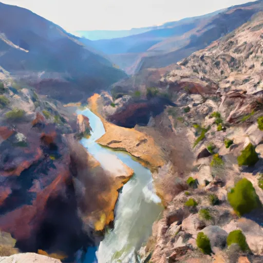
Lost Creek is a captivating water resource nestled in the heart of Morgan, Utah, just 11 miles away from Devils Slide. This Federal-owned reservoir, managed by the Bureau of Reclamation, serves primarily for irrigation purposes and has been a vital water source since its completion in 1966. With a storage capacity of 26,760 acre-feet and a surface area of 365 acres, Lost Creek harnesses the waters of its namesake stream to support agricultural activities in the region.
Standing at a structural height of 248 feet and with a hydraulic height of 184 feet, Lost Creek boasts an impressive earth dam that has undergone modifications in 1999 to enhance its foundation, seismic, and structural integrity. Despite its high hazard potential, the reservoir's risk assessment is rated as moderate, indicating a balanced approach to managing potential threats. With a maximum discharge of 800 cubic feet per second and uncontrolled spillway type, Lost Creek continues to play a crucial role in water management in the area.
Lost Creek's rich history, combined with its strategic location and ample storage capacity, makes it an essential component of Utah's water resource infrastructure. As climate change continues to impact water availability and quality, reservoirs like Lost Creek serve as valuable assets in ensuring a reliable water supply for irrigation and other essential needs in the region. With ongoing monitoring and maintenance by the Bureau of Reclamation, Lost Creek remains a beacon of resilience in the face of evolving environmental challenges.
Plan around the weather
Same NOAA / yr.no feed Snoflo's iOS app uses. Watch the precipitation column on the meteogram -- rain on the basin upstream typically lifts inflow 24-72 hours later.
Next 5 days, hour by hour
Temperature line with weather symbols on top, snow + rain accumulation as columns, humidity as a dotted line.
5-day forecast table
Every 3 hours, broken out across temperature, snow, rain, humidity, and wind. Each cell is colour-coded relative to the column min/max.
| Time | Condition | Temp (°F) | Snow (in) | Rain (in) | Humidity (%) | Wind (mps) | Wind dir |
|---|---|---|---|---|---|---|---|
| Loading detailed forecast… | |||||||
15-day temperature & precipitation
Daily temperatures, snow, and rain projected over the next two weeks.
Nearby streamflow gauges
USGS streamgauges around Lost Creek -- inflows here typically show up in storage 24-72 hours later.
| Streamgauge | Discharge | View |
|---|---|---|
| Lost Creek Near Croyden | 42 cfs | → |
| Weber River At Echo | 355 cfs | → |
| South Fork Ogden River Near Huntsville | 58 cfs | → |
| Chalk Creek At Coalville | 6 cfs | → |
| Weber River Near Coalville | 309 cfs | → |
| East Canyon Creek Near Morgan | 80 cfs | → |


About Lost Creek
Where does the data for Lost Creek come from?
Structural and regulatory data come from the U.S. Army Corps of Engineers' National Inventory of Dams (NID). Weather forecast comes from NOAA / yr.no -- the same feed Snoflo's iOS app uses.
How often is the report updated?
NID structural data refreshes annually as the Corps publishes updated assessments. The weather forecast refreshes throughout the day.
What does the High hazard rating mean?
The Corps of Engineers' hazard potential classification grades probable consequences if the dam fails: High = probable loss of human life; Significant = no probable loss of human life but possible economic loss / environmental damage; Low = no probable loss of human life, only minor economic / environmental losses. See the Dam Data Reference card below for the full definitions.
What's "% of normal"?
The current storage value compared to the historical average storage on this calendar day. 100% = right on average; values above 100% mean above-normal storage (wet year); values below mean below-normal (dry year or drought).
Can I get alerts when storage crosses a threshold?
Yes -- alerts are managed in the Snoflo iOS app. Favorite this dam, set a threshold, and you'll get a push the moment conditions cross.
Dam data reference
Condition Assessment
- Satisfactory
- No existing or potential dam safety deficiencies are recognized. Acceptable performance is expected under all loading conditions (static, hydrologic, seismic) in accordance with the minimum applicable state or federal regulatory criteria or tolerable risk guidelines.
- Fair
- No existing dam safety deficiencies are recognized for normal operating conditions. Rare or extreme hydrologic and/or seismic events may result in a dam safety deficiency. Risk may be in the range to take further action.
- Poor
- A dam safety deficiency is recognized for normal operating conditions which may realistically occur. Remedial action is necessary. POOR may also be used when uncertainties exist as to critical analysis parameters which identify a potential dam safety deficiency.
- Unsatisfactory
- A dam safety deficiency is recognized that requires immediate or emergency remedial action for problem resolution.
- Not Rated
- The dam has not been inspected, is not under state or federal jurisdiction, or has been inspected but, for whatever reason, has not been rated.
Hazard Potential Classification
- High
- Dams assigned the high hazard potential classification are those where failure or mis-operation will probably cause loss of human life.
- Significant
- Dams assigned the significant hazard potential classification are those dams where failure or mis-operation results in no probable loss of human life but can cause economic loss, environmental damage, disruption of lifeline facilities, or impact other concerns. Significant hazard potential classification dams are often located in predominantly rural or agricultural areas but could be in areas with population and significant infrastructure.
- Low
- Dams assigned the low hazard potential classification are those where failure or mis-operation results in no probable loss of human life and low economic and/or environmental losses. Losses are principally limited to the owner's property.
- Undetermined
- Dams for which a downstream hazard potential has not been designated or is not provided.