


Ben Creek Slurry Impoundment Reservoir Report
Last Updated: May 3, 2026
°F
°F
mph
Wind
%
Humidity
Located in Wharncliffe, West Virginia, the Ben Creek Slurry Impoundment is a privately-owned structure primarily used for tailings storage.
Summary
This earth dam stands at a height of 358 feet and spans a length of 2,195 feet, with a storage capacity of 16,797 acre-feet. Despite being regulated by the Mine Safety and Health Administration, the impoundment is not subject to state permitting, inspection, or enforcement.
With a high hazard potential, the Ben Creek Slurry Impoundment poses a significant risk to the surrounding area in Mingo County. While the condition assessment is not available, the emergency action plan and risk management measures are also lacking. The absence of crucial information raises concerns about the impoundment's safety and preparedness for potential emergencies, highlighting the need for improved monitoring and regulation of such structures in the region.
Regional Streamflow Levels
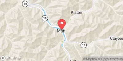 Guyandotte River At Man
|
968cfs |
 Panther Creek Near Panther
|
6cfs |
 Clear Fork At Clear Fork
|
79cfs |
 Guyandotte River At Logan
|
540cfs |
 Guyandotte River Near Baileysville
|
239cfs |
 Dry Fork At Beartown
|
66cfs |
15-Day Long Term Forecast
Dam Length |
2195 |
Dam Height |
358 |
Primary Dam Type |
Earth |
Nid Storage |
16797 |
Hazard Potential |
High |
Nid Height |
358 |
Seasonal Comparison
5-Day Hourly Forecast Detail
Dam Data Reference
Condition Assessment
SatisfactoryNo existing or potential dam safety deficiencies are recognized. Acceptable performance is expected under all loading conditions (static, hydrologic, seismic) in accordance with the minimum applicable state or federal regulatory criteria or tolerable risk guidelines.
Fair
No existing dam safety deficiencies are recognized for normal operating conditions. Rare or extreme hydrologic and/or seismic events may result in a dam safety deficiency. Risk may be in the range to take further action. Note: Rare or extreme event is defined by the regulatory agency based on their minimum
Poor A dam safety deficiency is recognized for normal operating conditions which may realistically occur. Remedial action is necessary. POOR may also be used when uncertainties exist as to critical analysis parameters which identify a potential dam safety deficiency. Investigations and studies are necessary.
Unsatisfactory
A dam safety deficiency is recognized that requires immediate or emergency remedial action for problem resolution.
Not Rated
The dam has not been inspected, is not under state or federal jurisdiction, or has been inspected but, for whatever reason, has not been rated.
Not Available
Dams for which the condition assessment is restricted to approved government users.
Hazard Potential Classification
HighDams assigned the high hazard potential classification are those where failure or mis-operation will probably cause loss of human life.
Significant
Dams assigned the significant hazard potential classification are those dams where failure or mis-operation results in no probable loss of human life but can cause economic loss, environment damage, disruption of lifeline facilities, or impact other concerns. Significant hazard potential classification dams are often located in predominantly rural or agricultural areas but could be in areas with population and significant infrastructure.
Low
Dams assigned the low hazard potential classification are those where failure or mis-operation results in no probable loss of human life and low economic and/or environmental losses. Losses are principally limited to the owner's property.
Undetermined
Dams for which a downstream hazard potential has not been designated or is not provided.
Not Available
Dams for which the downstream hazard potential is restricted to approved government users.
Area Campgrounds
| Location | Reservations | Toilets |
|---|---|---|
 Panther WMA
|
||
 Guyandotte
|
||
 Hatfield’s Hideout Riverfront Cabins and Campground
|
||
 Panther State Forest
|
||
 Chief Logan State Park
|
||
 Grapevine - Fishtrap Lake
|
 Mud River At Palermo
 Middle Fork Brush Creek At Edison
 Confluence Of White Branch With Russell Fork (And 1 Mile Upstream On Pound River) To Railroad Bridge Crossing Above Elkhorn City
 State Route 72 Bridge To Confluence With Clinch River