
Port Of Moses Lake Lagoon Reservoir Report
Last Updated: December 24, 2025
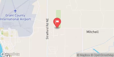
Located in Grant County, Washington, the Port of Moses Lake Lagoon is a man-made offstream reservoir constructed in 1999 with a primary purpose of "Other." The lagoon, designed by Montgomery Watson, has a dam type of Earth with a structural height of 8 feet and a hydraulic height of 30 feet.
°F
°F
mph
Wind
%
Humidity
Summary
With a storage capacity of 34 acre-feet, the lagoon serves as a water resource management facility for the local government.
Managed by the Washington Department of Ecology, the Port of Moses Lake Lagoon is state-regulated, permitted, inspected, and enforced to ensure compliance with environmental regulations. Despite its low hazard potential and "Not Rated" condition assessment, the lagoon plays a crucial role in water conservation and flood control efforts in the region. Its location along Crab Creek makes it an essential component of the local water infrastructure network.
While lacking certain features such as spillways, outlet gates, and locks, the Port of Moses Lake Lagoon remains a key asset for water management in the area. Its strategic design and functionality highlight the importance of sustainable water resource development and climate resilience in the region, making it a significant site for water resource and climate enthusiasts to explore and learn from.
Year Completed |
1999 |
Dam Length |
600 |
River Or Stream |
Crab Creek - offstream |
Primary Dam Type |
Earth |
Hydraulic Height |
30 |
Nid Storage |
34 |
Structural Height |
8 |
Hazard Potential |
Low |
Nid Height |
30 |
Seasonal Comparison
Weather Forecast
Nearby Streamflow Levels
 Crab Creek Near Moses Lake
|
24cfs |
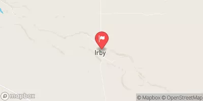 Crab Creek At Irby
|
2cfs |
 Wilson Creek Below Corbett Draw Near Almira
|
0cfs |
 Crab Creek Near Beverly
|
146cfs |
 Columbia River Below Priest Rapids Dam
|
152000cfs |
 Coal Creek At Mohler
|
1cfs |
Dam Data Reference
Condition Assessment
SatisfactoryNo existing or potential dam safety deficiencies are recognized. Acceptable performance is expected under all loading conditions (static, hydrologic, seismic) in accordance with the minimum applicable state or federal regulatory criteria or tolerable risk guidelines.
Fair
No existing dam safety deficiencies are recognized for normal operating conditions. Rare or extreme hydrologic and/or seismic events may result in a dam safety deficiency. Risk may be in the range to take further action. Note: Rare or extreme event is defined by the regulatory agency based on their minimum
Poor A dam safety deficiency is recognized for normal operating conditions which may realistically occur. Remedial action is necessary. POOR may also be used when uncertainties exist as to critical analysis parameters which identify a potential dam safety deficiency. Investigations and studies are necessary.
Unsatisfactory
A dam safety deficiency is recognized that requires immediate or emergency remedial action for problem resolution.
Not Rated
The dam has not been inspected, is not under state or federal jurisdiction, or has been inspected but, for whatever reason, has not been rated.
Not Available
Dams for which the condition assessment is restricted to approved government users.
Hazard Potential Classification
HighDams assigned the high hazard potential classification are those where failure or mis-operation will probably cause loss of human life.
Significant
Dams assigned the significant hazard potential classification are those dams where failure or mis-operation results in no probable loss of human life but can cause economic loss, environment damage, disruption of lifeline facilities, or impact other concerns. Significant hazard potential classification dams are often located in predominantly rural or agricultural areas but could be in areas with population and significant infrastructure.
Low
Dams assigned the low hazard potential classification are those where failure or mis-operation results in no probable loss of human life and low economic and/or environmental losses. Losses are principally limited to the owner's property.
Undetermined
Dams for which a downstream hazard potential has not been designated or is not provided.
Not Available
Dams for which the downstream hazard potential is restricted to approved government users.
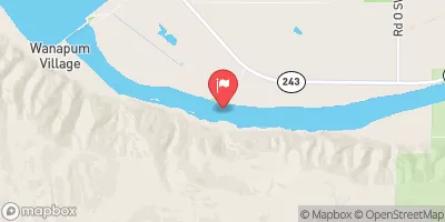
 Port Of Moses Lake Lagoon
 Moses Lake At Moses Lake
 Lewis County
River Runs
-
 Goat Rocks Wilderness Bounday To Cowlitz Falls Ferc Project Boundary In Ne1/4 Of Nw1/4 Of Sec 4, T11N, R6E
-
 Mount St. Helens National Volcanic Monument Boundary To Mount St. Helens National Volcanic Boundary In Sw 1/4 Of Sec 32, T11N, R5E
-
 Mount St. Helens National Volcanic Monument Boundary To To Point River Reenters Mshnvm In Se 1/4 Of Sec 11, T10N, R5E
-
 Headwaters In Se1/4 Of Sec 31, T10N, R6E To Mount St. Helens National Volcanic Monument Boundary