Wells dam

Wells
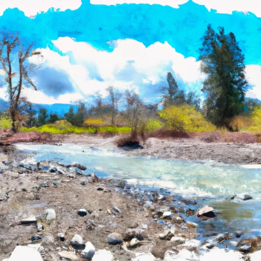
Wells, a hydroelectric facility located in Chelan Falls, Washington, harnesses the power of the Columbia River to generate electricity and support various purposes such as fish and wildlife ponds, irrigation, and recreation. Built in 1968 by the Bechtel Corporation, this gravity dam stands at 160 feet tall with a storage capacity of 500,000 acre-feet. Its controlled spillway and 11 other controlled outlet gates ensure the safe release of water, while its high hazard potential and very high risk assessment highlight the importance of effective risk management measures.
With a structural height of 160 feet and a length of 4,300 feet, Wells dam serves as a key player in the region's water resource management and climate resilience efforts. Managed by the Federal Energy Regulatory Commission, the dam plays a crucial role in regulating the flow of the Columbia River, supporting both local ecosystems and communities. Despite its high hazard potential, Wells dam continues to operate efficiently, providing clean energy and water resources to the surrounding areas while maintaining a strong commitment to safety and environmental stewardship.
As water resource and climate enthusiasts continue to monitor and assess the impacts of climate change on water infrastructure, facilities like Wells dam stand as vital assets in ensuring sustainable water management practices. The collaboration between federal agencies, local stakeholders, and the public utility sector is essential in safeguarding these critical resources for future generations. Wells dam's storied history and ongoing contributions underscore the importance of innovative solutions and strategic planning in addressing the challenges of a changing climate.
Plan around the weather
Same NOAA / yr.no feed Snoflo's iOS app uses. Watch the precipitation column on the meteogram -- rain on the basin upstream typically lifts inflow 24-72 hours later.
Next 5 days, hour by hour
Temperature line with weather symbols on top, snow + rain accumulation as columns, humidity as a dotted line.
5-day forecast table
Every 3 hours, broken out across temperature, snow, rain, humidity, and wind. Each cell is colour-coded relative to the column min/max.
| Time | Condition | Temp (°F) | Snow (in) | Rain (in) | Humidity (%) | Wind (mps) | Wind dir |
|---|---|---|---|---|---|---|---|
| Loading detailed forecast… | |||||||
15-day temperature & precipitation
Daily temperatures, snow, and rain projected over the next two weeks.
Nearby streamflow gauges
USGS streamgauges around Wells -- inflows here typically show up in storage 24-72 hours later.
| Streamgauge | Discharge | View |
|---|---|---|
| Methow River Near Pateros | 783 cfs | → |
| Chelan River At Chelan | 186 cfs | → |
| Okanogan River At Malott | 889 cfs | → |
| Entiat River Near Entiat | 219 cfs | → |
| Entiat River Near Ardenvoir | 186 cfs | → |
| Mad River At Ardenvoir | 26 cfs | → |
Make a day of it
Boat launches, lakeside camping, fishing access, and other reservoirs near Wells.
Boat launches
See all →


Campgrounds
See all →


Fishing spots
See all →
River runs
See all →


About Wells
Where does the data for Wells come from?
Structural and regulatory data come from the U.S. Army Corps of Engineers' National Inventory of Dams (NID). Weather forecast comes from NOAA / yr.no -- the same feed Snoflo's iOS app uses.
How often is the report updated?
NID structural data refreshes annually as the Corps publishes updated assessments. The weather forecast refreshes throughout the day.
What does the High hazard rating mean?
The Corps of Engineers' hazard potential classification grades probable consequences if the dam fails: High = probable loss of human life; Significant = no probable loss of human life but possible economic loss / environmental damage; Low = no probable loss of human life, only minor economic / environmental losses. See the Dam Data Reference card below for the full definitions.
What's "% of normal"?
The current storage value compared to the historical average storage on this calendar day. 100% = right on average; values above 100% mean above-normal storage (wet year); values below mean below-normal (dry year or drought).
Can I get alerts when storage crosses a threshold?
Yes -- alerts are managed in the Snoflo iOS app. Favorite this dam, set a threshold, and you'll get a push the moment conditions cross.
Dam data reference
Condition Assessment
- Satisfactory
- No existing or potential dam safety deficiencies are recognized. Acceptable performance is expected under all loading conditions (static, hydrologic, seismic) in accordance with the minimum applicable state or federal regulatory criteria or tolerable risk guidelines.
- Fair
- No existing dam safety deficiencies are recognized for normal operating conditions. Rare or extreme hydrologic and/or seismic events may result in a dam safety deficiency. Risk may be in the range to take further action.
- Poor
- A dam safety deficiency is recognized for normal operating conditions which may realistically occur. Remedial action is necessary. POOR may also be used when uncertainties exist as to critical analysis parameters which identify a potential dam safety deficiency.
- Unsatisfactory
- A dam safety deficiency is recognized that requires immediate or emergency remedial action for problem resolution.
- Not Rated
- The dam has not been inspected, is not under state or federal jurisdiction, or has been inspected but, for whatever reason, has not been rated.
Hazard Potential Classification
- High
- Dams assigned the high hazard potential classification are those where failure or mis-operation will probably cause loss of human life.
- Significant
- Dams assigned the significant hazard potential classification are those dams where failure or mis-operation results in no probable loss of human life but can cause economic loss, environmental damage, disruption of lifeline facilities, or impact other concerns. Significant hazard potential classification dams are often located in predominantly rural or agricultural areas but could be in areas with population and significant infrastructure.
- Low
- Dams assigned the low hazard potential classification are those where failure or mis-operation results in no probable loss of human life and low economic and/or environmental losses. Losses are principally limited to the owner's property.
- Undetermined
- Dams for which a downstream hazard potential has not been designated or is not provided.