Koura Dam Reservoir Report
Last Updated: January 1, 2026
Koura Dam, located in Kitsap, Washington, was completed in 1949 with the primary purpose of irrigation.
°F
°F
mph
Wind
%
Humidity
Summary
The dam is privately owned and regulated by the Washington Department of Ecology, with state jurisdiction, permitting, inspection, and enforcement in place. The earth dam stands at a hydraulic height of 28 feet, providing a storage capacity of 10 acre-feet and covering a surface area of 9 acres. The drainage area for the dam is 0.08 square miles, with a high hazard potential and a poor condition assessment as of May 2018.
The dam is situated on Tr-Murden Cove, within the Seattle District and Congressional District 06 of Washington. The structure is primarily made of stone core and rests on a soil foundation. Despite its high hazard potential, the dam has not undergone any modifications in recent years and lacks specific risk management measures or emergency action plans. The last inspection conducted on the dam was in August 2017, with an inspection frequency of 5 years. Overall, Koura Dam serves as a critical water resource for irrigation in the region, but its condition and hazard potential warrant careful monitoring and maintenance moving forward.
Year Completed |
1949 |
River Or Stream |
Tr-Murden Cove |
Primary Dam Type |
Earth |
Surface Area |
9 |
Hydraulic Height |
28 |
Drainage Area |
0.08 |
Nid Storage |
10 |
Structural Height |
28 |
Hazard Potential |
High |
Foundations |
Soil |
Nid Height |
28 |
Seasonal Comparison
Weather Forecast
Nearby Streamflow Levels
 Thornton Creek Near Seattle
|
41cfs |
 Mercer Creek Near Bellevue
|
12cfs |
 Duwamish River At Golf Course At Tukwila
|
6700cfs |
 Cedar River At Renton
|
1270cfs |
 Huge Creek Near Wauna
|
8cfs |
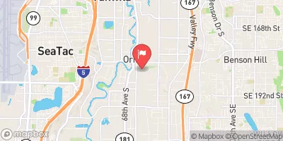 Mill Creek Near Mouth At Orillia
|
16cfs |
Dam Data Reference
Condition Assessment
SatisfactoryNo existing or potential dam safety deficiencies are recognized. Acceptable performance is expected under all loading conditions (static, hydrologic, seismic) in accordance with the minimum applicable state or federal regulatory criteria or tolerable risk guidelines.
Fair
No existing dam safety deficiencies are recognized for normal operating conditions. Rare or extreme hydrologic and/or seismic events may result in a dam safety deficiency. Risk may be in the range to take further action. Note: Rare or extreme event is defined by the regulatory agency based on their minimum
Poor A dam safety deficiency is recognized for normal operating conditions which may realistically occur. Remedial action is necessary. POOR may also be used when uncertainties exist as to critical analysis parameters which identify a potential dam safety deficiency. Investigations and studies are necessary.
Unsatisfactory
A dam safety deficiency is recognized that requires immediate or emergency remedial action for problem resolution.
Not Rated
The dam has not been inspected, is not under state or federal jurisdiction, or has been inspected but, for whatever reason, has not been rated.
Not Available
Dams for which the condition assessment is restricted to approved government users.
Hazard Potential Classification
HighDams assigned the high hazard potential classification are those where failure or mis-operation will probably cause loss of human life.
Significant
Dams assigned the significant hazard potential classification are those dams where failure or mis-operation results in no probable loss of human life but can cause economic loss, environment damage, disruption of lifeline facilities, or impact other concerns. Significant hazard potential classification dams are often located in predominantly rural or agricultural areas but could be in areas with population and significant infrastructure.
Low
Dams assigned the low hazard potential classification are those where failure or mis-operation results in no probable loss of human life and low economic and/or environmental losses. Losses are principally limited to the owner's property.
Undetermined
Dams for which a downstream hazard potential has not been designated or is not provided.
Not Available
Dams for which the downstream hazard potential is restricted to approved government users.

 Fay Bainbridge State Park
 Fay Bainbridge State Park campsite
 wwta campsite (human powered boats only)
 Illahee State Park
 Cascadia Marine Trail
 Manchester State Park
 Koura Dam
 Ogle Road Northeast 9790, Bremerton