


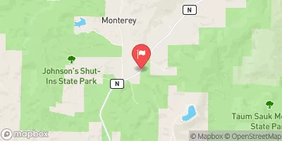
Mononame 466 Reservoir Report
Last Updated: May 3, 2026
Nearby: Green Dam Mononame 846
°F
°F
mph
Wind
%
Humidity
Mononame 466, located in Iron County, Missouri, is a privately owned earth dam constructed in 1972 for recreational purposes.
Summary
This dam on TR Big Creek Offstream stands at a height of 22 feet and has a storage capacity of 59 acre-feet. With a surface area of 5 acres and draining an area of 29 square miles, this dam provides opportunities for outdoor activities in the area.
Although Mononame 466 is classified as having a low hazard potential and is currently rated as "Not Rated" in terms of condition assessment, it remains an important structure for water resource management and recreational use. The dam has not been inspected recently, but it continues to serve its intended purpose without any major concerns. The surrounding area, which includes the city of Sabula, benefits from the presence of this dam for both water storage and recreational activities.
As water resource and climate enthusiasts, understanding the details of Mononame 466 allows for a broader appreciation of the importance of dams in managing water resources and providing opportunities for outdoor recreation. While this particular dam may not be regulated by the state or federal agencies, its presence contributes to the overall water management infrastructure in the region. The information provided gives insight into the history, purpose, and current status of Mononame 466, highlighting its role in the local ecosystem and community.
Regional Streamflow Levels
 Meramec River Near Steelville
|
816cfs |
 Meramec River At Cook Station
|
110cfs |
 Meramec River Near Sullivan
|
1770cfs |
 Big River At Irondale
|
315cfs |
 East Fork Black River Nr Lesterville
|
32cfs |
 Big River Near Richwoods
|
882cfs |
15-Day Long Term Forecast
Year Completed |
1972 |
Dam Height |
22 |
River Or Stream |
TR BIG CREEK OFFSTREAM |
Primary Dam Type |
Earth |
Surface Area |
5 |
Drainage Area |
29 |
Nid Storage |
59 |
Structural Height |
22 |
Hazard Potential |
Low |
Foundations |
Unlisted/Unknown |
Nid Height |
22 |
Seasonal Comparison
5-Day Hourly Forecast Detail
Dam Data Reference
Condition Assessment
SatisfactoryNo existing or potential dam safety deficiencies are recognized. Acceptable performance is expected under all loading conditions (static, hydrologic, seismic) in accordance with the minimum applicable state or federal regulatory criteria or tolerable risk guidelines.
Fair
No existing dam safety deficiencies are recognized for normal operating conditions. Rare or extreme hydrologic and/or seismic events may result in a dam safety deficiency. Risk may be in the range to take further action. Note: Rare or extreme event is defined by the regulatory agency based on their minimum
Poor A dam safety deficiency is recognized for normal operating conditions which may realistically occur. Remedial action is necessary. POOR may also be used when uncertainties exist as to critical analysis parameters which identify a potential dam safety deficiency. Investigations and studies are necessary.
Unsatisfactory
A dam safety deficiency is recognized that requires immediate or emergency remedial action for problem resolution.
Not Rated
The dam has not been inspected, is not under state or federal jurisdiction, or has been inspected but, for whatever reason, has not been rated.
Not Available
Dams for which the condition assessment is restricted to approved government users.
Hazard Potential Classification
HighDams assigned the high hazard potential classification are those where failure or mis-operation will probably cause loss of human life.
Significant
Dams assigned the significant hazard potential classification are those dams where failure or mis-operation results in no probable loss of human life but can cause economic loss, environment damage, disruption of lifeline facilities, or impact other concerns. Significant hazard potential classification dams are often located in predominantly rural or agricultural areas but could be in areas with population and significant infrastructure.
Low
Dams assigned the low hazard potential classification are those where failure or mis-operation results in no probable loss of human life and low economic and/or environmental losses. Losses are principally limited to the owner's property.
Undetermined
Dams for which a downstream hazard potential has not been designated or is not provided.
Not Available
Dams for which the downstream hazard potential is restricted to approved government users.
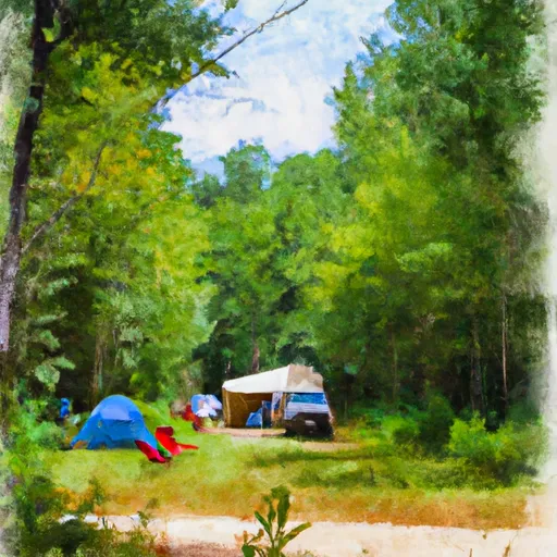
Area Campgrounds
| Location | Reservations | Toilets |
|---|---|---|
 Red Bluff
|
||
 Hazel Creek
|
||
 Hazel Creek Campground
|
||
 Berryman Campground
|
||
 Berryman
|
||
 Brazil Creek Trailhead
|
 Clearwater Lake Near Piedmont
 Ozark Trail - Marble Creek Section Iron County
River Runs
-
 State Highway 49 Bridge Near Dillard, Missouri To Forest Boundary In Sections 13/24, T38N, R3W
-
 Forest Boundary At North Section Line Of Sec 4, T33N, R5E To Forest Boundary At South Section Line Of Sec 35, T32N, R5E
-
 Confluence With Alley Spring (Branch) To Confluence With Current River (Does Not Include River Segment In Gap Between Parkland Units)
-
 Northern Boundary Of Fort Leonard Wood To North Section Line Of Sec 31, T36N, R10W
-
 Missouri State Highway 17 To Fort Leonard Wood (Army Base)
 Howell Lake
 Parole Lake
 Huzzah Ponds
 Timberline Lake
 Beaver Lake Recreation Area