Deer Creek Dam

Deer Creek
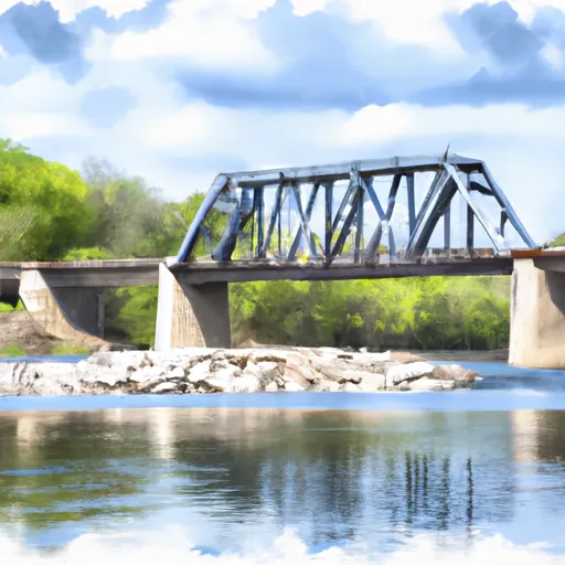
Deer Creek, located in Crivitz, Wisconsin, is a federal-owned dam on the Otter Creek Tributary. Built in 1989, this Earth-type dam stands at 12 feet high and spans 82 feet in length. With a storage capacity of 424 acre-feet, Deer Creek plays a crucial role in regulating water flow and providing flood control in the region. The dam's spillway, with a controlled design and 29 feet width, ensures the safe release of excess water during high flow events, with a maximum discharge capacity of 129 cubic feet per second.
Despite being classified as a low hazard potential structure, Deer Creek is considered to have a very high risk due to its location and the potential consequences of a failure. The dam's condition assessment is currently marked as 'Not Rated', highlighting the need for regular inspections and maintenance to ensure its continued safety and functionality. While the dam has not been inspected since 2010, it is permitted and regulated by the state of Wisconsin, underscoring the importance of ongoing monitoring and compliance with state regulations to mitigate risks and protect the surrounding community and environment from potential harm. For water resource and climate enthusiasts, Deer Creek represents a significant infrastructure that contributes to the management of water resources and the protection of downstream areas from flooding events.
Plan around the weather
Same NOAA / yr.no feed Snoflo's iOS app uses. Watch the precipitation column on the meteogram -- rain on the basin upstream typically lifts inflow 24-72 hours later.
Next 5 days, hour by hour
Temperature line with weather symbols on top, snow + rain accumulation as columns, humidity as a dotted line.
5-day forecast table
Every 3 hours, broken out across temperature, snow, rain, humidity, and wind. Each cell is colour-coded relative to the column min/max.
| Time | Condition | Temp (°F) | Snow (in) | Rain (in) | Humidity (%) | Wind (mps) | Wind dir |
|---|---|---|---|---|---|---|---|
| Loading detailed forecast… | |||||||
15-day temperature & precipitation
Daily temperatures, snow, and rain projected over the next two weeks.
Nearby streamflow gauges
USGS streamgauges around Deer Creek -- inflows here typically show up in storage 24-72 hours later.
| Streamgauge | Discharge | View |
|---|---|---|
| Peshtigo River Near Wabeno | 189 cfs | → |
| Wolf River At Langlade | 229 cfs | → |
| Popple River Near Fence | 37 cfs | → |
| Pike River At Amberg | 109 cfs | → |
| Pine River Below Pine R Powerplant Nr Florence | 197 cfs | → |
| Menominee River At White Rapids Dam Near Banat | 2,060 cfs | → |
Make a day of it
Boat launches, lakeside camping, fishing access, and other reservoirs near Deer Creek.
Boat launches
See all →


Campgrounds
See all →


Fishing spots
See all →


River runs
See all →


About Deer Creek
Where does the data for Deer Creek come from?
Structural and regulatory data come from the U.S. Army Corps of Engineers' National Inventory of Dams (NID). Weather forecast comes from NOAA / yr.no -- the same feed Snoflo's iOS app uses.
How often is the report updated?
NID structural data refreshes annually as the Corps publishes updated assessments. The weather forecast refreshes throughout the day.
What does the Low hazard rating mean?
The Corps of Engineers' hazard potential classification grades probable consequences if the dam fails: High = probable loss of human life; Significant = no probable loss of human life but possible economic loss / environmental damage; Low = no probable loss of human life, only minor economic / environmental losses. See the Dam Data Reference card below for the full definitions.
What's "% of normal"?
The current storage value compared to the historical average storage on this calendar day. 100% = right on average; values above 100% mean above-normal storage (wet year); values below mean below-normal (dry year or drought).
Can I get alerts when storage crosses a threshold?
Yes -- alerts are managed in the Snoflo iOS app. Favorite this dam, set a threshold, and you'll get a push the moment conditions cross.
Dam data reference
Condition Assessment
- Satisfactory
- No existing or potential dam safety deficiencies are recognized. Acceptable performance is expected under all loading conditions (static, hydrologic, seismic) in accordance with the minimum applicable state or federal regulatory criteria or tolerable risk guidelines.
- Fair
- No existing dam safety deficiencies are recognized for normal operating conditions. Rare or extreme hydrologic and/or seismic events may result in a dam safety deficiency. Risk may be in the range to take further action.
- Poor
- A dam safety deficiency is recognized for normal operating conditions which may realistically occur. Remedial action is necessary. POOR may also be used when uncertainties exist as to critical analysis parameters which identify a potential dam safety deficiency.
- Unsatisfactory
- A dam safety deficiency is recognized that requires immediate or emergency remedial action for problem resolution.
- Not Rated
- The dam has not been inspected, is not under state or federal jurisdiction, or has been inspected but, for whatever reason, has not been rated.
Hazard Potential Classification
- High
- Dams assigned the high hazard potential classification are those where failure or mis-operation will probably cause loss of human life.
- Significant
- Dams assigned the significant hazard potential classification are those dams where failure or mis-operation results in no probable loss of human life but can cause economic loss, environmental damage, disruption of lifeline facilities, or impact other concerns. Significant hazard potential classification dams are often located in predominantly rural or agricultural areas but could be in areas with population and significant infrastructure.
- Low
- Dams assigned the low hazard potential classification are those where failure or mis-operation results in no probable loss of human life and low economic and/or environmental losses. Losses are principally limited to the owner's property.
- Undetermined
- Dams for which a downstream hazard potential has not been designated or is not provided.