Fish Hatchery Dam

Fish Hatchery
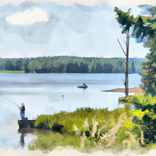
Fish Hatchery, located in Oneida, Wisconsin, is a state-owned facility regulated by the Wisconsin Department of Natural Resources. This gravity dam, completed in 1955, serves a primary purpose beyond water resource management, focusing on recreation and supporting the local ecosystem. With a height of 7.2 feet and a storage capacity of 800 acre-feet, the dam on the Minocqua Thoroughfare is an essential component in maintaining water levels and flow in the area.
Despite its vital role, Fish Hatchery faces significant hazard potential and poor condition assessment, highlighting the urgent need for maintenance and upgrades. The dam's inspection frequency of every three years and the last assessment in August 2020 underscore the ongoing monitoring efforts to ensure public safety and environmental protection. With a very high risk rating and limited risk management measures in place, stakeholders must prioritize addressing the dam's vulnerabilities to mitigate potential hazards and safeguard the surrounding community.
In light of its critical importance and the pressing need for improvements, Fish Hatchery stands as a valuable yet vulnerable asset in the water resource infrastructure of Wisconsin. As climate change continues to impact water resources and ecosystems, investing in the resilience and sustainability of facilities like Fish Hatchery is essential for the long-term viability of the region's water management strategies and environmental conservation efforts.
Plan around the weather
Same NOAA / yr.no feed Snoflo's iOS app uses. Watch the precipitation column on the meteogram -- rain on the basin upstream typically lifts inflow 24-72 hours later.
Next 5 days, hour by hour
Temperature line with weather symbols on top, snow + rain accumulation as columns, humidity as a dotted line.
5-day forecast table
Every 3 hours, broken out across temperature, snow, rain, humidity, and wind. Each cell is colour-coded relative to the column min/max.
| Time | Condition | Temp (°F) | Snow (in) | Rain (in) | Humidity (%) | Wind (mps) | Wind dir |
|---|---|---|---|---|---|---|---|
| Loading detailed forecast… | |||||||
15-day temperature & precipitation
Daily temperatures, snow, and rain projected over the next two weeks.
Nearby streamflow gauges
USGS streamgauges around Fish Hatchery -- inflows here typically show up in storage 24-72 hours later.
| Streamgauge | Discharge | View |
|---|---|---|
| Wisconsin River @ Rainbow Lake Nr Lake Tomahawk | 413 cfs | → |
| Allequash Creek At Cth M Nr Boulder Junction | 11 cfs | → |
| Allequash Creek Site 3 Near Boulder Junction | 4 cfs | → |
| Trout River At Trout Lake Near Boulder Junction | 30 cfs | → |
| Muskellunge Creek Near St. Germain | 9 cfs | → |
| Stevenson Creek At Cth M Nr Boulder Junction | 2 cfs | → |


About Fish Hatchery
Where does the data for Fish Hatchery come from?
Structural and regulatory data come from the U.S. Army Corps of Engineers' National Inventory of Dams (NID). Weather forecast comes from NOAA / yr.no -- the same feed Snoflo's iOS app uses.
How often is the report updated?
NID structural data refreshes annually as the Corps publishes updated assessments. The weather forecast refreshes throughout the day.
What does the Significant hazard rating mean?
The Corps of Engineers' hazard potential classification grades probable consequences if the dam fails: High = probable loss of human life; Significant = no probable loss of human life but possible economic loss / environmental damage; Low = no probable loss of human life, only minor economic / environmental losses. See the Dam Data Reference card below for the full definitions.
What's "% of normal"?
The current storage value compared to the historical average storage on this calendar day. 100% = right on average; values above 100% mean above-normal storage (wet year); values below mean below-normal (dry year or drought).
Can I get alerts when storage crosses a threshold?
Yes -- alerts are managed in the Snoflo iOS app. Favorite this dam, set a threshold, and you'll get a push the moment conditions cross.
Dam data reference
Condition Assessment
- Satisfactory
- No existing or potential dam safety deficiencies are recognized. Acceptable performance is expected under all loading conditions (static, hydrologic, seismic) in accordance with the minimum applicable state or federal regulatory criteria or tolerable risk guidelines.
- Fair
- No existing dam safety deficiencies are recognized for normal operating conditions. Rare or extreme hydrologic and/or seismic events may result in a dam safety deficiency. Risk may be in the range to take further action.
- Poor
- A dam safety deficiency is recognized for normal operating conditions which may realistically occur. Remedial action is necessary. POOR may also be used when uncertainties exist as to critical analysis parameters which identify a potential dam safety deficiency.
- Unsatisfactory
- A dam safety deficiency is recognized that requires immediate or emergency remedial action for problem resolution.
- Not Rated
- The dam has not been inspected, is not under state or federal jurisdiction, or has been inspected but, for whatever reason, has not been rated.
Hazard Potential Classification
- High
- Dams assigned the high hazard potential classification are those where failure or mis-operation will probably cause loss of human life.
- Significant
- Dams assigned the significant hazard potential classification are those dams where failure or mis-operation results in no probable loss of human life but can cause economic loss, environmental damage, disruption of lifeline facilities, or impact other concerns. Significant hazard potential classification dams are often located in predominantly rural or agricultural areas but could be in areas with population and significant infrastructure.
- Low
- Dams assigned the low hazard potential classification are those where failure or mis-operation results in no probable loss of human life and low economic and/or environmental losses. Losses are principally limited to the owner's property.
- Undetermined
- Dams for which a downstream hazard potential has not been designated or is not provided.