Pierpont Harbor Public Launch Ramp boat launch
Community Reviews
Been here? Share the conditions.
Reviews, ratings & photos are added in the free Snoflo iOS app — rate a spot, tag the conditions, and your visit is verified by location. Add or manage your reviews from the app.
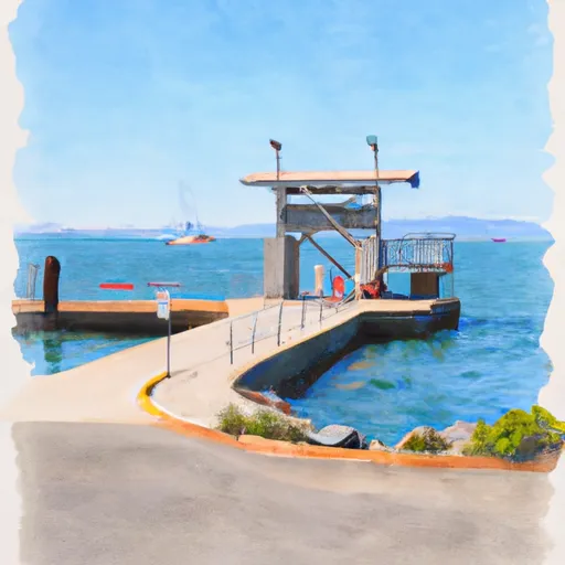
Pierpont Harbor Public Launch Ramp
This boat ramp is suitable for a variety of watercraft, including powerboats, sailboats, kayaks, and stand-up paddleboards. However, it is important to note that all vessels must comply with the local regulations and safety requirements, such as having proper safety equipment and registration.
Overall, the Pierpont Harbor Public Launch Ramp is a popular and well-maintained facility that provides convenient access to the beautiful waters of Pierpont Bay and the surrounding areas.
Plan your launch down to the hour
Same weather feed Snoflo's iOS app uses -- updated continuously from NOAA / yr.no.
Next 5 days, hour by hour
Temperature line with weather symbols on top, snow + rain accumulation as columns, humidity as a dotted line.
5-day forecast table
Every 3 hours, broken out across temperature, snow, rain, humidity, and wind.
| Time | Condition | Temp (°F) | Snow (in) | Rain (in) | Humidity (%) | Wind (mps) | Wind dir |
|---|---|---|---|---|---|---|---|
| Loading detailed forecast… | |||||||
15-day temperature & precipitation
Daily temperatures, snow, and rain projected over the next two weeks.
Area streamflow levels
USGS streamgauges around Pierpont Harbor Public Launch Ramp -- the same readings that determine whether your launch is safe and your boat is the right craft.
| Streamgauge | Discharge | View |
|---|---|---|
| Ventura R Nr Ventura | 15 cfs | → |
| Calleguas C Nr Camarillo Ca | 6 cfs | → |
| Santa Paula C Nr Santa Paula | 7 cfs | → |
| Carpinteria C Nr Carpinteria Ca | · | → |
| Matilija C Nr Res Nr Matilija Hot Springs Ca | 2 cfs | → |
| Sespe Creek Near Wheeler Springs Ca | 1 cfs | → |
Plan a longer trip
The closest paddle runs, fishing spots, and other boat launches so you can extend a day on the water.
River runs
- Headwaters In The Santa Monica Mountains To Mouth At Pacific Ocean
- Chorro Grande Canyon To Section Line Dividing Sec 1, T5n, R23w And Sec 6, T5n, T22w
- Section Line To Confluence With Rock Creek
- Headwaters, Upper Piru Creek To Wildernes Boundary
- Lower Piru Creek (Oulet At Pyramid Reservoir) To Piru Reservoir
- Wilderness Boundary To Confluence With Gold Hill Creek
Nearby fishing
Boating safety & etiquette
- Check the conditions before you launch
- Use the streamflow numbers, weather, and wind forecast on this page. High-cfs whitewater requires whitewater-specific craft and skill.
- Wear your life jacket
- Statistically the single biggest survival factor in a boating incident. State law often requires one per passenger.
- File a float plan
- Tell someone on shore your put-in, take-out, and expected return time. Especially for multi-day or remote trips.
- Yield at the ramp
- Prep gear in the parking lot, not on the ramp. Launch and clear quickly so others can use the lane.
- Clean, drain, dry
- Inspect, clean, drain and dry your boat between waters to prevent the spread of aquatic invasive species.
Set push alerts in the Snoflo app
Save Pierpont Harbor Public Launch Ramp as a favorite, set a discharge threshold or a wind/precipitation alert, and the iOS app will push the moment conditions cross.
About Pierpont Harbor Public Launch Ramp
Can I launch a motorboat here?
Most Snoflo-tracked launches support motorboats; check the operator for any horsepower restrictions, paddle-only zones, or seasonal closures.
How fresh is the streamflow data?
USGS streamgauges report continuously (every 15 minutes); the table on this page pulls the latest reading at page load.
Is there a fee?
Many federal and state boat launches charge a day-use fee. Check the operator's site before driving out.
What boat is right for these conditions?
Use the nearby streamflow numbers and river-run panel on this page to gauge current conditions. Wider, slower water is friendly for casual paddling and powerboats; high-cfs whitewater requires whitewater-specific craft and skill.
Can I get alerts when conditions change?
Yes -- alerts are managed in the Snoflo iOS app. Favorite this launch, set a threshold (discharge, wind), and you'll get a push the moment it crosses.
Other launches near here
Snoflo-tracked boat launches within driving distance of Pierpont Harbor Public Launch Ramp.