I 15 Provo Boat Launch
Community Reviews
Been here? Share the conditions.
Reviews, ratings & photos are added in the free Snoflo iOS app — rate a spot, tag the conditions, and your visit is verified by location. Add or manage your reviews from the app.
I 15 Provo
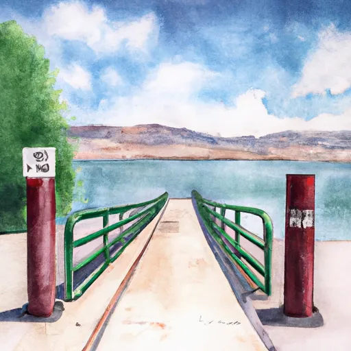
This boat ramp services Utah Lake, which is a large freshwater lake in Utah County, Utah. The lake is approximately 24 miles long and 13 miles wide, making it one of the largest lakes in Utah. Utah Lake is a popular destination for various water activities, including boating, fishing, and swimming.
As for the type of craft permitted on the water, Utah Lake allows a variety of watercraft, including powerboats, sailboats, kayaks, canoes, and paddleboards. However, all watercraft must comply with the regulations set forth by the Utah State Parks and Recreation Department, including safety equipment, registration, and licensing requirements.
According to the latest information available, the I 15 Provo boat ramp is open year-round, but hours of operation may vary depending on weather conditions and other factors. It is advisable to check with the Utah State Parks and Recreation Department for the latest information on the boat ramp's availability and any restrictions or advisories that may be in place.
Plan your launch down to the hour
Same weather feed Snoflo's iOS app uses -- updated continuously from NOAA / yr.no.
Next 5 days, hour by hour
Temperature line with weather symbols on top, snow + rain accumulation as columns, humidity as a dotted line.
5-day forecast table
Every 3 hours, broken out across temperature, snow, rain, humidity, and wind.
| Time | Condition | Temp (°F) | Snow (in) | Rain (in) | Humidity (%) | Wind (mps) | Wind dir |
|---|---|---|---|---|---|---|---|
| Loading detailed forecast… | |||||||
15-day temperature & precipitation
Daily temperatures, snow, and rain projected over the next two weeks.
Area streamflow levels
USGS streamgauges around I 15 Provo -- the same readings that determine whether your launch is safe and your boat is the right craft.
| Streamgauge | Discharge | View |
|---|---|---|
| Hobble Creek At 1650 West At Springville | 13 cfs | → |
| Provo River At Provo | 41 cfs | → |
| Spanish Fork At Castilla | 306 cfs | → |
| Diamond Fork Above Red Hollow | 39 cfs | → |
| American Fk Ab Upper Powerplant Nr American Fk | 21 cfs | → |
| Sixth Water Cr Ab Syar Tunnel | 23 cfs | → |
Plan a longer trip
The closest paddle runs, fishing spots, and other boat launches so you can extend a day on the water.
River runs
- Bridal Veil (Bv)
- Headwater Spring In Sec 8 To Mt Timpanogos Wilderness Boundary
- Mt Timpanogos Wilderness Boundary To Theater-In-The-Pines
- Spanish Fork
- Confluence Below Timpooneke To Mt Timpanogos Wilderness Boundary
- Mt Timpanogos Wilderenss Boundary To Scout Falls
Nearby fishing
Boating safety & etiquette
- Check the conditions before you launch
- Use the streamflow numbers, weather, and wind forecast on this page. High-cfs whitewater requires whitewater-specific craft and skill.
- Wear your life jacket
- Statistically the single biggest survival factor in a boating incident. State law often requires one per passenger.
- File a float plan
- Tell someone on shore your put-in, take-out, and expected return time. Especially for multi-day or remote trips.
- Yield at the ramp
- Prep gear in the parking lot, not on the ramp. Launch and clear quickly so others can use the lane.
- Clean, drain, dry
- Inspect, clean, drain and dry your boat between waters to prevent the spread of aquatic invasive species.
Set push alerts in the Snoflo app
Save I 15 Provo as a favorite, set a discharge threshold or a wind/precipitation alert, and the iOS app will push the moment conditions cross.
About I 15 Provo
Can I launch a motorboat here?
Most Snoflo-tracked launches support motorboats; check the operator for any horsepower restrictions, paddle-only zones, or seasonal closures.
How fresh is the streamflow data?
USGS streamgauges report continuously (every 15 minutes); the table on this page pulls the latest reading at page load.
Is there a fee?
Many federal and state boat launches charge a day-use fee. Check the operator's site before driving out.
What boat is right for these conditions?
Use the nearby streamflow numbers and river-run panel on this page to gauge current conditions. Wider, slower water is friendly for casual paddling and powerboats; high-cfs whitewater requires whitewater-specific craft and skill.
Can I get alerts when conditions change?
Yes -- alerts are managed in the Snoflo iOS app. Favorite this launch, set a threshold (discharge, wind), and you'll get a push the moment it crosses.
Other launches near here
Snoflo-tracked boat launches within driving distance of I 15 Provo.