Lincoln Beach Road Utah County boat launch
Community Reviews
Been here? Share the conditions.
Reviews, ratings & photos are added in the free Snoflo iOS app — rate a spot, tag the conditions, and your visit is verified by location. Add or manage your reviews from the app.
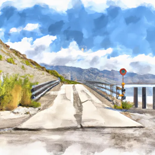
Lincoln Beach Road Utah County
The kind of craft permitted on the water varies depending on the regulations set by the Utah Division of Wildlife Resources. As of 2021, motorized watercraft are allowed on the Utah Lake, including powerboats, jet skis, sailboats, and other similar watercraft. However, there are certain restrictions in place, including speed limits and no-wake zones, to ensure the safety of all boaters and protect the environment.
In summary, the Lincoln Beach Road boat ramp in Utah County is a concrete boat ramp that services the Utah Lake. It is approximately 24 feet wide and allows for motorized watercraft, including powerboats, jet skis, and sailboats, subject to certain restrictions.
Plan your launch down to the hour
Same weather feed Snoflo's iOS app uses -- updated continuously from NOAA / yr.no.
Next 5 days, hour by hour
Temperature line with weather symbols on top, snow + rain accumulation as columns, humidity as a dotted line.
5-day forecast table
Every 3 hours, broken out across temperature, snow, rain, humidity, and wind.
| Time | Condition | Temp (°F) | Snow (in) | Rain (in) | Humidity (%) | Wind (mps) | Wind dir |
|---|---|---|---|---|---|---|---|
| Loading detailed forecast… | |||||||
15-day temperature & precipitation
Daily temperatures, snow, and rain projected over the next two weeks.
Area streamflow levels
USGS streamgauges around Lincoln Beach Road Utah County -- the same readings that determine whether your launch is safe and your boat is the right craft.
| Streamgauge | Discharge | View |
|---|---|---|
| Provo River At Provo | 36 cfs | → |
| Hobble Creek At 1650 West At Springville | 13 cfs | → |
| Summit Creek Abv Summit Cr Canal Nr Santaquin Ut | 3 cfs | → |
| Spanish Fork At Castilla | 318 cfs | → |
| American Fk Ab Upper Powerplant Nr American Fk | 19 cfs | → |
| Diamond Fork Above Red Hollow | 42 cfs | → |
Plan a longer trip
The closest paddle runs, fishing spots, and other boat launches so you can extend a day on the water.
River runs
- Spanish Fork
- Bridal Veil (Bv)
- Headwater Spring In Sec 8 To Mt Timpanogos Wilderness Boundary
- Mt Timpanogos Wilderness Boundary To Theater-In-The-Pines
- Eastern Boundary Of National Monument To Western Boundary Of National Monument
- Confluence Below Timpooneke To Mt Timpanogos Wilderness Boundary
Nearby fishing
Other boat launches
Boating safety & etiquette
- Check the conditions before you launch
- Use the streamflow numbers, weather, and wind forecast on this page. High-cfs whitewater requires whitewater-specific craft and skill.
- Wear your life jacket
- Statistically the single biggest survival factor in a boating incident. State law often requires one per passenger.
- File a float plan
- Tell someone on shore your put-in, take-out, and expected return time. Especially for multi-day or remote trips.
- Yield at the ramp
- Prep gear in the parking lot, not on the ramp. Launch and clear quickly so others can use the lane.
- Clean, drain, dry
- Inspect, clean, drain and dry your boat between waters to prevent the spread of aquatic invasive species.
Set push alerts in the Snoflo app
Save Lincoln Beach Road Utah County as a favorite, set a discharge threshold or a wind/precipitation alert, and the iOS app will push the moment conditions cross.
About Lincoln Beach Road Utah County
Can I launch a motorboat here?
Most Snoflo-tracked launches support motorboats; check the operator for any horsepower restrictions, paddle-only zones, or seasonal closures.
How fresh is the streamflow data?
USGS streamgauges report continuously (every 15 minutes); the table on this page pulls the latest reading at page load.
Is there a fee?
Many federal and state boat launches charge a day-use fee. Check the operator's site before driving out.
What boat is right for these conditions?
Use the nearby streamflow numbers and river-run panel on this page to gauge current conditions. Wider, slower water is friendly for casual paddling and powerboats; high-cfs whitewater requires whitewater-specific craft and skill.
Can I get alerts when conditions change?
Yes -- alerts are managed in the Snoflo iOS app. Favorite this launch, set a threshold (discharge, wind), and you'll get a push the moment it crosses.
Other launches near here
Snoflo-tracked boat launches within driving distance of Lincoln Beach Road Utah County.