Panamint Springs Campground
Community Reviews
Been here? Share the conditions.
Reviews, ratings & photos are added in the free Snoflo iOS app — rate a spot, tag the conditions, and your visit is verified by location. Add or manage your reviews from the app.
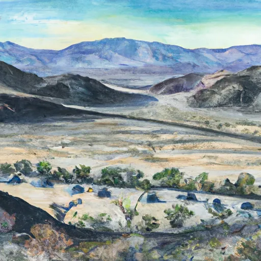
Panamint Springs
The campground offers basic amenities such as clean restrooms, hot showers, and a general store where campers can stock up on essentials and supplies. Additionally, there is a restaurant on-site, allowing visitors to enjoy a delicious meal without having to leave the camping area. It is important to note that reservations are not accepted at Panamint Springs Camping Area; campsites are available on a first-come, first-served basis.
The best time to visit this camping area is during the spring and fall seasons when the weather is milder, making it more comfortable for outdoor activities. The summer months should be approached with caution due to the extremely high temperatures in the area. It is recommended to bring plenty of water, sunscreen, and appropriate clothing to protect against the intense heat. Exploring the nearby Death Valley National Park is a must, as it offers stunning landscapes, hiking trails, and opportunities for stargazing. However, campers should be aware of potential wildlife encounters and follow all safety guidelines to ensure a safe and enjoyable experience. Overall, Panamint Springs Camping Area is a fantastic destination for nature enthusiasts seeking tranquility and adventure in the heart of California.
What's on-site at Panamint Springs
Key facilities Snoflo tracks for this campground. Confirm with the operator before booking -- amenities can change seasonally.
Plan your trip down to the hour
Same weather feed Snoflo's iOS app uses -- updated continuously from NOAA / yr.no.
Next 5 days, hour by hour
Temperature line with weather symbols on top, snow + rain accumulation as columns, humidity as a dotted line.
5-day forecast table
Every 3 hours, broken out across temperature, snow, rain, humidity, and wind. Each cell is colour-coded relative to the column min/max so trends jump out at a glance.
| Time | Condition | Temp (°F) | Snow (in) | Rain (in) | Humidity (%) | Wind (mps) | Wind dir |
|---|---|---|---|---|---|---|---|
| Loading detailed forecast… | |||||||
15-day temperature & precipitation
Daily temperatures, snow, and rain projected over the next two weeks. Hover any point for the full breakdown.
Other campgrounds in the area
Snoflo-tracked campsites within driving distance of Panamint Springs, with reservations status.
| Campground | Reservations | Toilets | View |
|---|---|---|---|
| Wildrose - Death Valley National Park | ✗ | ✓ | → |
| Emigrant - Death Valley National Park | ✗ | ✓ | → |
| Cottowood Canyon Campsite C7 | ✗ | ✗ | → |
| Homestake Dry Camp | ✗ | ✗ | → |
| Thorndike - Death Valley National Park | ✗ | ✓ | → |
Nearby streamflow
USGS streamgauges within reach of Panamint Springs -- pulled live from the National Water Information System.
| Streamgauge | Discharge | View |
|---|---|---|
| Sf Kern R Nr Onyx Ca | 21 cfs | → |
Nearby snow depths
NRCS SNOTEL stations within reach of Panamint Springs -- relevant when planning a shoulder-season or alpine trip.
| SNOTEL station | Snowpack | 24h Snowfall | View |
|---|---|---|---|
| Death Valley | 0.0 in | 0.0 in | → |
| Cottonwood Lakes | 0.0 in | 0.0 in | → |
| Nohrsc Casa Vieja Meadows | 169.8 in | 0.0 in | → |
| Beach Meadows | 0.0 in | 0.0 in | → |
Plan a longer trip
The closest parks, lakes, boat launches, and paddle runs so a camping night can grow into a full weekend.
Parks
- Darwin Falls Wilderness
- Malpais Mesa Wilderness
- Surprise Canyon Wilderness
- Coso Range Wilderness
- Wilderness Inyo Mountains
- Argus Range Wilderness
Fishing spots
- Cottonwood Creek Lower Lone Pine
- South Fork Cottonwood Creek
- Muir Lake
- Cottonwood Lakes
- High Lake
- Peanut Lake
Camping essentials & Leave No Trace
- Pack it in, pack it out
- Take all trash, food scraps, and gear back with you to keep campsites clean and protect wildlife.
- Respect wildlife
- Observe animals from a distance, store food securely, and never feed wildlife to maintain natural behavior and safety.
- Know before you go
- Check weather, fire restrictions, trail conditions, and permit requirements to ensure a safe and well-planned trip.
- Minimize campfire impact
- Use established fire rings, keep fires small, fully extinguish them, or opt for a camp stove when fires are restricted.
- Leave what you find
- Preserve natural and cultural features by avoiding removal of plants, rocks, artifacts, or other elements of the environment.
Set push alerts in the Snoflo app
Save Panamint Springs as a favorite, set a custom threshold (precipitation, snowpack, freezing temperatures), and the iOS app will push the moment conditions cross.
About Panamint Springs
Can I make reservations at Panamint Springs?
Yes -- this campground accepts reservations. Snoflo recommends booking early for peak season; check the operator (Recreation.gov / state park system / private operator) for the booking window and cancellation policy.
How fresh is the weather data on this page?
The hourly forecast updates throughout the day from the NOAA / yr.no public feeds. Streamflow data is pulled live from USGS streamgauges and snowpack from the NRCS SNOTEL network.
What's the best time of year to visit?
Use the 15-day temperature & precipitation outlook on this page to plan -- pick a window with comfortable temperatures and low precipitation. For longer trips, the 5-day hourly meteogram shows snow + rain accumulation hour-by-hour.
How do I get to Panamint Springs?
Tap Directions in the hero above to open driving directions in Google Maps, or Open in map to center the Snoflo interactive map on the campground.
Can I get alerts when conditions change?
Yes -- alerts are managed through the Snoflo iOS app. Favorite this campground, set a threshold (temperature, snowpack, precipitation), and you'll get a push the moment it crosses.
Other campgrounds near here
Snoflo-tracked campgrounds within driving distance of Panamint Springs.