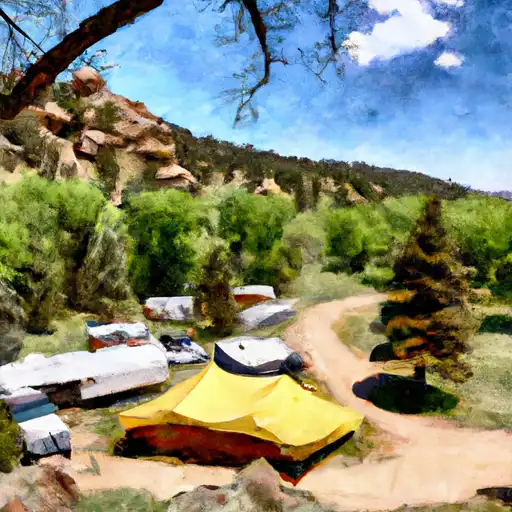
Davis Springs campground
Community Reviews
Been here? Share the conditions.
Reviews, ratings & photos are added in the free Snoflo iOS app — rate a spot, tag the conditions, and your visit is verified by location. Add or manage your reviews from the app.
Davis Springs
Reservations are accepted at Davis Springs camping area, which is a convenient feature for campers looking to secure a spot ahead of time. It is advisable to make a reservation, especially during peak seasons, to ensure availability.
The best time of year to visit Davis Springs camping area is during the summer months when the weather is favorable for outdoor activities. The campground offers beautiful hiking trails that showcase the stunning natural beauty of Colorado. Visitors can also enjoy fishing in nearby streams and lakes, providing ample opportunities for relaxation and enjoyment. However, it is important to note that the campground is located in bear country, so campers should take precautions by properly storing food and trash to avoid attracting wildlife. Overall, Davis Springs camping area offers a serene and scenic environment for a memorable camping experience.
What's on-site at Davis Springs
Key facilities Snoflo tracks for this campground. Confirm with the operator before booking -- amenities can change seasonally.
Plan your trip down to the hour
Same weather feed Snoflo's iOS app uses -- updated continuously from NOAA / yr.no.
Next 5 days, hour by hour
Temperature line with weather symbols on top, snow + rain accumulation as columns, humidity as a dotted line.
5-day forecast table
Every 3 hours, broken out across temperature, snow, rain, humidity, and wind. Each cell is colour-coded relative to the column min/max so trends jump out at a glance.
| Time | Condition | Temp (°F) | Snow (in) | Rain (in) | Humidity (%) | Wind (mps) | Wind dir |
|---|---|---|---|---|---|---|---|
| Loading detailed forecast… | |||||||
15-day temperature & precipitation
Daily temperatures, snow, and rain projected over the next two weeks. Hover any point for the full breakdown.
Other campgrounds in the area
Snoflo-tracked campsites within driving distance of Davis Springs, with reservations status.
| Campground | Reservations | Toilets | View |
|---|---|---|---|
| Prairie Point | ✗ | ✓ | → |
| Prairie Point Campground | ✓ | ✗ | → |
| Camping | ✗ | ✗ | → |
| Mcdonald Flats | ✗ | ✓ | → |
| Mcdonald Flats Campground | ✓ | ✗ | → |
Nearby streamflow
USGS streamgauges within reach of Davis Springs -- pulled live from the National Water Information System.
| Streamgauge | Discharge | View |
|---|---|---|
| Blue River Below Green Mountain Reservoir | 444 cfs | → |
| Williams Fork Near Leal | 25 cfs | → |
| South Fork Of Williams Fork Near Leal | 9 cfs | → |
| Williams Fork Above Darling Creek | 7 cfs | → |
| Williams Fork Near Parshall | 9 cfs | → |
| Williams Fork Below Williams Fork Reservoir | 469 cfs | → |
Nearby snow depths
NRCS SNOTEL stations within reach of Davis Springs -- relevant when planning a shoulder-season or alpine trip.
| SNOTEL station | Snowpack | 24h Snowfall | View |
|---|---|---|---|
| Silverthorne 21 Nw | 0.0 in | 0.0 in | → |
| Summit Ranch | 0.0 in | 0.0 in | → |
| Nohrsc Summit Ranch | 0.0 in | 0.0 in | → |
| Elliot Ridge | 0.0 in | -1.0 in | → |
| Elliot Ridge Snotel | 1.0 in | 0.0 in | → |
| Middle Fork Camp | 0.0 in | 0.0 in | → |
Plan a longer trip
The closest parks, lakes, boat launches, and paddle runs so a camping night can grow into a full weekend.
Parks
- Booth Creek Park
- Wilderness Byers Peak
- Bighorn Park
- Pirate Ship Playground
- Red Sandstone Park
- Donovan Park
Boat launches
- Co 9 Summit County
- Confluence Rec Site Boat Ramp
- Radium Rec Site Boat Ramp
- Eagle Valley Trail Avon
- State Bridge River Access
- State Bridge Boat Ramp
Fishing spots
- Green Mountain Reservoir
- Lower Cataract Lake
- Upper Cataract Lake
- Williams Fork Reservoir
- Giberson Bay Day Use Fishing Site
- Dillon Reservoir
Camping essentials & Leave No Trace
- Pack it in, pack it out
- Take all trash, food scraps, and gear back with you to keep campsites clean and protect wildlife.
- Respect wildlife
- Observe animals from a distance, store food securely, and never feed wildlife to maintain natural behavior and safety.
- Know before you go
- Check weather, fire restrictions, trail conditions, and permit requirements to ensure a safe and well-planned trip.
- Minimize campfire impact
- Use established fire rings, keep fires small, fully extinguish them, or opt for a camp stove when fires are restricted.
- Leave what you find
- Preserve natural and cultural features by avoiding removal of plants, rocks, artifacts, or other elements of the environment.
Set push alerts in the Snoflo app
Save Davis Springs as a favorite, set a custom threshold (precipitation, snowpack, freezing temperatures), and the iOS app will push the moment conditions cross.
About Davis Springs
Can I make reservations at Davis Springs?
This campground does not appear to accept reservations -- it's typically first-come, first-served. Arrive early on summer weekends.
How fresh is the weather data on this page?
The hourly forecast updates throughout the day from the NOAA / yr.no public feeds. Streamflow data is pulled live from USGS streamgauges and snowpack from the NRCS SNOTEL network.
What's the best time of year to visit?
Use the 15-day temperature & precipitation outlook on this page to plan -- pick a window with comfortable temperatures and low precipitation. For longer trips, the 5-day hourly meteogram shows snow + rain accumulation hour-by-hour.
How do I get to Davis Springs?
Tap Directions in the hero above to open driving directions in Google Maps, or Open in map to center the Snoflo interactive map on the campground.
Can I get alerts when conditions change?
Yes -- alerts are managed through the Snoflo iOS app. Favorite this campground, set a threshold (temperature, snowpack, precipitation), and you'll get a push the moment it crosses.
Other campgrounds near here
Snoflo-tracked campgrounds within driving distance of Davis Springs.