Dominguez Campground Campground
Community Reviews
Been here? Share the conditions.
Reviews, ratings & photos are added in the free Snoflo iOS app — rate a spot, tag the conditions, and your visit is verified by location. Add or manage your reviews from the app.
Dominguez Campground
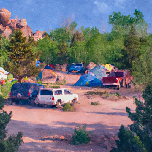
The campground itself offers a range of amenities, including picnic tables, fire rings, and vault toilets, as well as potable water. It is also suitable for RVs, although there are no hookups available.
One of the main points of interest in the area is the nearby Dominguez Canyon Wilderness Area. This 66,280-acre wilderness area features rugged canyons, towering cliffs, and cascading waterfalls. The area is home to a variety of wildlife, including bighorn sheep, mountain lions, and black bears.
Another nearby attraction is the Gunnison Gorge National Conservation Area, which offers world-class fishing opportunities for rainbow and brown trout. Visitors can also enjoy hiking and camping in this area.
The best time of year to visit the Dominguez Campground Campground area is in the spring and fall when temperatures are cooler and the area is less crowded. The average temperature during these seasons ranges from the mid-40s to mid-70s.
Overall, the Dominguez Campground Campground area offers visitors a beautiful and peaceful setting with plenty of opportunities for outdoor adventure.
What's on-site at Dominguez Campground
Key facilities Snoflo tracks for this campground. Confirm with the operator before booking -- amenities can change seasonally.
Plan your trip down to the hour
Same weather feed Snoflo's iOS app uses -- updated continuously from NOAA / yr.no.
Next 5 days, hour by hour
Temperature line with weather symbols on top, snow + rain accumulation as columns, humidity as a dotted line.
5-day forecast table
Every 3 hours, broken out across temperature, snow, rain, humidity, and wind. Each cell is colour-coded relative to the column min/max so trends jump out at a glance.
| Time | Condition | Temp (°F) | Snow (in) | Rain (in) | Humidity (%) | Wind (mps) | Wind dir |
|---|---|---|---|---|---|---|---|
| Loading detailed forecast… | |||||||
15-day temperature & precipitation
Daily temperatures, snow, and rain projected over the next two weeks. Hover any point for the full breakdown.
Other campgrounds in the area
Snoflo-tracked campsites within driving distance of Dominguez Campground, with reservations status.
| Campground | Reservations | Toilets | View |
|---|---|---|---|
| Big Dominguez Campground | ✗ | ✗ | → |
| Big Dominguez | ✗ | ✗ | → |
| Divide Fork | ✗ | ✓ | → |
| Divide Forks Campground - Grand Valley Rd | ✓ | ✗ | → |
| Aspen Leaf Cabin | ✓ | ✗ | → |
Nearby streamflow
USGS streamgauges within reach of Dominguez Campground -- pulled live from the National Water Information System.
| Streamgauge | Discharge | View |
|---|---|---|
| Gunnison River Near Grand Junction | 650 cfs | → |
| Dolores River Near Gateway | 5 cfs | → |
| Uncompahgre River At Delta | 115 cfs | → |
| Gunnison River At Delta | 426 cfs | → |
| Colo River Blw Grd Valley Div Nr Palisade Co | 310 cfs | → |
| San Miguel River At Uravan | 28 cfs | → |
Nearby snow depths
NRCS SNOTEL stations within reach of Dominguez Campground -- relevant when planning a shoulder-season or alpine trip.
| SNOTEL station | Snowpack | 24h Snowfall | View |
|---|---|---|---|
| East Junction Ham | 0.0 in | 0.0 in | → |
| Redlands 1.4 Sse | 0.0 in | 0.0 in | → |
| Grand Junction 3.6 W | 0.0 in | 0.0 in | → |
| Grand Junction 1.0 E | 0.0 in | 0.0 in | → |
| Columbine Pass | 1.0 in | 0.0 in | → |
| Grand Junction 4.0 W | 0.0 in | 0.0 in | → |
Plan a longer trip
The closest parks, lakes, boat launches, and paddle runs so a camping night can grow into a full weekend.
Parks
- Dominguez-Escalante National Conservation Area
- Colorado National Monument
- James M Robb Colorado River State Park
- Grand Mesa National Forest
- Columbine Park
- Confluence Park
Boat launches
- Escalante Canyon Road Delta County
- Escalante Boat Launch
- Whitewater Boat Launch
- State Highway 141 Mesa County
- Redlands Dam River Access
- Eagle Rim Trail Grand Junction
Fishing spots
Camping essentials & Leave No Trace
- Pack it in, pack it out
- Take all trash, food scraps, and gear back with you to keep campsites clean and protect wildlife.
- Respect wildlife
- Observe animals from a distance, store food securely, and never feed wildlife to maintain natural behavior and safety.
- Know before you go
- Check weather, fire restrictions, trail conditions, and permit requirements to ensure a safe and well-planned trip.
- Minimize campfire impact
- Use established fire rings, keep fires small, fully extinguish them, or opt for a camp stove when fires are restricted.
- Leave what you find
- Preserve natural and cultural features by avoiding removal of plants, rocks, artifacts, or other elements of the environment.
Set push alerts in the Snoflo app
Save Dominguez Campground as a favorite, set a custom threshold (precipitation, snowpack, freezing temperatures), and the iOS app will push the moment conditions cross.
About Dominguez Campground
Can I make reservations at Dominguez Campground?
This campground does not appear to accept reservations -- it's typically first-come, first-served. Arrive early on summer weekends.
How fresh is the weather data on this page?
The hourly forecast updates throughout the day from the NOAA / yr.no public feeds. Streamflow data is pulled live from USGS streamgauges and snowpack from the NRCS SNOTEL network.
What's the best time of year to visit?
Use the 15-day temperature & precipitation outlook on this page to plan -- pick a window with comfortable temperatures and low precipitation. For longer trips, the 5-day hourly meteogram shows snow + rain accumulation hour-by-hour.
How do I get to Dominguez Campground?
Tap Directions in the hero above to open driving directions in Google Maps, or Open in map to center the Snoflo interactive map on the campground.
Can I get alerts when conditions change?
Yes -- alerts are managed through the Snoflo iOS app. Favorite this campground, set a threshold (temperature, snowpack, precipitation), and you'll get a push the moment it crosses.
Other campgrounds near here
Snoflo-tracked campgrounds within driving distance of Dominguez Campground.