Fluffle 21 Campground
Community Reviews
Been here? Share the conditions.
Reviews, ratings & photos are added in the free Snoflo iOS app — rate a spot, tag the conditions, and your visit is verified by location. Add or manage your reviews from the app.
Fluffle 21
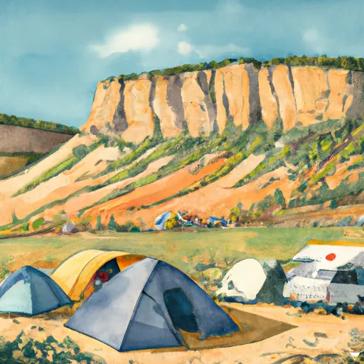
The campground itself offers several amenities for visitors, including picnic tables, fire rings, and vault toilets. There is also a nearby stream that provides a great spot for fishing or relaxing. Additionally, there are several hiking trails in the area, including the Continental Divide Trail and the Colorado Trail.
Interesting facts about the area include that the Colorado headwaters-Plateau watershed is the source of the Colorado River, which runs over 1,400 miles through seven US states and into Mexico. The area is also home to a variety of wildlife, including elk, deer, and mountain goats.
The best time of year to visit Fluffle 21 Campsite is during the summer months, when average temperatures range from the mid-50s to the mid-70s. This is also the peak season for hiking and fishing in the area, as the snow has melted and the trails are clear.
Sources:
- https://www.fs.usda.gov/recarea/mbr/recreation/camping-cabins/recarea/?recid=22844&actid=29
- https://www.colorado.com/articles/10-amazing-things-do-colorados-watershed
- https://www.visitcolorado.com/campgrounds/fluffle-21-campground
What's on-site at Fluffle 21
Key facilities Snoflo tracks for this campground. Confirm with the operator before booking -- amenities can change seasonally.
Plan your trip down to the hour
Same weather feed Snoflo's iOS app uses -- updated continuously from NOAA / yr.no.
Next 5 days, hour by hour
Temperature line with weather symbols on top, snow + rain accumulation as columns, humidity as a dotted line.
5-day forecast table
Every 3 hours, broken out across temperature, snow, rain, humidity, and wind. Each cell is colour-coded relative to the column min/max so trends jump out at a glance.
| Time | Condition | Temp (°F) | Snow (in) | Rain (in) | Humidity (%) | Wind (mps) | Wind dir |
|---|---|---|---|---|---|---|---|
| Loading detailed forecast… | |||||||
15-day temperature & precipitation
Daily temperatures, snow, and rain projected over the next two weeks. Hover any point for the full breakdown.
Other campgrounds in the area
Snoflo-tracked campsites within driving distance of Fluffle 21, with reservations status.
| Campground | Reservations | Toilets | View |
|---|---|---|---|
| Fluffle 22 | ✗ | ✗ | → |
| Fluffle 17 | ✗ | ✗ | → |
| Fluffle 23 | ✗ | ✗ | → |
| Fluffle 18 | ✗ | ✗ | → |
| Fluffle 19 | ✗ | ✗ | → |
Nearby streamflow
USGS streamgauges within reach of Fluffle 21 -- pulled live from the National Water Information System.
| Streamgauge | Discharge | View |
|---|---|---|
| Colorado River Near Colorado-Utah State Line | 1,580 cfs | → |
| Dolores River Near Cisco | 32 cfs | → |
| Colorado River Near Cisco | 1,610 cfs | → |
| Gunnison River Near Grand Junction | 2,230 cfs | → |
| Colo River Blw Grd Valley Div Nr Palisade Co | 294 cfs | → |
| Dolores River Near Gateway | 17 cfs | → |
Nearby snow depths
NRCS SNOTEL stations within reach of Fluffle 21 -- relevant when planning a shoulder-season or alpine trip.
| SNOTEL station | Snowpack | 24h Snowfall | View |
|---|---|---|---|
| Glade Park | 0.0 in | 0.0 in | → |
| Redlands 1.4 Sse | 0.0 in | 0.0 in | → |
| Grand Junction 4.0 W | 0.0 in | 0.0 in | → |
| Grand Junction 3.6 W | 0.0 in | 0.0 in | → |
| Grand Junction 1.0 E | 0.0 in | 0.0 in | → |
| Grand Junction | 0.0 in | 0.0 in | → |
Plan a longer trip
The closest parks, lakes, boat launches, and paddle runs so a camping night can grow into a full weekend.
Parks
- Highline Lake State Park
- Mcinnis Canyons National Conservation
- Mcinnis Canyons National Conservation Area
- Wilderness Black Ridge Canyons
- Colorado National Monument
- Columbine Park
Boat launches
Fishing spots
- Mack Mesa Reservoir
- Mack Mesa Lake
- Highline Lake
- Fruita Reservoir Number 2
- Connected Lakes
- West Lake (Gj)
Points of interest
Camping essentials & Leave No Trace
- Pack it in, pack it out
- Take all trash, food scraps, and gear back with you to keep campsites clean and protect wildlife.
- Respect wildlife
- Observe animals from a distance, store food securely, and never feed wildlife to maintain natural behavior and safety.
- Know before you go
- Check weather, fire restrictions, trail conditions, and permit requirements to ensure a safe and well-planned trip.
- Minimize campfire impact
- Use established fire rings, keep fires small, fully extinguish them, or opt for a camp stove when fires are restricted.
- Leave what you find
- Preserve natural and cultural features by avoiding removal of plants, rocks, artifacts, or other elements of the environment.
Set push alerts in the Snoflo app
Save Fluffle 21 as a favorite, set a custom threshold (precipitation, snowpack, freezing temperatures), and the iOS app will push the moment conditions cross.
About Fluffle 21
Can I make reservations at Fluffle 21?
This campground does not appear to accept reservations -- it's typically first-come, first-served. Arrive early on summer weekends.
How fresh is the weather data on this page?
The hourly forecast updates throughout the day from the NOAA / yr.no public feeds. Streamflow data is pulled live from USGS streamgauges and snowpack from the NRCS SNOTEL network.
What's the best time of year to visit?
Use the 15-day temperature & precipitation outlook on this page to plan -- pick a window with comfortable temperatures and low precipitation. For longer trips, the 5-day hourly meteogram shows snow + rain accumulation hour-by-hour.
How do I get to Fluffle 21?
Tap Directions in the hero above to open driving directions in Google Maps, or Open in map to center the Snoflo interactive map on the campground.
Can I get alerts when conditions change?
Yes -- alerts are managed through the Snoflo iOS app. Favorite this campground, set a threshold (temperature, snowpack, precipitation), and you'll get a push the moment it crosses.
Other campgrounds near here
Snoflo-tracked campgrounds within driving distance of Fluffle 21.