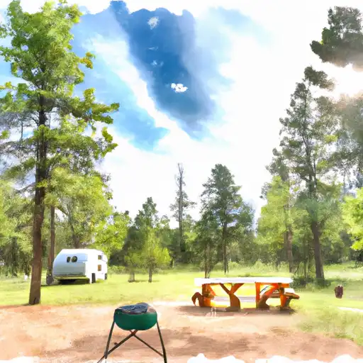
Iron Springs Campground
Community Reviews
Been here? Share the conditions.
Reviews, ratings & photos are added in the free Snoflo iOS app — rate a spot, tag the conditions, and your visit is verified by location. Add or manage your reviews from the app.
Iron Springs
Reservations are accepted at Iron Springs camping area, allowing campers to secure their spot in advance. It is recommended to make reservations, especially during peak seasons, to guarantee availability.
The best time of year to visit Iron Springs camping area is during the summer months when the weather is pleasant and conducive for outdoor activities. However, it's important to note that the campground may be more crowded during this time. Spring and fall can also be great seasons to visit, providing cooler temperatures and fewer crowds.
While camping at Iron Springs, visitors should be cautious of wildlife in the area, as encounters with animals such as bears and mountain lions may occur. It is essential to properly store food and dispose of trash to prevent attracting wildlife. Additionally, campers should be mindful of fire safety and adhere to any fire restrictions put in place by the campground or local authorities. By taking these precautions, visitors can enjoy a safe and memorable camping experience at Iron Springs camping area.
What's on-site at Iron Springs
Key facilities Snoflo tracks for this campground. Confirm with the operator before booking -- amenities can change seasonally.
Plan your trip down to the hour
Same weather feed Snoflo's iOS app uses -- updated continuously from NOAA / yr.no.
Next 5 days, hour by hour
Temperature line with weather symbols on top, snow + rain accumulation as columns, humidity as a dotted line.
5-day forecast table
Every 3 hours, broken out across temperature, snow, rain, humidity, and wind. Each cell is colour-coded relative to the column min/max so trends jump out at a glance.
| Time | Condition | Temp (°F) | Snow (in) | Rain (in) | Humidity (%) | Wind (mps) | Wind dir |
|---|---|---|---|---|---|---|---|
| Loading detailed forecast… | |||||||
15-day temperature & precipitation
Daily temperatures, snow, and rain projected over the next two weeks. Hover any point for the full breakdown.
Other campgrounds in the area
Snoflo-tracked campsites within driving distance of Iron Springs, with reservations status.
| Campground | Reservations | Toilets | View |
|---|---|---|---|
| Iron Springs Campground | ✗ | ✗ | → |
| Iron Springs Campground - Ouray Rd | ✓ | ✗ | → |
| Silesca Guard Station | ✓ | ✗ | → |
| Blue Spruce Camp | ✗ | ✗ | → |
| Horsefly Camp | ✗ | ✗ | → |
Nearby streamflow
USGS streamgauges within reach of Iron Springs -- pulled live from the National Water Information System.
| Streamgauge | Discharge | View |
|---|---|---|
| San Miguel River At Brooks Bridge Near Nucla Co | 4 cfs | → |
| San Miguel River Near Placerville | 111 cfs | → |
| Uncompahgre River At Colona | 105 cfs | → |
| Uncompahgre River Below Ridgway Reservoir | 144 cfs | → |
| Dallas Creek Near Ridgway | 2 cfs | → |
| Uncompahgre River Near Ridgway | 59 cfs | → |
Nearby snow depths
NRCS SNOTEL stations within reach of Iron Springs -- relevant when planning a shoulder-season or alpine trip.
| SNOTEL station | Snowpack | 24h Snowfall | View |
|---|---|---|---|
| Columbine Pass | 1.0 in | 0.0 in | → |
| Montrose 6.3 Wsw | 0.0 in | 0.0 in | → |
| Nohrsc Columbine Pass | 1.0 in | 0.0 in | → |
| Colona 4nw | 0.0 in | 0.0 in | → |
| Montrose 4.0 Nw | 0.0 in | 0.0 in | → |
| Montrose 1.6 E | 0.0 in | 0.0 in | → |
Plan a longer trip
The closest parks, lakes, boat launches, and paddle runs so a camping night can grow into a full weekend.
Parks
- Dominguez-Escalante National Conservation Area
- Rainbow Meadows
- Centennial Plaza
- Nucla Town Park
- Olathe Community Park
- Gunnison Gorge National Conservation Area
Boat launches
Fishing spots
- Twin Lakes Reservoir
- Chipeta Lakes Swa
- Ridgway Reservoir
- Miramonte Reservoir (Dan Noble Swa)
- Sweitzer Lake
- Confluence Lake
Points of interest
Camping essentials & Leave No Trace
- Pack it in, pack it out
- Take all trash, food scraps, and gear back with you to keep campsites clean and protect wildlife.
- Respect wildlife
- Observe animals from a distance, store food securely, and never feed wildlife to maintain natural behavior and safety.
- Know before you go
- Check weather, fire restrictions, trail conditions, and permit requirements to ensure a safe and well-planned trip.
- Minimize campfire impact
- Use established fire rings, keep fires small, fully extinguish them, or opt for a camp stove when fires are restricted.
- Leave what you find
- Preserve natural and cultural features by avoiding removal of plants, rocks, artifacts, or other elements of the environment.
Set push alerts in the Snoflo app
Save Iron Springs as a favorite, set a custom threshold (precipitation, snowpack, freezing temperatures), and the iOS app will push the moment conditions cross.
About Iron Springs
Can I make reservations at Iron Springs?
This campground does not appear to accept reservations -- it's typically first-come, first-served. Arrive early on summer weekends.
How fresh is the weather data on this page?
The hourly forecast updates throughout the day from the NOAA / yr.no public feeds. Streamflow data is pulled live from USGS streamgauges and snowpack from the NRCS SNOTEL network.
What's the best time of year to visit?
Use the 15-day temperature & precipitation outlook on this page to plan -- pick a window with comfortable temperatures and low precipitation. For longer trips, the 5-day hourly meteogram shows snow + rain accumulation hour-by-hour.
How do I get to Iron Springs?
Tap Directions in the hero above to open driving directions in Google Maps, or Open in map to center the Snoflo interactive map on the campground.
Can I get alerts when conditions change?
Yes -- alerts are managed through the Snoflo iOS app. Favorite this campground, set a threshold (temperature, snowpack, precipitation), and you'll get a push the moment it crosses.
Other campgrounds near here
Snoflo-tracked campgrounds within driving distance of Iron Springs.