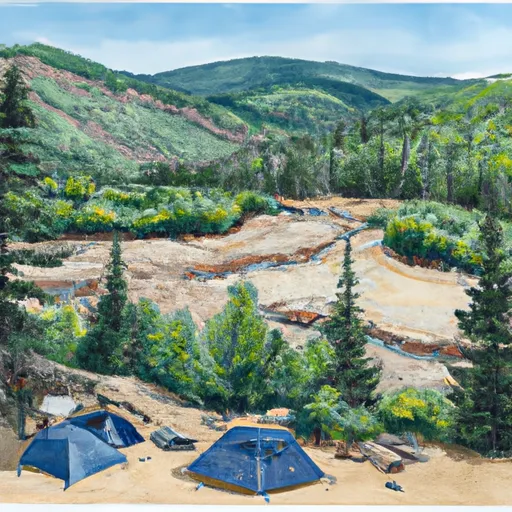
Lower Beaver Campground
Community Reviews
Been here? Share the conditions.
Reviews, ratings & photos are added in the free Snoflo iOS app — rate a spot, tag the conditions, and your visit is verified by location. Add or manage your reviews from the app.
Lower Beaver
Nearby points of interest include the Uncompahgre National Forest, which is home to a variety of trails and hiking options, as well as the Telluride Ski Resort, which offers skiing and snowboarding in the winter and mountain biking in the summer. The campground is also located near the San Miguel River, where visitors can go fishing or enjoy a picnic by the water.
Campground amenities include 19 campsites, each with a picnic table and fire ring. There are also vault toilets and potable water available for visitors. The campground does not offer electrical hookups or showers, but there are nearby facilities in the town of Telluride.
Interesting facts about the area include the fact that the San Miguel watershed is home to a variety of wildlife, including elk, moose, and black bears. Visitors should take caution and properly store their food to avoid encounters with these animals.
The best time of year to visit Lower Beaver Campground is from late spring to early fall. Average temperatures in the summer months range from the mid-70s during the day to the low 40s at night. Visitors should be prepared for cooler temperatures in the fall and spring, with average temperatures in the 50s and 60s during the day and 20s and 30s at night.
Sources:
- https://www.recreation.gov/camping/campgrounds/232163
- https://www.alltrails.com/parks/us/colorado/san-miguel-county
- https://www.telluride.com/things-to-do/exploring/nature-wildlife-in-summer
What's on-site at Lower Beaver
Key facilities Snoflo tracks for this campground. Confirm with the operator before booking -- amenities can change seasonally.
Plan your trip down to the hour
Same weather feed Snoflo's iOS app uses -- updated continuously from NOAA / yr.no.
Next 5 days, hour by hour
Temperature line with weather symbols on top, snow + rain accumulation as columns, humidity as a dotted line.
5-day forecast table
Every 3 hours, broken out across temperature, snow, rain, humidity, and wind. Each cell is colour-coded relative to the column min/max so trends jump out at a glance.
| Time | Condition | Temp (°F) | Snow (in) | Rain (in) | Humidity (%) | Wind (mps) | Wind dir |
|---|---|---|---|---|---|---|---|
| Loading detailed forecast… | |||||||
15-day temperature & precipitation
Daily temperatures, snow, and rain projected over the next two weeks. Hover any point for the full breakdown.
Other campgrounds in the area
Snoflo-tracked campsites within driving distance of Lower Beaver, with reservations status.
| Campground | Reservations | Toilets | View |
|---|---|---|---|
| Little Bench Camp | ✗ | ✗ | → |
| Jutten Camp | ✗ | ✗ | → |
| Caddis Flats | ✗ | ✗ | → |
| Ponderosa Camp | ✗ | ✗ | → |
| Blue Spruce Camp | ✗ | ✗ | → |
Nearby streamflow
USGS streamgauges within reach of Lower Beaver -- pulled live from the National Water Information System.
| Streamgauge | Discharge | View |
|---|---|---|
| San Miguel River Near Placerville | 117 cfs | → |
| San Miguel River At Brooks Bridge Near Nucla Co | 5 cfs | → |
| South Fork San Miguel River Near Ophir | 32 cfs | → |
| Dallas Creek Near Ridgway | 2 cfs | → |
| Uncompahgre River Near Ridgway | 79 cfs | → |
| Uncompahgre River Below Ridgway Reservoir | 144 cfs | → |
Nearby snow depths
NRCS SNOTEL stations within reach of Lower Beaver -- relevant when planning a shoulder-season or alpine trip.
| SNOTEL station | Snowpack | 24h Snowfall | View |
|---|---|---|---|
| Lone Cone | 1.0 in | 0.0 in | → |
| Nohrsc Lone Cone | 1.0 in | 0.0 in | → |
| Black Mesa | 0.0 in | 0.0 in | → |
| Nohrsc Black Mesa | 0.0 in | 0.0 in | → |
| El Diente Peak | 0.0 in | 0.0 in | → |
| Nohrsc Columbine Pass | 0.0 in | 0.0 in | → |
Plan a longer trip
The closest parks, lakes, boat launches, and paddle runs so a camping night can grow into a full weekend.
Parks
- Wilderness Mount Sneffels
- Nucla Town Park
- Judy Long Memorial Park
- Telluride Town Park
- Ridgway State Park
- Wilderness Lizard Head
Boat launches
Fishing spots
- Miramonte Reservoir (Dan Noble Swa)
- Woods Lake
- Sheep Corrals Fishing Site
- Groundhog Reservoir
- Ridgway Reservoir
- Chipeta Lakes Swa
Camping essentials & Leave No Trace
- Pack it in, pack it out
- Take all trash, food scraps, and gear back with you to keep campsites clean and protect wildlife.
- Respect wildlife
- Observe animals from a distance, store food securely, and never feed wildlife to maintain natural behavior and safety.
- Know before you go
- Check weather, fire restrictions, trail conditions, and permit requirements to ensure a safe and well-planned trip.
- Minimize campfire impact
- Use established fire rings, keep fires small, fully extinguish them, or opt for a camp stove when fires are restricted.
- Leave what you find
- Preserve natural and cultural features by avoiding removal of plants, rocks, artifacts, or other elements of the environment.
Set push alerts in the Snoflo app
Save Lower Beaver as a favorite, set a custom threshold (precipitation, snowpack, freezing temperatures), and the iOS app will push the moment conditions cross.
About Lower Beaver
Can I make reservations at Lower Beaver?
This campground does not appear to accept reservations -- it's typically first-come, first-served. Arrive early on summer weekends.
How fresh is the weather data on this page?
The hourly forecast updates throughout the day from the NOAA / yr.no public feeds. Streamflow data is pulled live from USGS streamgauges and snowpack from the NRCS SNOTEL network.
What's the best time of year to visit?
Use the 15-day temperature & precipitation outlook on this page to plan -- pick a window with comfortable temperatures and low precipitation. For longer trips, the 5-day hourly meteogram shows snow + rain accumulation hour-by-hour.
How do I get to Lower Beaver?
Tap Directions in the hero above to open driving directions in Google Maps, or Open in map to center the Snoflo interactive map on the campground.
Can I get alerts when conditions change?
Yes -- alerts are managed through the Snoflo iOS app. Favorite this campground, set a threshold (temperature, snowpack, precipitation), and you'll get a push the moment it crosses.
Other campgrounds near here
Snoflo-tracked campgrounds within driving distance of Lower Beaver.