Thompson Creek Camp campground
Community Reviews
Been here? Share the conditions.
Reviews, ratings & photos are added in the free Snoflo iOS app — rate a spot, tag the conditions, and your visit is verified by location. Add or manage your reviews from the app.
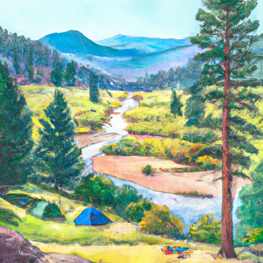
Thompson Creek Camp
The campsite is surrounded by several points of interest, including the Maroon Bells-Snowmass Wilderness Area, the White River National Forest, and the town of Carbondale. These areas offer opportunities for hiking, fishing, and other outdoor activities.
Amenities at the campsite include a fire ring and a vault toilet, but there is no potable water available, so campers must bring their own. Additionally, the campground has a "pack it in, pack it out" policy, meaning visitors must take all trash with them when they leave.
Interesting facts about the area include the fact that the Roaring Fork River is a popular destination for fly fishing, and the nearby town of Carbondale is known for its vibrant arts scene and growing culinary scene. Additionally, the Maroon Bells are the most photographed mountains in North America.
The best time of year to visit Thompson Creek Camp is during the summer months, from June through August, with average temperatures ranging from the mid-70s to the low 80s during the day and dropping into the 40s at night. It's important to note that the area can experience afternoon thunderstorms during the summer, so it's important to be prepared for changing weather conditions.
What's on-site at Thompson Creek Camp
Key facilities Snoflo tracks for this campground. Confirm with the operator before booking -- amenities can change seasonally.
Plan your trip down to the hour
Same weather feed Snoflo's iOS app uses -- updated continuously from NOAA / yr.no.
Next 5 days, hour by hour
Temperature line with weather symbols on top, snow + rain accumulation as columns, humidity as a dotted line.
5-day forecast table
Every 3 hours, broken out across temperature, snow, rain, humidity, and wind. Each cell is colour-coded relative to the column min/max so trends jump out at a glance.
| Time | Condition | Temp (°F) | Snow (in) | Rain (in) | Humidity (%) | Wind (mps) | Wind dir |
|---|---|---|---|---|---|---|---|
| Loading detailed forecast… | |||||||
15-day temperature & precipitation
Daily temperatures, snow, and rain projected over the next two weeks. Hover any point for the full breakdown.
Other campgrounds in the area
Snoflo-tracked campsites within driving distance of Thompson Creek Camp, with reservations status.
| Campground | Reservations | Toilets | View |
|---|---|---|---|
| Lower Prince Creek Campground | ✗ | ✗ | → |
| Upper Prince Creek Campground | ✗ | ✗ | → |
| Avalanche | ✗ | ✓ | → |
| Avalanche Campground | ✓ | ✗ | → |
| Redstone Campground | ✓ | ✗ | → |
Nearby streamflow
USGS streamgauges within reach of Thompson Creek Camp -- pulled live from the National Water Information System.
| Streamgauge | Discharge | View |
|---|---|---|
| Crystal River Ab Avalanche C | 105 cfs | → |
| Roaring Fork River Near Emma | 233 cfs | → |
| Roaring Fork River At Glenwood Springs | 405 cfs | → |
| Colorado River Below Glenwood Springs | 1,730 cfs | → |
| West Divide Creek Near Raven | 0 cfs | → |
| Colorado River Near Dotsero | 1,430 cfs | → |
Nearby snow depths
NRCS SNOTEL stations within reach of Thompson Creek Camp -- relevant when planning a shoulder-season or alpine trip.
| SNOTEL station | Snowpack | 24h Snowfall | View |
|---|---|---|---|
| Nohrsc Glenwood Springs 5.9 S | 0.0 in | 0.0 in | → |
| Carbondale 4.6 Nne | 0.0 in | 0.0 in | → |
| Carbondale 4.8 Ne | 0.0 in | 0.2 in | → |
| Carbondale 5.9 Ene | 0.0 in | 0.0 in | → |
| Mc Clure Pass | 0.0 in | 0.0 in | → |
| Nohrsc Mc Clure Pass | 0.0 in | 0.0 in | → |
Plan a longer trip
The closest parks, lakes, boat launches, and paddle runs so a camping night can grow into a full weekend.
Parks
Boat launches
- Bob Terrell State Wildlife Area
- Roaring Fork State Wildlife Area
- Wingo Boat Ramp
- Grizzly Creek Garfield County
- South Canyon Boat Ramp
- I 70 Garfield County
Fishing spots
- Christine Lake
- Fryingpan River
- Beaver Lake Swa (Marble)
- Emerald Lake (Crested Butte)
- Paonia Reservoir
- Ruedi Reservoir
Camping essentials & Leave No Trace
- Pack it in, pack it out
- Take all trash, food scraps, and gear back with you to keep campsites clean and protect wildlife.
- Respect wildlife
- Observe animals from a distance, store food securely, and never feed wildlife to maintain natural behavior and safety.
- Know before you go
- Check weather, fire restrictions, trail conditions, and permit requirements to ensure a safe and well-planned trip.
- Minimize campfire impact
- Use established fire rings, keep fires small, fully extinguish them, or opt for a camp stove when fires are restricted.
- Leave what you find
- Preserve natural and cultural features by avoiding removal of plants, rocks, artifacts, or other elements of the environment.
Set push alerts in the Snoflo app
Save Thompson Creek Camp as a favorite, set a custom threshold (precipitation, snowpack, freezing temperatures), and the iOS app will push the moment conditions cross.
About Thompson Creek Camp
Can I make reservations at Thompson Creek Camp?
This campground does not appear to accept reservations -- it's typically first-come, first-served. Arrive early on summer weekends.
How fresh is the weather data on this page?
The hourly forecast updates throughout the day from the NOAA / yr.no public feeds. Streamflow data is pulled live from USGS streamgauges and snowpack from the NRCS SNOTEL network.
What's the best time of year to visit?
Use the 15-day temperature & precipitation outlook on this page to plan -- pick a window with comfortable temperatures and low precipitation. For longer trips, the 5-day hourly meteogram shows snow + rain accumulation hour-by-hour.
How do I get to Thompson Creek Camp?
Tap Directions in the hero above to open driving directions in Google Maps, or Open in map to center the Snoflo interactive map on the campground.
Can I get alerts when conditions change?
Yes -- alerts are managed through the Snoflo iOS app. Favorite this campground, set a threshold (temperature, snowpack, precipitation), and you'll get a push the moment it crosses.
Other campgrounds near here
Snoflo-tracked campgrounds within driving distance of Thompson Creek Camp.