Upper Wind River Campground
Community Reviews
Been here? Share the conditions.
Reviews, ratings & photos are added in the free Snoflo iOS app — rate a spot, tag the conditions, and your visit is verified by location. Add or manage your reviews from the app.
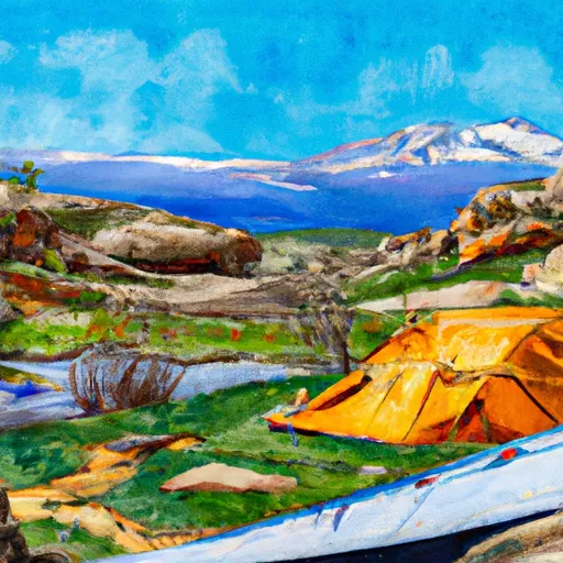
Upper Wind River
An interesting fact about the area is that it is home to the Wind River, one of the few remaining undammed rivers in Colorado. The best time of year to visit is during the summer months from June to August, with average temperatures ranging from the mid-60s to low 80s Fahrenheit. However, visitors should be prepared for sudden changes in weather and be aware of the potential for thunderstorms in the area. Overall, the Upper Wind River Camping Area is a fantastic destination for those seeking a peaceful and scenic camping experience in the heart of Colorado's natural beauty.
What's on-site at Upper Wind River
Key facilities Snoflo tracks for this campground. Confirm with the operator before booking -- amenities can change seasonally.
Plan your trip down to the hour
Same weather feed Snoflo's iOS app uses -- updated continuously from NOAA / yr.no.
Next 5 days, hour by hour
Temperature line with weather symbols on top, snow + rain accumulation as columns, humidity as a dotted line.
5-day forecast table
Every 3 hours, broken out across temperature, snow, rain, humidity, and wind. Each cell is colour-coded relative to the column min/max so trends jump out at a glance.
| Time | Condition | Temp (°F) | Snow (in) | Rain (in) | Humidity (%) | Wind (mps) | Wind dir |
|---|---|---|---|---|---|---|---|
| Loading detailed forecast… | |||||||
15-day temperature & precipitation
Daily temperatures, snow, and rain projected over the next two weeks. Hover any point for the full breakdown.
Other campgrounds in the area
Snoflo-tracked campsites within driving distance of Upper Wind River, with reservations status.
| Campground | Reservations | Toilets | View |
|---|---|---|---|
| Over The Hill | ✗ | ✗ | → |
| Wind River Bluff | ✗ | ✗ | → |
| G13s | ✗ | ✗ | → |
| G06l | ✗ | ✗ | → |
| D132 | ✗ | ✗ | → |
Nearby streamflow
USGS streamgauges within reach of Upper Wind River -- pulled live from the National Water Information System.
| Streamgauge | Discharge | View |
|---|---|---|
| Grand Lake Outlet Blw Chipmunk Ln At Grand Lk | 193 cfs | → |
| Colorado R Below Baker Gulch | 24 cfs | → |
| Colorado River Bl Shadow Mountain Reservoir | 51 cfs | → |
| South St. Vrain Creek Near Ward | 19 cfs | → |
| Grand River Ditch At La Poudre Pass | 19 cfs | → |
| Colorado River Below Lake Granby | 82 cfs | → |
Nearby snow depths
NRCS SNOTEL stations within reach of Upper Wind River -- relevant when planning a shoulder-season or alpine trip.
| SNOTEL station | Snowpack | 24h Snowfall | View |
|---|---|---|---|
| Bear Lake | 1.0 in | -1.0 in | → |
| Estes Park 3.3 Ssw | 0.0 in | 0.0 in | → |
| Estes Park 1.7 W | 0.0 in | 0.0 in | → |
| Estes Park 1.8 S | 0.0 in | 0.0 in | → |
| Estes Park 1.8 Sse | 0.0 in | 0.0 in | → |
| Estes Park | 0.0 in | 0.0 in | → |
Plan a longer trip
The closest parks, lakes, boat launches, and paddle runs so a camping night can grow into a full weekend.
Parks
- Comanche Peak Wilderness
- Rocky Mountain National Park
- Wilderness Never Summer
- Neota Wilderness
- Viestenz Smith Mountain Park
- State Forest State Park
Boat launches
- Boat Launch Grand Lake
- Hilltop Boating Site
- Grand County
- Us 34 Grand County
- Cr 6 Grand County
- Willow Creek Boating Site
Fishing spots
- Sprague Lake - Rmnp
- Mills Lake - Rmnp
- Jewel Lake - Rmnp
- Dream Lake - Rmnp
- Lily Lake - Rmnp
- Lake Haiyaha - Rmnp
Points of interest
- Moraine Park Discovery Center
- Wind River Ranch
- Beaver Meadows Visitor Center
- Trail Ridge Road Scenic Byway
- Images Of Rocky Mountain National Park
- The Wynbrier Ltd. Wilderness Gallery
Paddle runs
- Begins 0.5 Miles Upstream From End Of Fern Lake Road To Eastern Boundary Of Rocky Mountain National Park
- Begins 0.5 Miles Upstream From End Of County Hwy 115 To Eastern Boundary Of Rocky Mountain National Park
- Headwaters To Ends 0.5 Miles Upstream From End Of County Hwy 115
- Nsv
- Headwaters To Fan Lake
- Headwaters To Boundary Of Rocky Mountain National Park
Camping essentials & Leave No Trace
- Pack it in, pack it out
- Take all trash, food scraps, and gear back with you to keep campsites clean and protect wildlife.
- Respect wildlife
- Observe animals from a distance, store food securely, and never feed wildlife to maintain natural behavior and safety.
- Know before you go
- Check weather, fire restrictions, trail conditions, and permit requirements to ensure a safe and well-planned trip.
- Minimize campfire impact
- Use established fire rings, keep fires small, fully extinguish them, or opt for a camp stove when fires are restricted.
- Leave what you find
- Preserve natural and cultural features by avoiding removal of plants, rocks, artifacts, or other elements of the environment.
Set push alerts in the Snoflo app
Save Upper Wind River as a favorite, set a custom threshold (precipitation, snowpack, freezing temperatures), and the iOS app will push the moment conditions cross.
About Upper Wind River
Can I make reservations at Upper Wind River?
This campground does not appear to accept reservations -- it's typically first-come, first-served. Arrive early on summer weekends.
How fresh is the weather data on this page?
The hourly forecast updates throughout the day from the NOAA / yr.no public feeds. Streamflow data is pulled live from USGS streamgauges and snowpack from the NRCS SNOTEL network.
What's the best time of year to visit?
Use the 15-day temperature & precipitation outlook on this page to plan -- pick a window with comfortable temperatures and low precipitation. For longer trips, the 5-day hourly meteogram shows snow + rain accumulation hour-by-hour.
How do I get to Upper Wind River?
Tap Directions in the hero above to open driving directions in Google Maps, or Open in map to center the Snoflo interactive map on the campground.
Can I get alerts when conditions change?
Yes -- alerts are managed through the Snoflo iOS app. Favorite this campground, set a threshold (temperature, snowpack, precipitation), and you'll get a push the moment it crosses.
Other campgrounds near here
Snoflo-tracked campgrounds within driving distance of Upper Wind River.