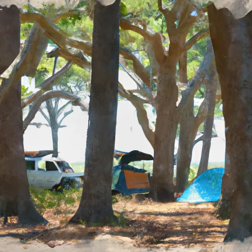
Davenport Landing campground
Community Reviews
Been here? Share the conditions.
Reviews, ratings & photos are added in the free Snoflo iOS app — rate a spot, tag the conditions, and your visit is verified by location. Add or manage your reviews from the app.
Davenport Landing
Reservations are accepted at the Davenport Landing camping area, ensuring campers can secure their spot in advance. This allows for a stress-free planning process and guarantees a spot at this popular destination. It is recommended to make reservations early, especially during peak seasons, as this campground tends to fill up quickly.
The best time of year to visit Davenport Landing camping area is during the cooler months, typically from November to April. The weather during this time is ideal for outdoor activities, with comfortable temperatures and lower humidity levels. Visitors should be aware that the camping area can be prone to mosquitos and other insects, especially during the warmer months. It is advisable to bring insect repellent and take necessary precautions to ensure a pleasant camping experience.
What's on-site at Davenport Landing
Key facilities Snoflo tracks for this campground. Confirm with the operator before booking -- amenities can change seasonally.
Plan your trip down to the hour
Same weather feed Snoflo's iOS app uses -- updated continuously from NOAA / yr.no.
Next 5 days, hour by hour
Temperature line with weather symbols on top, snow + rain accumulation as columns, humidity as a dotted line.
5-day forecast table
Every 3 hours, broken out across temperature, snow, rain, humidity, and wind. Each cell is colour-coded relative to the column min/max so trends jump out at a glance.
| Time | Condition | Temp (°F) | Snow (in) | Rain (in) | Humidity (%) | Wind (mps) | Wind dir |
|---|---|---|---|---|---|---|---|
| Loading detailed forecast… | |||||||
15-day temperature & precipitation
Daily temperatures, snow, and rain projected over the next two weeks. Hover any point for the full breakdown.
Other campgrounds in the area
Snoflo-tracked campsites within driving distance of Davenport Landing, with reservations status.
| Campground | Reservations | Toilets | View |
|---|---|---|---|
| Lake Delancy | ✗ | ✗ | → |
| Lake Delancy East Campground | ✗ | ✗ | → |
| Rodman Rec Area | ✗ | ✗ | → |
| Kenwood Rec Area | ✗ | ✗ | → |
| Salt Springs | ✓ | ✗ | → |
Nearby streamflow
USGS streamgauges within reach of Davenport Landing -- pulled live from the National Water Information System.
| Streamgauge | Discharge | View |
|---|---|---|
| Ocklawaha R At Rodman Dam Nr Orange Springs | 379 cfs | → |
| St. Johns R At Buffalo Bluff Nr Satsuma | 4,100 cfs | → |
| Ocklawaha River At Eureka | 439 cfs | → |
| Orange Creek At Orange Springs | 3 cfs | → |
| Dunns Creek Near Satsuma | 2,950 cfs | → |
| Ocklawaha River Nr Conner | 361 cfs | → |
Nearby snow depths
NRCS SNOTEL stations within reach of Davenport Landing -- relevant when planning a shoulder-season or alpine trip.
| SNOTEL station | Snowpack | 24h Snowfall | View |
|---|---|---|---|
| Hastings 4ne | 0.0 in | 0.0 in | → |
| St. Augustine 3.4 Sw | 0.0 in | 0.0 in | → |
Plan a longer trip
The closest parks, lakes, boat launches, and paddle runs so a camping night can grow into a full weekend.
Parks
- Caravelle Ranch Wildlife Management Area
- Wilderness Little Lake George
- Welaka State Forest
- Dunns Creek State Park
- Carl Duval Moore State Forest
- Ravine Gardens State Park
Boat launches
- Johnson Field - Oklawaha River At State Road 19
- Rodman Dam Road Putnam County
- Rodman Dam Road, Palatka
- Front Street 701, Welaka
- Shell Harbor Public Boat Ramp
- Kenwood Recreation Area Main Boat Ramp
Fishing spots
Points of interest
- Little Lake George Wilderness
- Large Cypress Tree
- David Browning Railroad Museum
- Gem City Cottage Llc.
- Bronson Mulholland House
- Orange Creek Restoration Area
Paddle runs
- Segment A--Mouth Of Spring On Ocala Nf (At Juniper Springs Wilderness) To Bridge On Sh 19 (At Wilderness Boundary)
- Segment B--Bridge On Sh 19 To Confluence With Lake George
- Segment A--Mouth Of Spring On Ocala Nf To Alexander Springs Wilderness Boundary
- Segment B--Alexander Springs Wilderness Boundary To Confluence With St. Johns River
Camping essentials & Leave No Trace
- Pack it in, pack it out
- Take all trash, food scraps, and gear back with you to keep campsites clean and protect wildlife.
- Respect wildlife
- Observe animals from a distance, store food securely, and never feed wildlife to maintain natural behavior and safety.
- Know before you go
- Check weather, fire restrictions, trail conditions, and permit requirements to ensure a safe and well-planned trip.
- Minimize campfire impact
- Use established fire rings, keep fires small, fully extinguish them, or opt for a camp stove when fires are restricted.
- Leave what you find
- Preserve natural and cultural features by avoiding removal of plants, rocks, artifacts, or other elements of the environment.
Set push alerts in the Snoflo app
Save Davenport Landing as a favorite, set a custom threshold (precipitation, snowpack, freezing temperatures), and the iOS app will push the moment conditions cross.
About Davenport Landing
Can I make reservations at Davenport Landing?
This campground does not appear to accept reservations -- it's typically first-come, first-served. Arrive early on summer weekends.
How fresh is the weather data on this page?
The hourly forecast updates throughout the day from the NOAA / yr.no public feeds. Streamflow data is pulled live from USGS streamgauges and snowpack from the NRCS SNOTEL network.
What's the best time of year to visit?
Use the 15-day temperature & precipitation outlook on this page to plan -- pick a window with comfortable temperatures and low precipitation. For longer trips, the 5-day hourly meteogram shows snow + rain accumulation hour-by-hour.
How do I get to Davenport Landing?
Tap Directions in the hero above to open driving directions in Google Maps, or Open in map to center the Snoflo interactive map on the campground.
Can I get alerts when conditions change?
Yes -- alerts are managed through the Snoflo iOS app. Favorite this campground, set a threshold (temperature, snowpack, precipitation), and you'll get a push the moment it crosses.
Other campgrounds near here
Snoflo-tracked campgrounds within driving distance of Davenport Landing.