Brickhill Bluff Campground
Community Reviews
Been here? Share the conditions.
Reviews, ratings & photos are added in the free Snoflo iOS app — rate a spot, tag the conditions, and your visit is verified by location. Add or manage your reviews from the app.
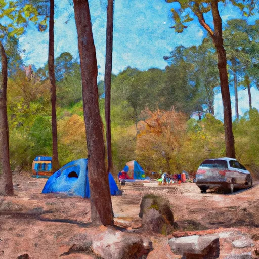
Brickhill Bluff
What's on-site at Brickhill Bluff
Key facilities Snoflo tracks for this campground. Confirm with the operator before booking -- amenities can change seasonally.
Plan your trip down to the hour
Same weather feed Snoflo's iOS app uses -- updated continuously from NOAA / yr.no.
Next 5 days, hour by hour
Temperature line with weather symbols on top, snow + rain accumulation as columns, humidity as a dotted line.
5-day forecast table
Every 3 hours, broken out across temperature, snow, rain, humidity, and wind. Each cell is colour-coded relative to the column min/max so trends jump out at a glance.
| Time | Condition | Temp (°F) | Snow (in) | Rain (in) | Humidity (%) | Wind (mps) | Wind dir |
|---|---|---|---|---|---|---|---|
| Loading detailed forecast… | |||||||
15-day temperature & precipitation
Daily temperatures, snow, and rain projected over the next two weeks. Hover any point for the full breakdown.
Other campgrounds in the area
Snoflo-tracked campsites within driving distance of Brickhill Bluff, with reservations status.
| Campground | Reservations | Toilets | View |
|---|---|---|---|
| Yankee Paradise | ✗ | ✗ | → |
| Hickory Hill | ✗ | ✗ | → |
| Stafford Beach | ✗ | ✗ | → |
| Stafford | ✓ | ✗ | → |
| Crooked River State Park | ✓ | ✗ | → |
Nearby streamflow
USGS streamgauges within reach of Brickhill Bluff -- pulled live from the National Water Information System.
| Streamgauge | Discharge | View |
|---|---|---|
| Satilla River At Atkinson | 510 cfs | → |
| St. Johns River At Jacksonville | 69,000 cfs | → |
| Pottsburg Creek Nr South Jacksonville | 8 cfs | → |
| Cedar River At San Juan Ave At Jacksonville | 349 cfs | → |
| Ortega River At Kirwin Rd Nr Jacksonville | 9 cfs | → |
| Julington Crk At Old St August Rd Nr Bayard | 66 cfs | → |
Nearby snow depths
NRCS SNOTEL stations within reach of Brickhill Bluff -- relevant when planning a shoulder-season or alpine trip.
| SNOTEL station | Snowpack | 24h Snowfall | View |
|---|---|---|---|
| Fernandina Beach | 0.0 in | 0.0 in | → |
Plan a longer trip
The closest parks, lakes, boat launches, and paddle runs so a camping night can grow into a full weekend.
Parks
- Wilderness Cumberland Island
- Crooked River State Park Boat Launch
- Cumberland Island National Seashore
- St. Marys Civic Park
- Howard Peeple's Park
- Kingsland Lions Park
Boat launches
- Mush Bluff Road 3405, Saint Marys
- Crooked River Drive 327, Woodbine
- Harbor Road 35, Jekyll Island
- Meeting Street East 309, Saint Marys
- St. Marys Waterfront
- De De Bartells Nature Center
Fishing spots
- Jekyll Island Fishing Center
- Bethesda Pond
- Hanna Lake Park
- Duval Lake
- Pope Duval East Pond
- Laura S Walker Lake
Points of interest
- Plum Orchard Mansion
- Little Cumberland Lighthouse (Abandoned)
- Ice House Museum
- Tabby Ruins
- Uss George Bancroft
- Captain Phillips Dolphin Boat Tour
Paddle runs
- Begins Approximately 1 Mile Upstream Of Flea Hill, Georgia To The Bells River Confluence
- Begins Approximately 1 Mile Downstream Of U.S. 301 Crossing To Ends Approximately 1 Mile Upstream Of Flea Hill, Georgia
- Trader's Hill To Ends Approximately 1 Mile Downstream Of U.S. 301 Crossing
Camping essentials & Leave No Trace
- Pack it in, pack it out
- Take all trash, food scraps, and gear back with you to keep campsites clean and protect wildlife.
- Respect wildlife
- Observe animals from a distance, store food securely, and never feed wildlife to maintain natural behavior and safety.
- Know before you go
- Check weather, fire restrictions, trail conditions, and permit requirements to ensure a safe and well-planned trip.
- Minimize campfire impact
- Use established fire rings, keep fires small, fully extinguish them, or opt for a camp stove when fires are restricted.
- Leave what you find
- Preserve natural and cultural features by avoiding removal of plants, rocks, artifacts, or other elements of the environment.
Set push alerts in the Snoflo app
Save Brickhill Bluff as a favorite, set a custom threshold (precipitation, snowpack, freezing temperatures), and the iOS app will push the moment conditions cross.
About Brickhill Bluff
Can I make reservations at Brickhill Bluff?
This campground does not appear to accept reservations -- it's typically first-come, first-served. Arrive early on summer weekends.
How fresh is the weather data on this page?
The hourly forecast updates throughout the day from the NOAA / yr.no public feeds. Streamflow data is pulled live from USGS streamgauges and snowpack from the NRCS SNOTEL network.
What's the best time of year to visit?
Use the 15-day temperature & precipitation outlook on this page to plan -- pick a window with comfortable temperatures and low precipitation. For longer trips, the 5-day hourly meteogram shows snow + rain accumulation hour-by-hour.
How do I get to Brickhill Bluff?
Tap Directions in the hero above to open driving directions in Google Maps, or Open in map to center the Snoflo interactive map on the campground.
Can I get alerts when conditions change?
Yes -- alerts are managed through the Snoflo iOS app. Favorite this campground, set a threshold (temperature, snowpack, precipitation), and you'll get a push the moment it crosses.
Other campgrounds near here
Snoflo-tracked campgrounds within driving distance of Brickhill Bluff.