25 Mile Campground
Community Reviews
Been here? Share the conditions.
Reviews, ratings & photos are added in the free Snoflo iOS app — rate a spot, tag the conditions, and your visit is verified by location. Add or manage your reviews from the app.
25 Mile
Reservations are accepted at the 25 Mile camping area, making it convenient for campers to secure a spot ahead of time. It is advisable to make reservations, especially during peak seasons, to guarantee availability. The best time to visit this camping area is during the summer months when the weather is pleasant, and outdoor activities can be enjoyed to the fullest. However, it is essential to note that the campground tends to get crowded during weekends and holidays, so planning accordingly is recommended.
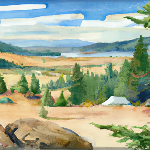
While exploring the 25 Mile camping area, campers will find themselves surrounded by breathtaking landscapes, including lush forests, stunning mountains, and nearby lakes. Nature lovers will appreciate the abundance of hiking trails, fishing opportunities, and wildlife sightings. However, it is important to exercise caution while hiking, as some trails may be steep and rugged. Additionally, campers should be mindful of local wildlife and adhere to proper food storage techniques to avoid conflicts with animals. Overall, the 25 Mile camping area in Idaho offers a serene and well-equipped camping experience, perfect for those seeking tranquility in nature.
What's on-site at 25 Mile
Key facilities Snoflo tracks for this campground. Confirm with the operator before booking -- amenities can change seasonally.
Plan your trip down to the hour
Same weather feed Snoflo's iOS app uses -- updated continuously from NOAA / yr.no.
Next 5 days, hour by hour
Temperature line with weather symbols on top, snow + rain accumulation as columns, humidity as a dotted line.
5-day forecast table
Every 3 hours, broken out across temperature, snow, rain, humidity, and wind. Each cell is colour-coded relative to the column min/max so trends jump out at a glance.
| Time | Condition | Temp (°F) | Snow (in) | Rain (in) | Humidity (%) | Wind (mps) | Wind dir |
|---|---|---|---|---|---|---|---|
| Loading detailed forecast… | |||||||
15-day temperature & precipitation
Daily temperatures, snow, and rain projected over the next two weeks. Hover any point for the full breakdown.
Other campgrounds in the area
Snoflo-tracked campsites within driving distance of 25 Mile, with reservations status.
| Campground | Reservations | Toilets | View |
|---|---|---|---|
| Twenty-Mile Bar Dispersed Site | ✓ | ✗ | → |
| Glover Campground | ✓ | ✗ | → |
| Glover Creek | ✗ | ✗ | → |
| Gedney Creek | ✗ | ✗ | → |
| Boyd Creek | ✗ | ✗ | → |
Nearby streamflow
USGS streamgauges within reach of 25 Mile -- pulled live from the National Water Information System.
| Streamgauge | Discharge | View |
|---|---|---|
| Selway River Nr Lowell Id | 1,030 cfs | → |
| Lochsa River Nr Lowell Id | 766 cfs | → |
| Sf Clearwater River Nr Elk City Id | 42 cfs | → |
| Clear Ck At Kooskia National Fish Hatchery | 18 cfs | → |
| Sf Clearwater River At Stites Id | 172 cfs | → |
| Lolo Creek Nr Greer Id | 257 cfs | → |
Nearby snow depths
NRCS SNOTEL stations within reach of 25 Mile -- relevant when planning a shoulder-season or alpine trip.
| SNOTEL station | Snowpack | 24h Snowfall | View |
|---|---|---|---|
| Bald Mountain | 26.2 in | 0.0 in | → |
| Mountain Meadows | 0.0 in | 0.0 in | → |
| Nohrsc Mountain Meadows | 0.0 in | 0.0 in | → |
| Hemlock Butte | 1.0 in | 0.0 in | → |
| Hemlock Butte | 1.0 in | 0.0 in | → |
| Kamiah | 0.0 in | 0.0 in | → |
Plan a longer trip
The closest parks, lakes, boat launches, and paddle runs so a camping night can grow into a full weekend.
Paddle runs
- Wilderness Boundary To Fs Road 319
- Fs Road 319 To Selway River Road (Fs 223)
- Selway River, Sec. 11, T31n, R9e To Road Crossing, Sec. 14, T31n, R9e
- Road Crossing, Sec. 14, T31n, R9e To Headwaters
- Selway-Bitterroot Wilderness Boundary, Sec. 35, T33n, R9e To Headwaters, Sec. 33, T33n, R10e
- Headwaters (Sec 5, T32n, R10e) To Selway-Bitterroot Wilderness Boundary
Camping essentials & Leave No Trace
- Pack it in, pack it out
- Take all trash, food scraps, and gear back with you to keep campsites clean and protect wildlife.
- Respect wildlife
- Observe animals from a distance, store food securely, and never feed wildlife to maintain natural behavior and safety.
- Know before you go
- Check weather, fire restrictions, trail conditions, and permit requirements to ensure a safe and well-planned trip.
- Minimize campfire impact
- Use established fire rings, keep fires small, fully extinguish them, or opt for a camp stove when fires are restricted.
- Leave what you find
- Preserve natural and cultural features by avoiding removal of plants, rocks, artifacts, or other elements of the environment.
Set push alerts in the Snoflo app
Save 25 Mile as a favorite, set a custom threshold (precipitation, snowpack, freezing temperatures), and the iOS app will push the moment conditions cross.
About 25 Mile
Can I make reservations at 25 Mile?
This campground does not appear to accept reservations -- it's typically first-come, first-served. Arrive early on summer weekends.
How fresh is the weather data on this page?
The hourly forecast updates throughout the day from the NOAA / yr.no public feeds. Streamflow data is pulled live from USGS streamgauges and snowpack from the NRCS SNOTEL network.
What's the best time of year to visit?
Use the 15-day temperature & precipitation outlook on this page to plan -- pick a window with comfortable temperatures and low precipitation. For longer trips, the 5-day hourly meteogram shows snow + rain accumulation hour-by-hour.
How do I get to 25 Mile?
Tap Directions in the hero above to open driving directions in Google Maps, or Open in map to center the Snoflo interactive map on the campground.
Can I get alerts when conditions change?
Yes -- alerts are managed through the Snoflo iOS app. Favorite this campground, set a threshold (temperature, snowpack, precipitation), and you'll get a push the moment it crosses.
Other campgrounds near here
Snoflo-tracked campgrounds within driving distance of 25 Mile.