Graham Bridge Campground
Community Reviews
Been here? Share the conditions.
Reviews, ratings & photos are added in the free Snoflo iOS app — rate a spot, tag the conditions, and your visit is verified by location. Add or manage your reviews from the app.
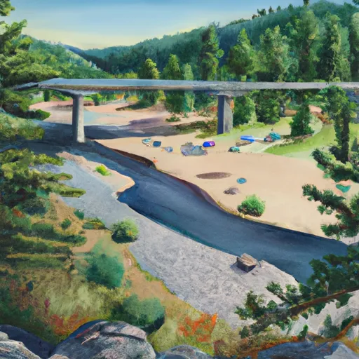
Graham Bridge
What's on-site at Graham Bridge
Key facilities Snoflo tracks for this campground. Confirm with the operator before booking -- amenities can change seasonally.
Plan your trip down to the hour
Same weather feed Snoflo's iOS app uses -- updated continuously from NOAA / yr.no.
Next 5 days, hour by hour
Temperature line with weather symbols on top, snow + rain accumulation as columns, humidity as a dotted line.
5-day forecast table
Every 3 hours, broken out across temperature, snow, rain, humidity, and wind. Each cell is colour-coded relative to the column min/max so trends jump out at a glance.
| Time | Condition | Temp (°F) | Snow (in) | Rain (in) | Humidity (%) | Wind (mps) | Wind dir |
|---|---|---|---|---|---|---|---|
| Loading detailed forecast… | |||||||
15-day temperature & precipitation
Daily temperatures, snow, and rain projected over the next two weeks. Hover any point for the full breakdown.
Other campgrounds in the area
Snoflo-tracked campsites within driving distance of Graham Bridge, with reservations status.
| Campground | Reservations | Toilets | View |
|---|---|---|---|
| Graham Guard Station - Rental Cabin | ✓ | ✗ | → |
| Deer Park Guard Station - Rental Cabin | ✓ | ✗ | → |
| Queens River | ✗ | ✗ | → |
| Queens River Campground | ✓ | ✗ | → |
| Warm Springs Guard Station - Rental Cabin | ✓ | ✗ | → |
Nearby streamflow
USGS streamgauges within reach of Graham Bridge -- pulled live from the National Water Information System.
| Streamgauge | Discharge | View |
|---|---|---|
| Sf Payette River At Lowman Id | 500 cfs | → |
| Valley Creek At Stanley Id | 124 cfs | → |
| Deadwood River Bl Deadwood Res Nr Lowman Id | 848 cfs | → |
| Boise River Nr Twin Springs Id | 386 cfs | → |
| Sf Boise River Nr Featherville Id | 196 cfs | → |
| Salmon River Bl Yankee Fork Nr Clayton Id | 590 cfs | → |
Nearby snow depths
NRCS SNOTEL stations within reach of Graham Bridge -- relevant when planning a shoulder-season or alpine trip.
| SNOTEL station | Snowpack | 24h Snowfall | View |
|---|---|---|---|
| Graham Guard Sta. | 0.0 in | 0.0 in | → |
| Graham Guard Sta. | 0.0 in | 0.0 in | → |
| Jackson Peak | 0.0 in | 0.0 in | → |
| Nohrsc Jackson Peak | 0.0 in | 0.0 in | → |
| Atlanta Summit | 1.0 in | 0.0 in | → |
| Nohrsc Atlanta Summit | 1.0 in | 0.0 in | → |
Plan a longer trip
The closest parks, lakes, boat launches, and paddle runs so a camping night can grow into a full weekend.
Boat launches
Fishing spots
- Lowman Nature Ponds
- Yellowbelly Lake
- Alturas Lake And Pettit Lake Areas
- Redfish Lake
- Perkins Lake
- Stanley Lake
Points of interest
Camping essentials & Leave No Trace
- Pack it in, pack it out
- Take all trash, food scraps, and gear back with you to keep campsites clean and protect wildlife.
- Respect wildlife
- Observe animals from a distance, store food securely, and never feed wildlife to maintain natural behavior and safety.
- Know before you go
- Check weather, fire restrictions, trail conditions, and permit requirements to ensure a safe and well-planned trip.
- Minimize campfire impact
- Use established fire rings, keep fires small, fully extinguish them, or opt for a camp stove when fires are restricted.
- Leave what you find
- Preserve natural and cultural features by avoiding removal of plants, rocks, artifacts, or other elements of the environment.
Set push alerts in the Snoflo app
Save Graham Bridge as a favorite, set a custom threshold (precipitation, snowpack, freezing temperatures), and the iOS app will push the moment conditions cross.
About Graham Bridge
Can I make reservations at Graham Bridge?
This campground does not appear to accept reservations -- it's typically first-come, first-served. Arrive early on summer weekends.
How fresh is the weather data on this page?
The hourly forecast updates throughout the day from the NOAA / yr.no public feeds. Streamflow data is pulled live from USGS streamgauges and snowpack from the NRCS SNOTEL network.
What's the best time of year to visit?
Use the 15-day temperature & precipitation outlook on this page to plan -- pick a window with comfortable temperatures and low precipitation. For longer trips, the 5-day hourly meteogram shows snow + rain accumulation hour-by-hour.
How do I get to Graham Bridge?
Tap Directions in the hero above to open driving directions in Google Maps, or Open in map to center the Snoflo interactive map on the campground.
Can I get alerts when conditions change?
Yes -- alerts are managed through the Snoflo iOS app. Favorite this campground, set a threshold (temperature, snowpack, precipitation), and you'll get a push the moment it crosses.
Other campgrounds near here
Snoflo-tracked campgrounds within driving distance of Graham Bridge.