Craig Lake State Park Site 21 Campground
Community Reviews
Been here? Share the conditions.
Reviews, ratings & photos are added in the free Snoflo iOS app — rate a spot, tag the conditions, and your visit is verified by location. Add or manage your reviews from the app.
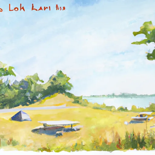
Craig Lake State Park Site 21
It is important to note that reservations are required for Site 21 at Craig Lake State Park. This ensures that campers have a designated spot upon arrival, guaranteeing a hassle-free camping experience. Reservations can easily be made online or by contacting the park office.
The best time to visit Craig Lake State Park Site 21 is during the warmer months, typically from late spring to early fall. This allows campers to take advantage of outdoor activities such as hiking, fishing, and wildlife viewing. The park's serene lake provides a beautiful backdrop for camping, and the surrounding trails offer scenic views.
While exploring this camping area, campers should be cautious of wildlife encounters. It is important to properly store food and dispose of waste to avoid attracting animals. Additionally, ticks and mosquitoes can be prevalent during certain times of the year, so campers should take necessary precautions such as using insect repellent and wearing appropriate clothing.
In conclusion, Craig Lake State Park Site 21 in Illinois offers a well-equipped campground with amenities such as picnic tables, fire pits, potable water, and restroom facilities. Reservations are required for this campground, and the best time to visit is during the warmer months. Campers should be mindful of wildlife encounters and take precautions against ticks and mosquitoes.
What's on-site at Craig Lake State Park Site 21
Key facilities Snoflo tracks for this campground. Confirm with the operator before booking -- amenities can change seasonally.
Plan your trip down to the hour
Same weather feed Snoflo's iOS app uses -- updated continuously from NOAA / yr.no.
Next 5 days, hour by hour
Temperature line with weather symbols on top, snow + rain accumulation as columns, humidity as a dotted line.
5-day forecast table
Every 3 hours, broken out across temperature, snow, rain, humidity, and wind. Each cell is colour-coded relative to the column min/max so trends jump out at a glance.
| Time | Condition | Temp (°F) | Snow (in) | Rain (in) | Humidity (%) | Wind (mps) | Wind dir |
|---|---|---|---|---|---|---|---|
| Loading detailed forecast… | |||||||
15-day temperature & precipitation
Daily temperatures, snow, and rain projected over the next two weeks. Hover any point for the full breakdown.
Other campgrounds in the area
Snoflo-tracked campsites within driving distance of Craig Lake State Park Site 21, with reservations status.
| Campground | Reservations | Toilets | View |
|---|---|---|---|
| Craig Lake State Park Site 2 | ✗ | ✗ | → |
| Craig Lake State Park Site 1 | ✗ | ✗ | → |
| Craig Lake State Park Sites 3, 9 | ✗ | ✗ | → |
| Craig Lake State Park Sites 4, 5 | ✗ | ✗ | → |
| Craig Lake State Park Sites 6, 7 | ✗ | ✗ | → |
Nearby streamflow
USGS streamgauges within reach of Craig Lake State Park Site 21 -- pulled live from the National Water Information System.
| Streamgauge | Discharge | View |
|---|---|---|
| Silver River Near L'Anse | 26 cfs | → |
| Middle Branch Escanaba River At Humboldt | 15 cfs | → |
| Sturgeon River Near Sidnaw | 27 cfs | → |
| Greenwood Release Near Greenwood | 25 cfs | → |
| Greenwood Diversion Near Greenwood | 18 cfs | → |
| Sturgeon River Near Alston | 45 cfs | → |
Nearby snow depths
NRCS SNOTEL stations within reach of Craig Lake State Park Site 21 -- relevant when planning a shoulder-season or alpine trip.
| SNOTEL station | Snowpack | 24h Snowfall | View |
|---|---|---|---|
| Three Lakes | 0.0 in | 0.0 in | → |
| Michigamme 3wnw | 0.0 in | 0.0 in | → |
| Herman | 0.0 in | 0.0 in | → |
| Big Bay 9sw | 0.0 in | 0.0 in | → |
| Covington | 0.0 in | 0.0 in | → |
| Clarksburg | 0.0 in | 0.0 in | → |
Plan a longer trip
The closest parks, lakes, boat launches, and paddle runs so a camping night can grow into a full weekend.
Parks
- Craig Lake State Park
- Mccormick Wilderness
- Van Riper State Park
- Baraga State Park
- Wilderness Sturgeon River Gorge
- Sturgeon River Sloughs State Wildlife Area
Boat launches
- Craig Lake Road Spurr Township
- Keewaydin Road Spurr Township
- Pine Avenue Spurr Township
- Beaufort Road West Spurr Township
- North Country Trail Michigamme Township
- Imperial Heights Road Spurr Township
Fishing spots
- Alberta Pond
- Deer Lake Basin
- Prickett Reservoir
- Otter Lake
- Lake Gerald (Twin Lakes)
- Lake Roland (Twin Lakes)
Points of interest
- Michigamme Historical Museum
- Alberta Village Museum
- Baraga County Historical Museum
- Cliffs Shaft Mine Museum
- Big Bay Point Lighthouse
- Negaunee Historical Society Museum
Paddle runs
- From Wagner Lake In Sec 13, T49n, R31w To Eastern Boundary Of The Ottawa Nf In Sec 12, T48n, R35@
- East Branch Net River, From Its Source In Sec 8, T47n, R32w To Confluence With Mainstem Net River In Sec 24, T46n, R34w
- West Branch Net River, From Its Source In Sec 35, T48n, R34w To Confluence With Mainstem Net River In Sec 24, T46n, R34w
- Net River Mainstem, Confluence With East/West Branches To Confluence With The Mainstem Paint River
- Mainstem, Easternforest Boundary In Sec 1, T44n, R35w To City Of Crystal Falls
Camping essentials & Leave No Trace
- Pack it in, pack it out
- Take all trash, food scraps, and gear back with you to keep campsites clean and protect wildlife.
- Respect wildlife
- Observe animals from a distance, store food securely, and never feed wildlife to maintain natural behavior and safety.
- Know before you go
- Check weather, fire restrictions, trail conditions, and permit requirements to ensure a safe and well-planned trip.
- Minimize campfire impact
- Use established fire rings, keep fires small, fully extinguish them, or opt for a camp stove when fires are restricted.
- Leave what you find
- Preserve natural and cultural features by avoiding removal of plants, rocks, artifacts, or other elements of the environment.
Set push alerts in the Snoflo app
Save Craig Lake State Park Site 21 as a favorite, set a custom threshold (precipitation, snowpack, freezing temperatures), and the iOS app will push the moment conditions cross.
About Craig Lake State Park Site 21
Can I make reservations at Craig Lake State Park Site 21?
This campground does not appear to accept reservations -- it's typically first-come, first-served. Arrive early on summer weekends.
How fresh is the weather data on this page?
The hourly forecast updates throughout the day from the NOAA / yr.no public feeds. Streamflow data is pulled live from USGS streamgauges and snowpack from the NRCS SNOTEL network.
What's the best time of year to visit?
Use the 15-day temperature & precipitation outlook on this page to plan -- pick a window with comfortable temperatures and low precipitation. For longer trips, the 5-day hourly meteogram shows snow + rain accumulation hour-by-hour.
How do I get to Craig Lake State Park Site 21?
Tap Directions in the hero above to open driving directions in Google Maps, or Open in map to center the Snoflo interactive map on the campground.
Can I get alerts when conditions change?
Yes -- alerts are managed through the Snoflo iOS app. Favorite this campground, set a threshold (temperature, snowpack, precipitation), and you'll get a push the moment it crosses.
Other campgrounds near here
Snoflo-tracked campgrounds within driving distance of Craig Lake State Park Site 21.