Teal Pond Campground Campground
Community Reviews
Been here? Share the conditions.
Reviews, ratings & photos are added in the free Snoflo iOS app — rate a spot, tag the conditions, and your visit is verified by location. Add or manage your reviews from the app.
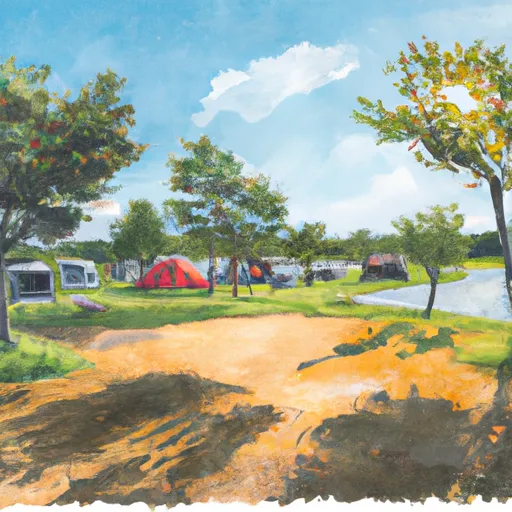
Teal Pond Campground
There are many points of interest near the campground, including the Shawnee Hills Wine Trail, the Garden of the Gods, the Shawnee National Forest, and the Ohio River.
The campground amenities include electric and water hookups, showers, restrooms, a playground, and a boat ramp. The campground also has a picnic area and a fishing pier.
Reservations are available for Teal Pond Campground, and it is recommended to book in advance to ensure availability. There are 18 campsites available for visitors.
An interesting fact about the area is that it is home to the highest waterfall in Illinois, the Ferne Clyffe Waterfall.
The best time to visit Teal Pond Campground is from May to October when the weather is warm and the average temperatures range from the mid-60s to mid-80s Fahrenheit.
In summary, Teal Pond Campground offers a picturesque setting, many nearby points of interest, and good amenities. It is a great place to visit for those who enjoy camping, hiking, fishing, and exploring the outdoors.
What's on-site at Teal Pond Campground
Key facilities Snoflo tracks for this campground. Confirm with the operator before booking -- amenities can change seasonally.
Plan your trip down to the hour
Same weather feed Snoflo's iOS app uses -- updated continuously from NOAA / yr.no.
Next 5 days, hour by hour
Temperature line with weather symbols on top, snow + rain accumulation as columns, humidity as a dotted line.
5-day forecast table
Every 3 hours, broken out across temperature, snow, rain, humidity, and wind. Each cell is colour-coded relative to the column min/max so trends jump out at a glance.
| Time | Condition | Temp (°F) | Snow (in) | Rain (in) | Humidity (%) | Wind (mps) | Wind dir |
|---|---|---|---|---|---|---|---|
| Loading detailed forecast… | |||||||
15-day temperature & precipitation
Daily temperatures, snow, and rain projected over the next two weeks. Hover any point for the full breakdown.
Other campgrounds in the area
Snoflo-tracked campsites within driving distance of Teal Pond Campground, with reservations status.
| Campground | Reservations | Toilets | View |
|---|---|---|---|
| Red Bud Campground | ✓ | ✗ | → |
| Bear Branch Horse Resort | ✗ | ✗ | → |
| Chabnel | ✗ | ✗ | → |
| Lalamont | ✗ | ✗ | → |
| Goupil | ✗ | ✗ | → |
Nearby streamflow
USGS streamgauges within reach of Teal Pond Campground -- pulled live from the National Water Information System.
| Streamgauge | Discharge | View |
|---|---|---|
| South Fork Saline River Nr Carrier Mills | 45 cfs | → |
| Lusk Creek Near Eddyville | 4 cfs | → |
| Crab Orchard Creek Near Marion | 2 cfs | → |
| Cache River At Forman | 257 cfs | → |
| Ohio River At Metropolis | 444,000 cfs | → |
| Little Bayou Creek Near Grahamville | 1 cfs | → |
Nearby snow depths
NRCS SNOTEL stations within reach of Teal Pond Campground -- relevant when planning a shoulder-season or alpine trip.
| SNOTEL station | Snowpack | 24h Snowfall | View |
|---|---|---|---|
| New Burnside 1.8 Ene | 0.0 in | 0.0 in | → |
| De Soto 0.3 Ese | 0.0 in | 0.0 in | → |
Plan a longer trip
The closest parks, lakes, boat launches, and paddle runs so a camping night can grow into a full weekend.
Parks
- Wilderness Bay Creek
- Wilderness Burden Falls
- Nature Preserve Lusk Creek Canyon
- Wilderness Lusk Creek
- Dixon Springs State Park
- Wilderness Garden Of The Gods
Boat launches
- Bay Creek Lake
- Town Park Road Saline County
- Sahara Lake
- Hickory Johnson County
- Cotton Road Saline County
- Lake Of Egypt
Fishing spots
- One Horse Gap Lake
- Little Cache Lake #1 (Bowman Lake)
- Lake Of Egypt
- Dutchman Lake
- Lake Tecumseh
- Whoopie Cat Lake
Points of interest
- Woodmanship
- Boating
- Simpson Barrens Natural Area
- Carrier Millswater Department
- Carrier Mills Municpal Building
- Absher Nicholson Funeral Home
Paddle runs
- 1 Minle Southwest Of Delwood, Il (Sec. 18, T11s, R13e) To Reesville, 1/4 Mile South Of The Confluence With Sugar Creek
- Source, About 2 Miles East Of Delwood, Il (Sec 10, T11s, R6e) To Bridge At Eddyville Blacktop (Se1/4,Sec.16,T12s, R6e)
- Bridge At Eddyville Blacktop To Confluence With Ohio River At Golconda,Il
- Wallace Cemetery Approx 2.5 Miles Nw Of Herod, Il To Confluence With Ohio River At Golconda Jobs Corp Center
- Russell Cemetery, Approx 1/4 Mile North Of Karbers Ridge Road To Proclamation Boundary, 1 Mile Nw Of Elizabethtown,Il
- 1 Mile West Of Alto Pass, Il To 1/2 Mile South Of Confluence With Clear Creek, West Of Trail Of Tears State Forest
Camping essentials & Leave No Trace
- Pack it in, pack it out
- Take all trash, food scraps, and gear back with you to keep campsites clean and protect wildlife.
- Respect wildlife
- Observe animals from a distance, store food securely, and never feed wildlife to maintain natural behavior and safety.
- Know before you go
- Check weather, fire restrictions, trail conditions, and permit requirements to ensure a safe and well-planned trip.
- Minimize campfire impact
- Use established fire rings, keep fires small, fully extinguish them, or opt for a camp stove when fires are restricted.
- Leave what you find
- Preserve natural and cultural features by avoiding removal of plants, rocks, artifacts, or other elements of the environment.
Set push alerts in the Snoflo app
Save Teal Pond Campground as a favorite, set a custom threshold (precipitation, snowpack, freezing temperatures), and the iOS app will push the moment conditions cross.
About Teal Pond Campground
Can I make reservations at Teal Pond Campground?
This campground does not appear to accept reservations -- it's typically first-come, first-served. Arrive early on summer weekends.
How fresh is the weather data on this page?
The hourly forecast updates throughout the day from the NOAA / yr.no public feeds. Streamflow data is pulled live from USGS streamgauges and snowpack from the NRCS SNOTEL network.
What's the best time of year to visit?
Use the 15-day temperature & precipitation outlook on this page to plan -- pick a window with comfortable temperatures and low precipitation. For longer trips, the 5-day hourly meteogram shows snow + rain accumulation hour-by-hour.
How do I get to Teal Pond Campground?
Tap Directions in the hero above to open driving directions in Google Maps, or Open in map to center the Snoflo interactive map on the campground.
Can I get alerts when conditions change?
Yes -- alerts are managed through the Snoflo iOS app. Favorite this campground, set a threshold (temperature, snowpack, precipitation), and you'll get a push the moment it crosses.
Other campgrounds near here
Snoflo-tracked campgrounds within driving distance of Teal Pond Campground.