Craigs Creek Group Use Area Campground
Community Reviews
Been here? Share the conditions.
Reviews, ratings & photos are added in the free Snoflo iOS app — rate a spot, tag the conditions, and your visit is verified by location. Add or manage your reviews from the app.
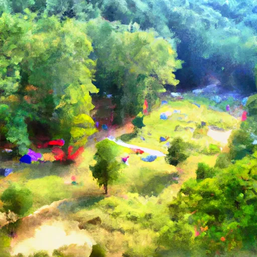
Craigs Creek Group Use Area
Reservations are accepted at Craigs Creek Group Use Area, which is highly recommended, especially during peak seasons. This ensures that you have a guaranteed spot and can plan your camping trip accordingly. The campground is open year-round, providing opportunities for camping in all seasons. However, the best time to visit is during spring and fall when the weather is milder and the surrounding nature is at its most vibrant.
When visiting Craigs Creek Group Use Area, campers should be cautious of potential wildlife encounters, such as snakes and ticks, which are common in the area. It is also advised to bring insect repellent to protect against mosquitoes. Additionally, campers should follow all safety regulations and guidelines, including proper disposal of trash and fire safety precautions. By taking these measures, visitors can fully enjoy the serene beauty of Craigs Creek Group Use Area while staying safe and comfortable during their camping trip.
What's on-site at Craigs Creek Group Use Area
Key facilities Snoflo tracks for this campground. Confirm with the operator before booking -- amenities can change seasonally.
Plan your trip down to the hour
Same weather feed Snoflo's iOS app uses -- updated continuously from NOAA / yr.no.
Next 5 days, hour by hour
Temperature line with weather symbols on top, snow + rain accumulation as columns, humidity as a dotted line.
5-day forecast table
Every 3 hours, broken out across temperature, snow, rain, humidity, and wind. Each cell is colour-coded relative to the column min/max so trends jump out at a glance.
| Time | Condition | Temp (°F) | Snow (in) | Rain (in) | Humidity (%) | Wind (mps) | Wind dir |
|---|---|---|---|---|---|---|---|
| Loading detailed forecast… | |||||||
15-day temperature & precipitation
Daily temperatures, snow, and rain projected over the next two weeks. Hover any point for the full breakdown.
Other campgrounds in the area
Snoflo-tracked campsites within driving distance of Craigs Creek Group Use Area, with reservations status.
| Campground | Reservations | Toilets | View |
|---|---|---|---|
| Holly Bay Rec Area | ✓ | ✗ | → |
| Holly Bay Campground | ✓ | ✗ | → |
| White Oak Boat-In Campground | ✗ | ✗ | → |
| Grove Boat-In Campground | ✓ | ✗ | → |
| Grove Drive-In Campground | ✓ | ✗ | → |
Nearby streamflow
USGS streamgauges within reach of Craigs Creek Group Use Area -- pulled live from the National Water Information System.
| Streamgauge | Discharge | View |
|---|---|---|
| Lynn Camp Creek At Corbin | 20 cfs | → |
| Cumberland River At Cumberland Falls | 1,730 cfs | → |
| Rockcastle River At Billows | 272 cfs | → |
| Cumberland River At Williamsburg | 1,300 cfs | → |
| Buck Creek Near Shopville | 1,230 cfs | → |
| Clear Fork At Saxton | 378 cfs | → |
Nearby snow depths
NRCS SNOTEL stations within reach of Craigs Creek Group Use Area -- relevant when planning a shoulder-season or alpine trip.
| SNOTEL station | Snowpack | 24h Snowfall | View |
|---|---|---|---|
| Clover Bottom 1 Wsw | 0.0 in | 0.0 in | → |
| Booneville 12sw | 0.0 in | 0.0 in | → |
Plan a longer trip
The closest parks, lakes, boat launches, and paddle runs so a camping night can grow into a full weekend.
Parks
- Buck Creek Wildlife Management Area
- Cumberland Falls State Resort Park
- Levi Jackson Wilderness Road State Park
- Wilderness Beaver Creek
- General Burnside Island State Park
- Dr Thomas Walker State Historic Site
Boat launches
Points of interest
- Sander's Cafe And Museum
- Engineer Street Bridge
- Short Creek Cave
- Beast Mode
- Natural Arch Scenic Area
- Yahoo Falls
Paddle runs
- Kentucky Road 80 Bridge To Downstream Part Of Rockcastle Narrows
- 4 Miles Downstream From The Kentucky Highway 90 Bridge To Confluence With Cane Creek
- Kentucky Road 679 To Confluence Of Cumberland River
- Kentucky Road 478 To Kentucky Road 679
- Tn/Ky State Line To White Oak Junction
- Turkey Foot Campground To Confluence With South Fork Of Station Camp Creek
Camping essentials & Leave No Trace
- Pack it in, pack it out
- Take all trash, food scraps, and gear back with you to keep campsites clean and protect wildlife.
- Respect wildlife
- Observe animals from a distance, store food securely, and never feed wildlife to maintain natural behavior and safety.
- Know before you go
- Check weather, fire restrictions, trail conditions, and permit requirements to ensure a safe and well-planned trip.
- Minimize campfire impact
- Use established fire rings, keep fires small, fully extinguish them, or opt for a camp stove when fires are restricted.
- Leave what you find
- Preserve natural and cultural features by avoiding removal of plants, rocks, artifacts, or other elements of the environment.
Set push alerts in the Snoflo app
Save Craigs Creek Group Use Area as a favorite, set a custom threshold (precipitation, snowpack, freezing temperatures), and the iOS app will push the moment conditions cross.
About Craigs Creek Group Use Area
Can I make reservations at Craigs Creek Group Use Area?
Yes -- this campground accepts reservations. Snoflo recommends booking early for peak season; check the operator (Recreation.gov / state park system / private operator) for the booking window and cancellation policy.
How fresh is the weather data on this page?
The hourly forecast updates throughout the day from the NOAA / yr.no public feeds. Streamflow data is pulled live from USGS streamgauges and snowpack from the NRCS SNOTEL network.
What's the best time of year to visit?
Use the 15-day temperature & precipitation outlook on this page to plan -- pick a window with comfortable temperatures and low precipitation. For longer trips, the 5-day hourly meteogram shows snow + rain accumulation hour-by-hour.
How do I get to Craigs Creek Group Use Area?
Tap Directions in the hero above to open driving directions in Google Maps, or Open in map to center the Snoflo interactive map on the campground.
Can I get alerts when conditions change?
Yes -- alerts are managed through the Snoflo iOS app. Favorite this campground, set a threshold (temperature, snowpack, precipitation), and you'll get a push the moment it crosses.
Other campgrounds near here
Snoflo-tracked campgrounds within driving distance of Craigs Creek Group Use Area.