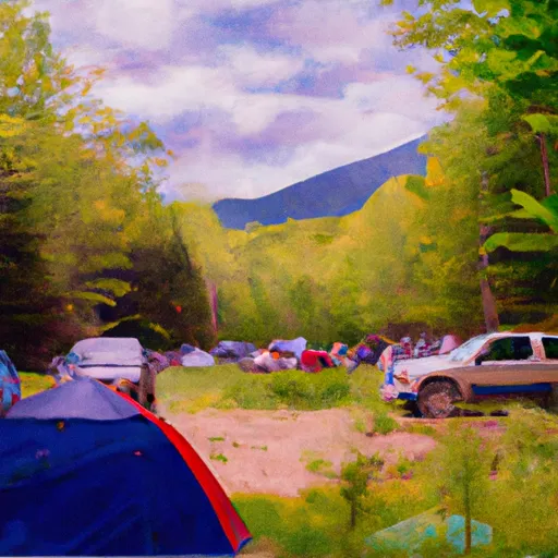
Tripoli Rd Campground
Community Reviews
Been here? Share the conditions.
Reviews, ratings & photos are added in the free Snoflo iOS app — rate a spot, tag the conditions, and your visit is verified by location. Add or manage your reviews from the app.
Tripoli Rd
A quirky fact about the area is that Tripoli Rd was named after a World War II battle that happened in North Africa. Interestingly, the road was built during the Cold War, and the government planned to use it to evacuate Boston in case of a nuclear attack.
The best time to visit the Tripoli Rd Camping Area is from late spring to early fall when the weather is pleasant for outdoor activities. The average temperature during the summer months is around 70°F, making it an excellent time for hiking, fishing, and other outdoor activities. In the fall, the foliage is particularly stunning, with a riot of colors that make it an excellent time for photographers.
In summary, the Tripoli Rd Camping Area is an ideal spot for campers and outdoor enthusiasts looking for a serene environment surrounded by stunning views. With numerous points of interest nearby, excellent amenities, and a quirky history, it is a must-visit destination in New Hampshire.
What's on-site at Tripoli Rd
Key facilities Snoflo tracks for this campground. Confirm with the operator before booking -- amenities can change seasonally.
Plan your trip down to the hour
Same weather feed Snoflo's iOS app uses -- updated continuously from NOAA / yr.no.
Next 5 days, hour by hour
Temperature line with weather symbols on top, snow + rain accumulation as columns, humidity as a dotted line.
5-day forecast table
Every 3 hours, broken out across temperature, snow, rain, humidity, and wind. Each cell is colour-coded relative to the column min/max so trends jump out at a glance.
| Time | Condition | Temp (°F) | Snow (in) | Rain (in) | Humidity (%) | Wind (mps) | Wind dir |
|---|---|---|---|---|---|---|---|
| Loading detailed forecast… | |||||||
15-day temperature & precipitation
Daily temperatures, snow, and rain projected over the next two weeks. Hover any point for the full breakdown.
Other campgrounds in the area
Snoflo-tracked campsites within driving distance of Tripoli Rd, with reservations status.
| Campground | Reservations | Toilets | View |
|---|---|---|---|
| Tripoli Road Camping Area | ✗ | ✗ | → |
| Russell Pond | ✗ | ✗ | → |
| Waterest Campground | ✗ | ✗ | → |
| Koa Campground | ✗ | ✗ | → |
| Hancock | ✗ | ✗ | → |
Nearby streamflow
USGS streamgauges within reach of Tripoli Rd -- pulled live from the National Water Information System.
| Streamgauge | Discharge | View |
|---|---|---|
| Pemigewasset River At Woodstock | 133 cfs | → |
| East Branch Pemigewasset River At Lincoln | 92 cfs | → |
| Pemigewasset River At Plymouth | 272 cfs | → |
| Baker River Near Rumney | 38 cfs | → |
| Ammonoosuc River At Bethlehem Junction | 74 cfs | → |
| Bearcamp River At South Tamworth | 16 cfs | → |
Nearby snow depths
NRCS SNOTEL stations within reach of Tripoli Rd -- relevant when planning a shoulder-season or alpine trip.
| SNOTEL station | Snowpack | 24h Snowfall | View |
|---|---|---|---|
| Nohrsc Hubbard Brook | 0.0 in | 0.0 in | → |
| Holderness 4.6 Nw | 0.0 in | 0.0 in | → |
| Crawford Notch | 0.0 in | 0.0 in | → |
| East Sandwich | 0.0 in | 0.0 in | → |
| Nohrsc Center Sandwich 4.9 E | 0.0 in | 0.0 in | → |
| Nohrsc Tamworth 0.4 Nnw | 0.0 in | 0.0 in | → |
Plan a longer trip
The closest parks, lakes, boat launches, and paddle runs so a camping night can grow into a full weekend.
Parks
- Franconia Notch State Park
- Wilderness Pemigewasset
- Wilderness Sandwich Range
- Wilderness Presidential Range-Dry River
- White Mountain National Forest
- Crawford Notch State Park
Boat launches
- Mirror Lake Boat Launch
- Stinson Lake Boat Launch
- Echo Lake Boat Launch
- Bog Pond
- White Mountain National Forest
- Olivarian Road 99, Benton
Camping essentials & Leave No Trace
- Pack it in, pack it out
- Take all trash, food scraps, and gear back with you to keep campsites clean and protect wildlife.
- Respect wildlife
- Observe animals from a distance, store food securely, and never feed wildlife to maintain natural behavior and safety.
- Know before you go
- Check weather, fire restrictions, trail conditions, and permit requirements to ensure a safe and well-planned trip.
- Minimize campfire impact
- Use established fire rings, keep fires small, fully extinguish them, or opt for a camp stove when fires are restricted.
- Leave what you find
- Preserve natural and cultural features by avoiding removal of plants, rocks, artifacts, or other elements of the environment.
Set push alerts in the Snoflo app
Save Tripoli Rd as a favorite, set a custom threshold (precipitation, snowpack, freezing temperatures), and the iOS app will push the moment conditions cross.
About Tripoli Rd
Can I make reservations at Tripoli Rd?
This campground does not appear to accept reservations -- it's typically first-come, first-served. Arrive early on summer weekends.
How fresh is the weather data on this page?
The hourly forecast updates throughout the day from the NOAA / yr.no public feeds. Streamflow data is pulled live from USGS streamgauges and snowpack from the NRCS SNOTEL network.
What's the best time of year to visit?
Use the 15-day temperature & precipitation outlook on this page to plan -- pick a window with comfortable temperatures and low precipitation. For longer trips, the 5-day hourly meteogram shows snow + rain accumulation hour-by-hour.
How do I get to Tripoli Rd?
Tap Directions in the hero above to open driving directions in Google Maps, or Open in map to center the Snoflo interactive map on the campground.
Can I get alerts when conditions change?
Yes -- alerts are managed through the Snoflo iOS app. Favorite this campground, set a threshold (temperature, snowpack, precipitation), and you'll get a push the moment it crosses.
Other campgrounds near here
Snoflo-tracked campgrounds within driving distance of Tripoli Rd.