Charles Waters Campground Campground
Community Reviews
Been here? Share the conditions.
Reviews, ratings & photos are added in the free Snoflo iOS app — rate a spot, tag the conditions, and your visit is verified by location. Add or manage your reviews from the app.
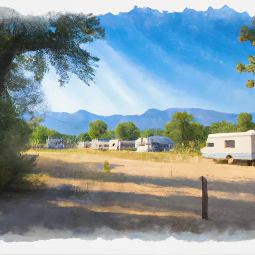
Charles Waters Campground
Reservations are accepted at Charles Waters Campground, ensuring campers have a guaranteed spot during their visit. It is recommended to make a reservation in advance, especially during peak seasons, to secure a desirable campsite. The campground offers both tent and RV camping options, making it suitable for all types of campers.
The best time to visit Charles Waters Campground is during the summer months, from June to September, when the weather is generally pleasant and accommodating for outdoor activities. However, it is crucial to note that Montana's weather can be unpredictable, so it is advisable to come prepared with appropriate clothing and gear for sudden changes in conditions.
While enjoying the campground, campers should be mindful of wildlife in the area, particularly bears. It is essential to store food properly and follow guidelines for bear safety. Additionally, respecting the campsite and leaving it clean for the next visitors is important to preserve the natural beauty of the surroundings.
Overall, Charles Waters Campground offers a peaceful and enjoyable camping experience in the state of Montana. With its amenities, reservation availability, and natural attractions, it is an ideal destination for nature enthusiasts and those seeking a relaxing outdoor getaway.
What's on-site at Charles Waters Campground
Key facilities Snoflo tracks for this campground. Confirm with the operator before booking -- amenities can change seasonally.
Plan your trip down to the hour
Same weather feed Snoflo's iOS app uses -- updated continuously from NOAA / yr.no.
Next 5 days, hour by hour
Temperature line with weather symbols on top, snow + rain accumulation as columns, humidity as a dotted line.
5-day forecast table
Every 3 hours, broken out across temperature, snow, rain, humidity, and wind. Each cell is colour-coded relative to the column min/max so trends jump out at a glance.
| Time | Condition | Temp (°F) | Snow (in) | Rain (in) | Humidity (%) | Wind (mps) | Wind dir |
|---|---|---|---|---|---|---|---|
| Loading detailed forecast… | |||||||
15-day temperature & precipitation
Daily temperatures, snow, and rain projected over the next two weeks. Hover any point for the full breakdown.
Other campgrounds in the area
Snoflo-tracked campsites within driving distance of Charles Waters Campground, with reservations status.
| Campground | Reservations | Toilets | View |
|---|---|---|---|
| Charles Waters | ✗ | ✗ | → |
| Larry Creek Group Site Group Campground | ✓ | ✗ | → |
| Chief Looking Glass Fas | ✗ | ✓ | → |
| Gold Creek Campground | ✗ | ✗ | → |
| West Fork Butte Lookout | ✗ | ✗ | → |
Nearby streamflow
USGS streamgauges within reach of Charles Waters Campground -- pulled live from the National Water Information System.
| Streamgauge | Discharge | View |
|---|---|---|
| Bitterroot River At Bell Crossing Nr Victor Mt | 516 cfs | → |
| Bitterroot River Near Missoula Mt | 1,230 cfs | → |
| Clark Fork Below Missoula Mt | 3,760 cfs | → |
| Clark Fork Above Missoula Mt | 2,550 cfs | → |
| Clark Fork At Turah Bridge Nr Bonner Mt | 1,220 cfs | → |
| Rock Creek Near Clinton Mt | 544 cfs | → |
Nearby snow depths
NRCS SNOTEL stations within reach of Charles Waters Campground -- relevant when planning a shoulder-season or alpine trip.
| SNOTEL station | Snowpack | 24h Snowfall | View |
|---|---|---|---|
| Missoula 4.4 W | 0.0 in | 0.0 in | → |
| Lolo Pass | 0.0 in | 0.0 in | → |
| Nohrsc Lolo Pass | 0.0 in | 0.0 in | → |
| Missoula | 0.0 in | 0.0 in | → |
| Savage Pass | 1.0 in | 0.0 in | → |
| Missoula 6 Nw Wfo | 0.0 in | 0.0 in | → |
Plan a longer trip
The closest parks, lakes, boat launches, and paddle runs so a camping night can grow into a full weekend.
Parks
- Lee Metcalf National Wildlife Refuge
- Fort Owen State Park
- Travelers' Rest State Park
- Wilderness Welcome Creek
- Playfair Park
- Missoula Memorial Rose Garden
Boat launches
Fishing spots
- Bass Creek
- Burnt Fork Bitterroot River
- Blodgett Creek
- Bitterroot River
- Blackfoot River
- Burnt Fork Lake
Points of interest
- Fort Owen State Park
- Studio Greytak
- Historical Museum At Fort Missoula
- Glacial Lake Missoula Strandlines
- Radius Gallery
- The Artists' Shop
Paddle runs
- No Name Creek Headwaters, Sec. 30, T10n, R22w To Mainstem, Sec. 24, T10n, R22w
- Mainstem Headwaters, Sec. 35, T10n, R22w To South Fork Lolo Creek Trailhead, Sec. 12, T11n, R22w
- West Side Blodgett Campground, Sec. 17, T6n, R21w To Bitterroot Forest Boundary, Sec. 17, T6n, R21w
- S-B Boundary, Sec. 17, T6n, R21w To Westside Of Blodgett Campground, Sec. 17, T6n, R22w
- Trail #47 And #50, Sec. 5, T36n, R15e To Selway-Bitterroot Wilderness Boundary, Sec. 36, T36n, R15e
- Blodgett Lake Dam, Sec. 27, T6n, R23w To S-B Wilderness Boundary, Sec. 17, T6n, R21w
Camping essentials & Leave No Trace
- Pack it in, pack it out
- Take all trash, food scraps, and gear back with you to keep campsites clean and protect wildlife.
- Respect wildlife
- Observe animals from a distance, store food securely, and never feed wildlife to maintain natural behavior and safety.
- Know before you go
- Check weather, fire restrictions, trail conditions, and permit requirements to ensure a safe and well-planned trip.
- Minimize campfire impact
- Use established fire rings, keep fires small, fully extinguish them, or opt for a camp stove when fires are restricted.
- Leave what you find
- Preserve natural and cultural features by avoiding removal of plants, rocks, artifacts, or other elements of the environment.
Set push alerts in the Snoflo app
Save Charles Waters Campground as a favorite, set a custom threshold (precipitation, snowpack, freezing temperatures), and the iOS app will push the moment conditions cross.
About Charles Waters Campground
Can I make reservations at Charles Waters Campground?
This campground does not appear to accept reservations -- it's typically first-come, first-served. Arrive early on summer weekends.
How fresh is the weather data on this page?
The hourly forecast updates throughout the day from the NOAA / yr.no public feeds. Streamflow data is pulled live from USGS streamgauges and snowpack from the NRCS SNOTEL network.
What's the best time of year to visit?
Use the 15-day temperature & precipitation outlook on this page to plan -- pick a window with comfortable temperatures and low precipitation. For longer trips, the 5-day hourly meteogram shows snow + rain accumulation hour-by-hour.
How do I get to Charles Waters Campground?
Tap Directions in the hero above to open driving directions in Google Maps, or Open in map to center the Snoflo interactive map on the campground.
Can I get alerts when conditions change?
Yes -- alerts are managed through the Snoflo iOS app. Favorite this campground, set a threshold (temperature, snowpack, precipitation), and you'll get a push the moment it crosses.
Other campgrounds near here
Snoflo-tracked campgrounds within driving distance of Charles Waters Campground.