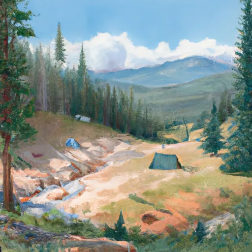
Washington Creek Campground
Community Reviews
Been here? Share the conditions.
Reviews, ratings & photos are added in the free Snoflo iOS app — rate a spot, tag the conditions, and your visit is verified by location. Add or manage your reviews from the app.
Washington Creek
There are several nearby points of interest that make the Washington Creek Camping Area a great place to stay. The area is home to many hiking trails that lead to scenic overlooks and mountain lakes. The nearby Magruder Corridor is a popular destination for off-road enthusiasts.
The campground amenities include vault toilets, picnic tables, and fire rings. There is a nearby water source for drinking and cooking, but visitors need to bring their own water or filter it. The campground is first-come-first-serve and has 17 campsites.
An interesting fact about the area is that it was once home to the Nez Perce tribe, who used the land for fishing and hunting. The tribe's history is still evident in the area, with several historical sites and landmarks.
The best time of year to visit the Washington Creek Camping Area is from June through September. During this time, temperatures range from 60-80 degrees Fahrenheit during the day and 30-50 degrees Fahrenheit at night. Visitors should be aware that the area can experience sudden weather changes and should prepare accordingly.
What's on-site at Washington Creek
Key facilities Snoflo tracks for this campground. Confirm with the operator before booking -- amenities can change seasonally.
Plan your trip down to the hour
Same weather feed Snoflo's iOS app uses -- updated continuously from NOAA / yr.no.
Next 5 days, hour by hour
Temperature line with weather symbols on top, snow + rain accumulation as columns, humidity as a dotted line.
5-day forecast table
Every 3 hours, broken out across temperature, snow, rain, humidity, and wind. Each cell is colour-coded relative to the column min/max so trends jump out at a glance.
| Time | Condition | Temp (°F) | Snow (in) | Rain (in) | Humidity (%) | Wind (mps) | Wind dir |
|---|---|---|---|---|---|---|---|
| Loading detailed forecast… | |||||||
15-day temperature & precipitation
Daily temperatures, snow, and rain projected over the next two weeks. Hover any point for the full breakdown.
Other campgrounds in the area
Snoflo-tracked campsites within driving distance of Washington Creek, with reservations status.
| Campground | Reservations | Toilets | View |
|---|---|---|---|
| Station Creek Camp | ✗ | ✗ | → |
| Weitas Creek Campground | ✓ | ✗ | → |
| Weitas | ✗ | ✗ | → |
| Noe Creek Campground | ✗ | ✗ | → |
| Noe Creek | ✗ | ✗ | → |
Nearby streamflow
USGS streamgauges within reach of Washington Creek -- pulled live from the National Water Information System.
| Streamgauge | Discharge | View |
|---|---|---|
| Nf Clearwater River Nr Canyon Ranger Station Id | 1,200 cfs | → |
| St. Joe River At Red Ives Ranger Station Id | 117 cfs | → |
| Lolo Creek Nr Greer Id | 257 cfs | → |
| Clearwater River At Orofino Id | 2,630 cfs | → |
| Lochsa River Nr Lowell Id | 914 cfs | → |
| Clearwater River Nr Peck Id | 11,300 cfs | → |
Nearby snow depths
NRCS SNOTEL stations within reach of Washington Creek -- relevant when planning a shoulder-season or alpine trip.
| SNOTEL station | Snowpack | 24h Snowfall | View |
|---|---|---|---|
| Shanghi Summit | 0.0 in | -1.0 in | → |
| Shanghi Summit | 1.0 in | 0.0 in | → |
| Nohrsc Cool Creek | 2.0 in | 0.0 in | → |
| Cool Creek | 1.0 in | -1.0 in | → |
| Hemlock Butte | 1.0 in | 1.0 in | → |
| Hemlock Butte | 1.0 in | 0.0 in | → |
Plan a longer trip
The closest parks, lakes, boat launches, and paddle runs so a camping night can grow into a full weekend.
Boat launches
Paddle runs
- Dworshak Reservoir, Sec. 34, T41n, R6e To Forest Road #250, Sec. 6, T40n, R11e
- Road 581, Sec. 19, T39n, R13e To Mouth, Sec. 18, T39n, R10e
- Cedar Creek, Sec. 6, T41n, R6e To Adair Creek
- Dworshak Reservoir, Sec. 19, T41n, R5e To Forest Boundary, Sec. 33, T42n, R6e
- Source, Sec. 19, T39n, R13e To Road #581 Near Moose Ck, Sec. 16, T39n, R11i
- Proposed Hoodoo Wilderness Boundary, Sec. 28, T10n, R26w To Mouth, Clearwater Nf
Camping essentials & Leave No Trace
- Pack it in, pack it out
- Take all trash, food scraps, and gear back with you to keep campsites clean and protect wildlife.
- Respect wildlife
- Observe animals from a distance, store food securely, and never feed wildlife to maintain natural behavior and safety.
- Know before you go
- Check weather, fire restrictions, trail conditions, and permit requirements to ensure a safe and well-planned trip.
- Minimize campfire impact
- Use established fire rings, keep fires small, fully extinguish them, or opt for a camp stove when fires are restricted.
- Leave what you find
- Preserve natural and cultural features by avoiding removal of plants, rocks, artifacts, or other elements of the environment.
Set push alerts in the Snoflo app
Save Washington Creek as a favorite, set a custom threshold (precipitation, snowpack, freezing temperatures), and the iOS app will push the moment conditions cross.
About Washington Creek
Can I make reservations at Washington Creek?
This campground does not appear to accept reservations -- it's typically first-come, first-served. Arrive early on summer weekends.
How fresh is the weather data on this page?
The hourly forecast updates throughout the day from the NOAA / yr.no public feeds. Streamflow data is pulled live from USGS streamgauges and snowpack from the NRCS SNOTEL network.
What's the best time of year to visit?
Use the 15-day temperature & precipitation outlook on this page to plan -- pick a window with comfortable temperatures and low precipitation. For longer trips, the 5-day hourly meteogram shows snow + rain accumulation hour-by-hour.
How do I get to Washington Creek?
Tap Directions in the hero above to open driving directions in Google Maps, or Open in map to center the Snoflo interactive map on the campground.
Can I get alerts when conditions change?
Yes -- alerts are managed through the Snoflo iOS app. Favorite this campground, set a threshold (temperature, snowpack, precipitation), and you'll get a push the moment it crosses.
Other campgrounds near here
Snoflo-tracked campgrounds within driving distance of Washington Creek.