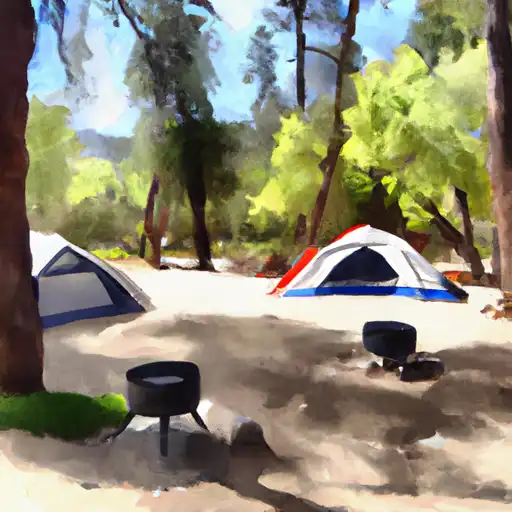
Grover Hot Springs State Park campground
Grover Hot Springs State Park
Reservations are accepted at Grover Hot Springs State Park, which is recommended, especially during peak seasons. This ensures campers have a guaranteed spot and avoids any disappointment upon arrival. The campground offers both tent and RV sites, accommodating different camping preferences.
The best time to visit Grover Hot Springs State Park is typically during the spring and fall seasons when the weather is mild and comfortable. Summers tend to be hot, while winters can be cold and snowy. It's important to note that the park is at a high elevation, so temperatures can fluctuate significantly throughout the day and night.
One of the highlights of the camping area is the Grover Hot Springs themselves. These geothermal pools provide a unique experience for visitors, offering relaxation and rejuvenation. However, it's essential to be cautious when using the hot springs as the water can be very hot. Following posted rules and guidelines is crucial for a safe and enjoyable experience.
Overall, Grover Hot Springs State Park offers a beautiful camping experience with various amenities, accepting reservations to ensure a hassle-free stay. It is best to plan a visit during the spring or fall, and while enjoying the hot springs, being mindful of safety precautions will ensure a memorable and enjoyable camping trip.
What's on-site at Grover Hot Springs State Park
Key facilities Snoflo tracks for this campground. Confirm with the operator before booking -- amenities can change seasonally.
Plan your trip down to the hour
Same weather feed Snoflo's iOS app uses -- updated continuously from NOAA / yr.no.
Next 5 days, hour by hour
Temperature line with weather symbols on top, snow + rain accumulation as columns, humidity as a dotted line.
5-day forecast table
Every 3 hours, broken out across temperature, snow, rain, humidity, and wind. Each cell is colour-coded relative to the column min/max so trends jump out at a glance.
| Time | Condition | Temp (°F) | Snow (in) | Rain (in) | Humidity (%) | Wind (mps) | Wind dir |
|---|---|---|---|---|---|---|---|
| Loading detailed forecast… | |||||||
15-day temperature & precipitation
Daily temperatures, snow, and rain projected over the next two weeks. Hover any point for the full breakdown.
Other campgrounds in the area
Snoflo-tracked campsites within driving distance of Grover Hot Springs State Park, with reservations status.
| Campground | Reservations | Toilets | View |
|---|---|---|---|
| Turtle Rock Park | ✗ | ✓ | → |
| Turtle Rock Campground | ✗ | ✗ | → |
| Markleeville | ✗ | ✓ | → |
| Markleeville Campground | ✗ | ✗ | → |
| Indian Creek Camp Ground | ✗ | ✗ | → |
Nearby streamflow
USGS streamgauges within reach of Grover Hot Springs State Park -- pulled live from the National Water Information System.
| Streamgauge | Discharge | View |
|---|---|---|
| E F Carson R Bl Markleeville C Nr Markleevilleca | 329 cfs | → |
| West Fork Carson River At Woodfords | 79 cfs | → |
| 4l C Nr Markleeville Ca | 0 cfs | → |
| Leviathan C Channel Underdrain Nr Markleeville Ca | 0 cfs | → |
| Leviathan Mine Adit Drain Nr Markleeville Ca | 0 cfs | → |
| Leviathan C Ab Aspen C Nr Markleeville Ca | 0 cfs | → |
Nearby snow depths
NRCS SNOTEL stations within reach of Grover Hot Springs State Park -- relevant when planning a shoulder-season or alpine trip.
| SNOTEL station | Snowpack | 24h Snowfall | View |
|---|---|---|---|
| Spratt Creek | 0.0 in | 0.0 in | → |
| Nohrsc Spratt Creek | 0.0 in | 0.0 in | → |
| Burnside Lake | 1.0 in | 1.0 in | → |
| Nohrsc Burnside Lake | 0.0 in | 0.0 in | → |
| Forestdale Creek | 0.0 in | 0.0 in | → |
| Nohrsc Forestdale Creek | 0.0 in | 0.0 in | → |
Plan a longer trip
The closest parks, lakes, boat launches, and paddle runs so a camping night can grow into a full weekend.
Parks
- Grover Hot Springs State Park
- Heenan Lake Wildlife Area
- Ranchos Aspen Park
- Ranchos Conifer Park
- Lake Valley State Recreation Area
- Washoe Meadows State Park
Boat launches
- Summit Lake Trail Alpine County
- Indian Creek Camp Ground Day Use Area
- Amador County
- Topaz Park Road Douglas County
- Cave Rock Boat Launch Douglas County
Fishing spots
Paddle runs
- Centerville Flat To Hangman's Bridge
- Headwaters In Sec 2, T9n, R18e To Confluence With Mokelumne River
- Source Sec 24, T6n, R21e To Centerville Flat
- Headwaters To South Of Upper Truckee Road (Sec Line Between 17/20 Intercepts River And Unnamed Tributary)
- Highway 4 To Salt Springs Reservoir
- Headwaters In Sec 15,T10n, R17e To Confluence With Silver Fork Of American River
Camping essentials & Leave No Trace
- Pack it in, pack it out
- Take all trash, food scraps, and gear back with you to keep campsites clean and protect wildlife.
- Respect wildlife
- Observe animals from a distance, store food securely, and never feed wildlife to maintain natural behavior and safety.
- Know before you go
- Check weather, fire restrictions, trail conditions, and permit requirements to ensure a safe and well-planned trip.
- Minimize campfire impact
- Use established fire rings, keep fires small, fully extinguish them, or opt for a camp stove when fires are restricted.
- Leave what you find
- Preserve natural and cultural features by avoiding removal of plants, rocks, artifacts, or other elements of the environment.
Set push alerts in the Snoflo app
Save Grover Hot Springs State Park as a favorite, set a custom threshold (precipitation, snowpack, freezing temperatures), and the iOS app will push the moment conditions cross.
About Grover Hot Springs State Park
Can I make reservations at Grover Hot Springs State Park?
Yes -- this campground accepts reservations. Snoflo recommends booking early for peak season; check the operator (Recreation.gov / state park system / private operator) for the booking window and cancellation policy.
How fresh is the weather data on this page?
The hourly forecast updates throughout the day from the NOAA / yr.no public feeds. Streamflow data is pulled live from USGS streamgauges and snowpack from the NRCS SNOTEL network.
What's the best time of year to visit?
Use the 15-day temperature & precipitation outlook on this page to plan -- pick a window with comfortable temperatures and low precipitation. For longer trips, the 5-day hourly meteogram shows snow + rain accumulation hour-by-hour.
How do I get to Grover Hot Springs State Park?
Tap Directions in the hero above to open driving directions in Google Maps, or Open in map to center the Snoflo interactive map on the campground.
Can I get alerts when conditions change?
Yes -- alerts are managed through the Snoflo iOS app. Favorite this campground, set a threshold (temperature, snowpack, precipitation), and you'll get a push the moment it crosses.
Other campgrounds near here
Snoflo-tracked campgrounds within driving distance of Grover Hot Springs State Park.