Banco Bonito Campground campground
Community Reviews
Been here? Share the conditions.
Reviews, ratings & photos are added in the free Snoflo iOS app — rate a spot, tag the conditions, and your visit is verified by location. Add or manage your reviews from the app.
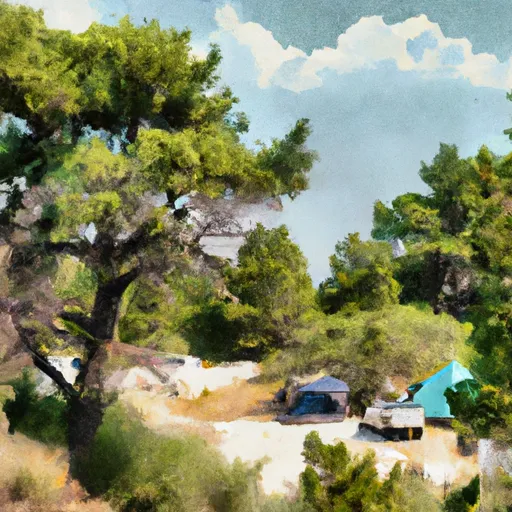
Banco Bonito Campground
The campground provides several amenities to cater to camper's needs. It offers picnic tables, fire rings, and grills, making it perfect for outdoor cooking and dining. Additionally, there are clean restrooms and potable water available, ensuring convenience during your stay. It is important to note that Banco Bonito Campground does not offer electrical hookups, so campers should plan accordingly.
Reservations are accepted at Banco Bonito Campground, allowing campers to secure their spot in advance. This is especially recommended during peak seasons when the campground tends to get busy. It is advisable to check with the campground administration for availability and reservation details.
The best time to visit Banco Bonito Campground is during the summer and fall months when the weather is pleasant and ideal for camping activities. It is important to note that during the winter, the campground may experience snowfall, which can limit access and make camping more challenging. Additionally, it is crucial to be cautious of wildlife in the area and take necessary precautions to avoid any encounters. Overall, Banco Bonito Campground provides a serene and well-equipped camping environment, offering a delightful experience for nature enthusiasts.
What's on-site at Banco Bonito Campground
Key facilities Snoflo tracks for this campground. Confirm with the operator before booking -- amenities can change seasonally.
Plan your trip down to the hour
Same weather feed Snoflo's iOS app uses -- updated continuously from NOAA / yr.no.
Next 5 days, hour by hour
Temperature line with weather symbols on top, snow + rain accumulation as columns, humidity as a dotted line.
5-day forecast table
Every 3 hours, broken out across temperature, snow, rain, humidity, and wind. Each cell is colour-coded relative to the column min/max so trends jump out at a glance.
| Time | Condition | Temp (°F) | Snow (in) | Rain (in) | Humidity (%) | Wind (mps) | Wind dir |
|---|---|---|---|---|---|---|---|
| Loading detailed forecast… | |||||||
15-day temperature & precipitation
Daily temperatures, snow, and rain projected over the next two weeks. Hover any point for the full breakdown.
Other campgrounds in the area
Snoflo-tracked campsites within driving distance of Banco Bonito Campground, with reservations status.
| Campground | Reservations | Toilets | View |
|---|---|---|---|
| Banco Bonito Campground (Special Use Permit Required) | ✗ | ✗ | → |
| Jemez Falls | ✗ | ✓ | → |
| Jemez Falls Campground | ✗ | ✗ | → |
| Redondo | ✓ | ✓ | → |
| Redondo Campground | ✗ | ✗ | → |
Nearby streamflow
USGS streamgauges within reach of Banco Bonito Campground -- pulled live from the National Water Information System.
| Streamgauge | Discharge | View |
|---|---|---|
| Jemez River Near Jemez | 17 cfs | → |
| Rito De Los Frijoles In Bandelier Nat Mon | 1 cfs | → |
| Rio Grande Below Cochiti Dam | 126 cfs | → |
| Rio Grande At Otowi Bridge | 266 cfs | → |
| Rio Grande At San Felipe | 532 cfs | → |
| Rio Chama Below Abiquiu Dam | 220 cfs | → |
Nearby snow depths
NRCS SNOTEL stations within reach of Banco Bonito Campground -- relevant when planning a shoulder-season or alpine trip.
| SNOTEL station | Snowpack | 24h Snowfall | View |
|---|---|---|---|
| Redondo (Valles Caldera) | 0.0 in | 0.0 in | → |
| Headquarters (Valles Caldera) | 0.0 in | 0.0 in | → |
| Wolf Canyon | 0.0 in | 0.0 in | → |
| Nohrsc Garita Peak | 0.0 in | 0.0 in | → |
| Nohrsc Quemazon | 1.0 in | 0.0 in | → |
| Quemazon | 1.0 in | 0.0 in | → |
Plan a longer trip
The closest parks, lakes, boat launches, and paddle runs so a camping night can grow into a full weekend.
Parks
- Valles Caldera National Preserve
- Fenton Lake State Park
- Western Area Park
- Urban Park
- Homestead Crossing Trail
- Wilderness Dome
Boat launches
Fishing spots
- Rincon Fishing Site
- Dark Canyon Fishing Site
- Bluffs Fishing Site
- River's Bend Fishing Site
- San Diego Fishing Site
- Las Casitas Fishing Site
Camping essentials & Leave No Trace
- Pack it in, pack it out
- Take all trash, food scraps, and gear back with you to keep campsites clean and protect wildlife.
- Respect wildlife
- Observe animals from a distance, store food securely, and never feed wildlife to maintain natural behavior and safety.
- Know before you go
- Check weather, fire restrictions, trail conditions, and permit requirements to ensure a safe and well-planned trip.
- Minimize campfire impact
- Use established fire rings, keep fires small, fully extinguish them, or opt for a camp stove when fires are restricted.
- Leave what you find
- Preserve natural and cultural features by avoiding removal of plants, rocks, artifacts, or other elements of the environment.
Set push alerts in the Snoflo app
Save Banco Bonito Campground as a favorite, set a custom threshold (precipitation, snowpack, freezing temperatures), and the iOS app will push the moment conditions cross.
About Banco Bonito Campground
Can I make reservations at Banco Bonito Campground?
This campground does not appear to accept reservations -- it's typically first-come, first-served. Arrive early on summer weekends.
How fresh is the weather data on this page?
The hourly forecast updates throughout the day from the NOAA / yr.no public feeds. Streamflow data is pulled live from USGS streamgauges and snowpack from the NRCS SNOTEL network.
What's the best time of year to visit?
Use the 15-day temperature & precipitation outlook on this page to plan -- pick a window with comfortable temperatures and low precipitation. For longer trips, the 5-day hourly meteogram shows snow + rain accumulation hour-by-hour.
How do I get to Banco Bonito Campground?
Tap Directions in the hero above to open driving directions in Google Maps, or Open in map to center the Snoflo interactive map on the campground.
Can I get alerts when conditions change?
Yes -- alerts are managed through the Snoflo iOS app. Favorite this campground, set a threshold (temperature, snowpack, precipitation), and you'll get a push the moment it crosses.
Other campgrounds near here
Snoflo-tracked campgrounds within driving distance of Banco Bonito Campground.