Cuchillo De Medio Campground
Community Reviews
Been here? Share the conditions.
Reviews, ratings & photos are added in the free Snoflo iOS app — rate a spot, tag the conditions, and your visit is verified by location. Add or manage your reviews from the app.
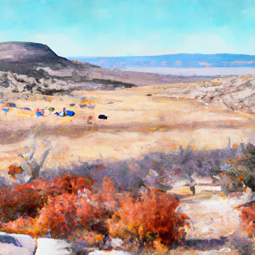
Cuchillo De Medio
Reservations are not accepted at Cuchillo De Medio camping area; therefore, it operates on a first-come, first-served basis. It is advised to arrive early, especially during peak seasons, to secure a camping spot. The best time to visit this camping area is during spring and fall when the weather is mild and pleasant. Summers can be hot, so it is recommended to carry plenty of water and to seek shade during the day.
Cuchillo De Medio camping area offers several points of interest nearby. Campers can explore the Cibola National Forest, which provides opportunities for hiking, wildlife viewing, and photography. The area is also known for its beautiful wildflowers, making it a popular spot for nature enthusiasts. It is important to be cautious of local wildlife, such as snakes, and to follow safe camping practices to ensure a enjoyable and safe experience.
What's on-site at Cuchillo De Medio
Key facilities Snoflo tracks for this campground. Confirm with the operator before booking -- amenities can change seasonally.
Plan your trip down to the hour
Same weather feed Snoflo's iOS app uses -- updated continuously from NOAA / yr.no.
Next 5 days, hour by hour
Temperature line with weather symbols on top, snow + rain accumulation as columns, humidity as a dotted line.
5-day forecast table
Every 3 hours, broken out across temperature, snow, rain, humidity, and wind. Each cell is colour-coded relative to the column min/max so trends jump out at a glance.
| Time | Condition | Temp (°F) | Snow (in) | Rain (in) | Humidity (%) | Wind (mps) | Wind dir |
|---|---|---|---|---|---|---|---|
| Loading detailed forecast… | |||||||
15-day temperature & precipitation
Daily temperatures, snow, and rain projected over the next two weeks. Hover any point for the full breakdown.
Other campgrounds in the area
Snoflo-tracked campsites within driving distance of Cuchillo De Medio, with reservations status.
| Campground | Reservations | Toilets | View |
|---|---|---|---|
| Cuchillo | ✗ | ✓ | → |
| Cuchillo Del Medio Campground | ✗ | ✗ | → |
| Cuchilla Campground | ✗ | ✗ | → |
| Lower Hondo Campground | ✗ | ✗ | → |
| Lower Hondo | ✗ | ✓ | → |
Nearby streamflow
USGS streamgauges within reach of Cuchillo De Medio -- pulled live from the National Water Information System.
| Streamgauge | Discharge | View |
|---|---|---|
| Rio Hondo Near Valdez | 11 cfs | → |
| Rio Lucero Near Arroyo Seco | 6 cfs | → |
| Rio Pueblo De Taos Near Taos | 4 cfs | → |
| Red River Near Questa | 16 cfs | → |
| Red River Below Fish Hatchery | 24 cfs | → |
| Rio Pueblo De Taos Below Los Cordovas | 4 cfs | → |
Nearby snow depths
NRCS SNOTEL stations within reach of Cuchillo De Medio -- relevant when planning a shoulder-season or alpine trip.
| SNOTEL station | Snowpack | 24h Snowfall | View |
|---|---|---|---|
| Top 7 | 3.3 in | 0.0 in | → |
| Taos Powderhorn | 0.0 in | 0.0 in | → |
| Base Area - Rueggli | 1.6 in | 0.0 in | → |
| Nohrsc Red River Pass #2 | 0.0 in | 0.0 in | → |
| Red River Pass #2 | 0.0 in | 0.0 in | → |
| Eagle Nest | 0.0 in | 0.0 in | → |
Plan a longer trip
The closest parks, lakes, boat launches, and paddle runs so a camping night can grow into a full weekend.
Parks
- Wilderness Area Columbine Hondo
- Wilderness Wheeler Peak
- Red Willow State Park
- Fred Baca Park
- Filemon Sanchez Fairground - Park
- Wilderness Latir Peak
Boat launches
- John Dunn Bridge Boat Takeout
- John Dunn Bridge Boat Launch
- Eagle Nest State Park
- Marina Way Eagle Nest
- Taos Junction Bridge Taos County
- Taos Junction Bridge Boat Takeout
Fishing spots
- Columbine Creek Fishing
- Rio Grande Fishing
- Red River Fishing
- Rio Fernando Fishing
- Rio Chiquito Fishing
- Rito De La Olla Fishing
Camping essentials & Leave No Trace
- Pack it in, pack it out
- Take all trash, food scraps, and gear back with you to keep campsites clean and protect wildlife.
- Respect wildlife
- Observe animals from a distance, store food securely, and never feed wildlife to maintain natural behavior and safety.
- Know before you go
- Check weather, fire restrictions, trail conditions, and permit requirements to ensure a safe and well-planned trip.
- Minimize campfire impact
- Use established fire rings, keep fires small, fully extinguish them, or opt for a camp stove when fires are restricted.
- Leave what you find
- Preserve natural and cultural features by avoiding removal of plants, rocks, artifacts, or other elements of the environment.
Set push alerts in the Snoflo app
Save Cuchillo De Medio as a favorite, set a custom threshold (precipitation, snowpack, freezing temperatures), and the iOS app will push the moment conditions cross.
About Cuchillo De Medio
Can I make reservations at Cuchillo De Medio?
This campground does not appear to accept reservations -- it's typically first-come, first-served. Arrive early on summer weekends.
How fresh is the weather data on this page?
The hourly forecast updates throughout the day from the NOAA / yr.no public feeds. Streamflow data is pulled live from USGS streamgauges and snowpack from the NRCS SNOTEL network.
What's the best time of year to visit?
Use the 15-day temperature & precipitation outlook on this page to plan -- pick a window with comfortable temperatures and low precipitation. For longer trips, the 5-day hourly meteogram shows snow + rain accumulation hour-by-hour.
How do I get to Cuchillo De Medio?
Tap Directions in the hero above to open driving directions in Google Maps, or Open in map to center the Snoflo interactive map on the campground.
Can I get alerts when conditions change?
Yes -- alerts are managed through the Snoflo iOS app. Favorite this campground, set a threshold (temperature, snowpack, precipitation), and you'll get a push the moment it crosses.
Other campgrounds near here
Snoflo-tracked campgrounds within driving distance of Cuchillo De Medio.