Gibson Cove - Chatuge Reservoir Campground
Community Reviews
Been here? Share the conditions.
Reviews, ratings & photos are added in the free Snoflo iOS app — rate a spot, tag the conditions, and your visit is verified by location. Add or manage your reviews from the app.
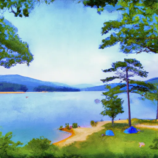
Gibson Cove - Chatuge Reservoir
Gibson Cove - Chatuge Reservoir is a campground in North-Carolina tracked by Snoflo. This page combines live weather, USGS streamflow, NRCS snowpack readings, and amenity data with nearby parks, lakes, and boat launches so you can plan a trip from a single screen.
Use the forecast meteograms to pick a weather window, the amenities card to confirm reservations and facilities, and the Nearby section to extend a single night into a longer trip. For push alerts when conditions change, save this campground as a favorite in the Snoflo iOS app.
What's on-site at Gibson Cove - Chatuge Reservoir
Key facilities Snoflo tracks for this campground. Confirm with the operator before booking -- amenities can change seasonally.
Plan your trip down to the hour
Same weather feed Snoflo's iOS app uses -- updated continuously from NOAA / yr.no.
Next 5 days, hour by hour
Temperature line with weather symbols on top, snow + rain accumulation as columns, humidity as a dotted line.
5-day forecast table
Every 3 hours, broken out across temperature, snow, rain, humidity, and wind. Each cell is colour-coded relative to the column min/max so trends jump out at a glance.
| Time | Condition | Temp (°F) | Snow (in) | Rain (in) | Humidity (%) | Wind (mps) | Wind dir |
|---|---|---|---|---|---|---|---|
| Loading detailed forecast… | |||||||
15-day temperature & precipitation
Daily temperatures, snow, and rain projected over the next two weeks. Hover any point for the full breakdown.
Other campgrounds in the area
Snoflo-tracked campsites within driving distance of Gibson Cove - Chatuge Reservoir, with reservations status.
| Campground | Reservations | Toilets | View |
|---|---|---|---|
| Clay County Recreation Campground | ✗ | ✗ | → |
| Gibson Cove Campground | ✗ | ✗ | → |
| Clay Co Park | ✗ | ✗ | → |
| Jackrabbit Mountain | ✓ | ✗ | → |
| Jackrabbit Mountain Campground | ✗ | ✗ | → |
Nearby streamflow
USGS streamgauges within reach of Gibson Cove - Chatuge Reservoir -- pulled live from the National Water Information System.
| Streamgauge | Discharge | View |
|---|---|---|
| Nantahala River Near Rainbow Springs | 254 cfs | → |
| Valley River At Tomotla | 182 cfs | → |
| Nottely River Near Blairsville | 120 cfs | → |
| Tallulah River Near Clayton | 159 cfs | → |
| Chattahoochee River At Helen | 55 cfs | → |
| Cartoogechaye Creek Near Franklin | 261 cfs | → |
Nearby snow depths
NRCS SNOTEL stations within reach of Gibson Cove - Chatuge Reservoir -- relevant when planning a shoulder-season or alpine trip.
| SNOTEL station | Snowpack | 24h Snowfall | View |
|---|---|---|---|
| Germany Valley | 0.0 in | 0.0 in | → |
| Dillard 0.7 Nnw | 0.0 in | 0.0 in | → |
| Sautee 3.5 Sw | 0.0 in | 0.0 in | → |
| Dahlonega | 0.0 in | 0.0 in | → |
| Bryson City 4 | 0.0 in | 0.0 in | → |
| New Found Gap | 14.4 in | 0.0 in | → |
Plan a longer trip
The closest parks, lakes, boat launches, and paddle runs so a camping night can grow into a full weekend.
Parks
- Nantahala National Forest
- Wilderness Southern Nantahala
- Wilderness Brasstown
- Moccasin Creek State Park
- Wilderness Tray Mountain
- Vogel State Park
Boat launches
- Jackrabbit Boating Access
- Ledfords Chapel
- Music Hall Road Towns County
- The Ridges Resort & Marina
- Chatuge Cove Marina
- Lake Chatuge Towns County
Fishing spots
- Hickory Nut Cove Trout Farm
- Lake Burton
- Massey Branch Fishing Pier
- Seed Lake
- Santeetlah Lake
- Dockery Lake
Points of interest
- Cherokee Homestead Exhibit
- Waterwheel
- Fishing Hole Rock
- Treetop Terrace
- Old Union County Courthouse
- M551 Sheridan
Paddle runs
- Headwaters In Standing Indian Basin To Slackwater Of Natahala Lake
- Source Near Chattahoochee Gap To Mark Trail Wilderness Boundary
- Mark Trail Wilderness Boundry To Old Turnpike Crossing Near Vandiver Branch
- Old Turnpike Crossing To Martin Branch Bridge
- Martin Branch Bridge To Robertsontown Bridge On Ga Highway 356
- Headwaters Near Mitchell Lick To Owlcamp Branch
Camping essentials & Leave No Trace
- Pack it in, pack it out
- Take all trash, food scraps, and gear back with you to keep campsites clean and protect wildlife.
- Respect wildlife
- Observe animals from a distance, store food securely, and never feed wildlife to maintain natural behavior and safety.
- Know before you go
- Check weather, fire restrictions, trail conditions, and permit requirements to ensure a safe and well-planned trip.
- Minimize campfire impact
- Use established fire rings, keep fires small, fully extinguish them, or opt for a camp stove when fires are restricted.
- Leave what you find
- Preserve natural and cultural features by avoiding removal of plants, rocks, artifacts, or other elements of the environment.
Set push alerts in the Snoflo app
Save Gibson Cove - Chatuge Reservoir as a favorite, set a custom threshold (precipitation, snowpack, freezing temperatures), and the iOS app will push the moment conditions cross.
About Gibson Cove - Chatuge Reservoir
Can I make reservations at Gibson Cove - Chatuge Reservoir?
This campground does not appear to accept reservations -- it's typically first-come, first-served. Arrive early on summer weekends.
How fresh is the weather data on this page?
The hourly forecast updates throughout the day from the NOAA / yr.no public feeds. Streamflow data is pulled live from USGS streamgauges and snowpack from the NRCS SNOTEL network.
What's the best time of year to visit?
Use the 15-day temperature & precipitation outlook on this page to plan -- pick a window with comfortable temperatures and low precipitation. For longer trips, the 5-day hourly meteogram shows snow + rain accumulation hour-by-hour.
How do I get to Gibson Cove - Chatuge Reservoir?
Tap Directions in the hero above to open driving directions in Google Maps, or Open in map to center the Snoflo interactive map on the campground.
Can I get alerts when conditions change?
Yes -- alerts are managed through the Snoflo iOS app. Favorite this campground, set a threshold (temperature, snowpack, precipitation), and you'll get a push the moment it crosses.
Other campgrounds near here
Snoflo-tracked campgrounds within driving distance of Gibson Cove - Chatuge Reservoir.