Lake Chatuga Campground
Community Reviews
Been here? Share the conditions.
Reviews, ratings & photos are added in the free Snoflo iOS app — rate a spot, tag the conditions, and your visit is verified by location. Add or manage your reviews from the app.
Lake Chatuga
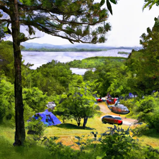
Reservations are accepted at Lake Chatuge Camping Area, allowing campers to secure their spot in advance and ensure availability. This is particularly beneficial during peak seasons when the campground tends to fill up quickly.
The best time of year to visit Lake Chatuge Camping Area is during the spring and fall months, when the weather is pleasant and the surrounding natural beauty is at its peak. However, it is advisable to check the weather forecast before planning a trip, as conditions can change rapidly in this area.
While exploring the camping area, visitors should be cautious of the local wildlife and take necessary precautions to ensure their safety. It is essential to store food properly to avoid attracting animals and to be aware of any potential hiking hazards, such as uneven terrain or slippery rocks.
What's on-site at Lake Chatuga
Key facilities Snoflo tracks for this campground. Confirm with the operator before booking -- amenities can change seasonally.
Plan your trip down to the hour
Same weather feed Snoflo's iOS app uses -- updated continuously from NOAA / yr.no.
Next 5 days, hour by hour
Temperature line with weather symbols on top, snow + rain accumulation as columns, humidity as a dotted line.
5-day forecast table
Every 3 hours, broken out across temperature, snow, rain, humidity, and wind. Each cell is colour-coded relative to the column min/max so trends jump out at a glance.
| Time | Condition | Temp (°F) | Snow (in) | Rain (in) | Humidity (%) | Wind (mps) | Wind dir |
|---|---|---|---|---|---|---|---|
| Loading detailed forecast… | |||||||
15-day temperature & precipitation
Daily temperatures, snow, and rain projected over the next two weeks. Hover any point for the full breakdown.
Other campgrounds in the area
Snoflo-tracked campsites within driving distance of Lake Chatuga, with reservations status.
| Campground | Reservations | Toilets | View |
|---|---|---|---|
| Georgia Mountain Fair Campground | ✗ | ✗ | → |
| Clay Co Park | ✗ | ✗ | → |
| Jackrabbit Mountain Campground | ✗ | ✗ | → |
| Clay County Recreation Campground | ✗ | ✗ | → |
| Jackrabbit Mountain | ✓ | ✗ | → |
Nearby streamflow
USGS streamgauges within reach of Lake Chatuga -- pulled live from the National Water Information System.
| Streamgauge | Discharge | View |
|---|---|---|
| Kawishiwi River Near Ely | 63 cfs | → |
| South Kawishiwi River Near Ely | 102 cfs | → |
| South Kawishiwi R Abv White Iron Lake Nr Ely | 162 cfs | → |
| Knife River Near Two Harbors | 13 cfs | → |
| Basswood River Near Winton | 495 cfs | → |
| Whittlesey Creek Near Ashland | 21 cfs | → |
Nearby snow depths
NRCS SNOTEL stations within reach of Lake Chatuga -- relevant when planning a shoulder-season or alpine trip.
| SNOTEL station | Snowpack | 24h Snowfall | View |
|---|---|---|---|
| Germany Valley | 0.0 in | 0.0 in | → |
| Sautee 3.5 Sw | 0.0 in | 0.0 in | → |
| Dillard 0.7 Nnw | 0.0 in | 0.0 in | → |
| Dahlonega | 0.0 in | 0.0 in | → |
| Bryson City 4 | 0.0 in | 0.0 in | → |
| New Found Gap | 16.1 in | 0.0 in | → |
Plan a longer trip
The closest parks, lakes, boat launches, and paddle runs so a camping night can grow into a full weekend.
Parks
- Wilderness Brasstown
- Nantahala National Forest
- Wilderness Southern Nantahala
- Moccasin Creek State Park
- Wilderness Tray Mountain
- Vogel State Park
Boat launches
- Lake County
- Crooked Lake
- Taconite Harbor
- Dumbbell Lake
- Hogback Lupus Trail Loop Lake County
- Lax Lake Public Water Access
Fishing spots
Points of interest
- Waterwheel
- Fishing Hole Rock
- Cherokee Homestead Exhibit
- Old Union County Courthouse
- World's Largest Amish Chair
- Paradise Valley Resort Tasting Room
Paddle runs
- Source Near Chattahoochee Gap To Mark Trail Wilderness Boundary
- Mark Trail Wilderness Boundry To Old Turnpike Crossing Near Vandiver Branch
- Old Turnpike Crossing To Martin Branch Bridge
- Headwaters In Standing Indian Basin To Slackwater Of Natahala Lake
- Martin Branch Bridge To Robertsontown Bridge On Ga Highway 356
- Headwaters Near Mitchell Lick To Owlcamp Branch
Camping essentials & Leave No Trace
- Pack it in, pack it out
- Take all trash, food scraps, and gear back with you to keep campsites clean and protect wildlife.
- Respect wildlife
- Observe animals from a distance, store food securely, and never feed wildlife to maintain natural behavior and safety.
- Know before you go
- Check weather, fire restrictions, trail conditions, and permit requirements to ensure a safe and well-planned trip.
- Minimize campfire impact
- Use established fire rings, keep fires small, fully extinguish them, or opt for a camp stove when fires are restricted.
- Leave what you find
- Preserve natural and cultural features by avoiding removal of plants, rocks, artifacts, or other elements of the environment.
Set push alerts in the Snoflo app
Save Lake Chatuga as a favorite, set a custom threshold (precipitation, snowpack, freezing temperatures), and the iOS app will push the moment conditions cross.
About Lake Chatuga
Can I make reservations at Lake Chatuga?
This campground does not appear to accept reservations -- it's typically first-come, first-served. Arrive early on summer weekends.
How fresh is the weather data on this page?
The hourly forecast updates throughout the day from the NOAA / yr.no public feeds. Streamflow data is pulled live from USGS streamgauges and snowpack from the NRCS SNOTEL network.
What's the best time of year to visit?
Use the 15-day temperature & precipitation outlook on this page to plan -- pick a window with comfortable temperatures and low precipitation. For longer trips, the 5-day hourly meteogram shows snow + rain accumulation hour-by-hour.
How do I get to Lake Chatuga?
Tap Directions in the hero above to open driving directions in Google Maps, or Open in map to center the Snoflo interactive map on the campground.
Can I get alerts when conditions change?
Yes -- alerts are managed through the Snoflo iOS app. Favorite this campground, set a threshold (temperature, snowpack, precipitation), and you'll get a push the moment it crosses.
Other campgrounds near here
Snoflo-tracked campgrounds within driving distance of Lake Chatuga.