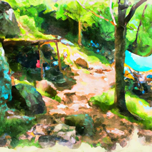
Mountaineer Shelter campground
Community Reviews
Been here? Share the conditions.
Reviews, ratings & photos are added in the free Snoflo iOS app — rate a spot, tag the conditions, and your visit is verified by location. Add or manage your reviews from the app.
Mountaineer Shelter
Reservations are not accepted at the Mountaineer Shelter camping area. Therefore, it operates on a first-come, first-served basis. It is advisable to arrive early to secure a spot, especially during peak seasons when the campground tends to be busier.
The best time to visit Mountaineer Shelter camping area is during the spring and fall seasons when the weather is mild and most enjoyable. Summers can be hot and humid, while winters can bring cold temperatures and snow. It is essential to pack appropriate clothing and gear to withstand the varying weather conditions.
While camping at Mountaineer Shelter, there are several points of interest to explore. The camping area provides access to various hiking trails, allowing visitors to enjoy the scenic beauty of the surrounding mountains. However, it is crucial to be cautious of wildlife encounters, particularly black bears, as they are known to inhabit the area. Campers should store food securely and follow proper camping etiquette to avoid attracting any unwanted wildlife.
In summary, Mountaineer Shelter camping area in North Carolina offers campers a serene and picturesque retreat. With its amenities, first-come, first-served policy, and ideal times to visit, it provides an excellent opportunity to immerse oneself in nature while enjoying the beauty of the mountains. However, campers should remain vigilant and take necessary precautions to ensure a safe and enjoyable camping experience.
What's on-site at Mountaineer Shelter
Key facilities Snoflo tracks for this campground. Confirm with the operator before booking -- amenities can change seasonally.
Plan your trip down to the hour
Same weather feed Snoflo's iOS app uses -- updated continuously from NOAA / yr.no.
Next 5 days, hour by hour
Temperature line with weather symbols on top, snow + rain accumulation as columns, humidity as a dotted line.
5-day forecast table
Every 3 hours, broken out across temperature, snow, rain, humidity, and wind. Each cell is colour-coded relative to the column min/max so trends jump out at a glance.
| Time | Condition | Temp (°F) | Snow (in) | Rain (in) | Humidity (%) | Wind (mps) | Wind dir |
|---|---|---|---|---|---|---|---|
| Loading detailed forecast… | |||||||
15-day temperature & precipitation
Daily temperatures, snow, and rain projected over the next two weeks. Hover any point for the full breakdown.
Other campgrounds in the area
Snoflo-tracked campsites within driving distance of Mountaineer Shelter, with reservations status.
| Campground | Reservations | Toilets | View |
|---|---|---|---|
| Upper Laurel Fork | ✗ | ✗ | → |
| Mountain View Motorcycle Campground | ✗ | ✗ | → |
| Doll Flats Camping Area | ✗ | ✗ | → |
| Teepee Camp Hoa | ✗ | ✗ | → |
| Roan Mountain State Park | ✓ | ✗ | → |
Nearby streamflow
USGS streamgauges within reach of Mountaineer Shelter -- pulled live from the National Water Information System.
| Streamgauge | Discharge | View |
|---|---|---|
| Watauga River Near Sugar Grove | 150 cfs | → |
| Doe River At Elizabethton | 293 cfs | → |
| Watauga River At Elizabethton | 826 cfs | → |
| Nolichucky River At Embreeville | 2,020 cfs | → |
| Yadkin River At Patterson | 26 cfs | → |
| South Toe River Near Celo | 536 cfs | → |
Nearby snow depths
NRCS SNOTEL stations within reach of Mountaineer Shelter -- relevant when planning a shoulder-season or alpine trip.
| SNOTEL station | Snowpack | 24h Snowfall | View |
|---|---|---|---|
| Flat Springs 1e | 0.0 in | 0.0 in | → |
| Flat Springs 1.2 E | 0.0 in | 0.0 in | → |
| Beech Mountain | 0.0 in | 0.0 in | → |
| Banner Elk | 0.0 in | 0.0 in | → |
| Vilas 6.3 Nnw | 0.0 in | 0.0 in | → |
| Elizabethton | 0.0 in | 0.0 in | → |
Plan a longer trip
The closest parks, lakes, boat launches, and paddle runs so a camping night can grow into a full weekend.
Parks
- Wilderness Pond Mountain
- Roan Mountain State Park
- Beech Creek Bog State Natural Area
- Watauga Point Recreational Area
- Wilderness Big Laurel Brcanch
- Bear Paw State Natural Area
Boat launches
- Pioneer Landing Campground
- Moody Circle Carter County
- Mallard Cove Road
- Fish Springs Marina
- Watauga Lakeshores Marina
- Cove Ridge Yacht Club And Marina
Fishing spots
Points of interest
- Clark Gallery
- Wautauga Dam
- Grandfather Mountain
- Wilson Center For Nature Discovery
- Greater Foscoe Mining Company
- Beacon Heights Parking Area
Paddle runs
- Watauga Reservoir To Tn/Nc State Line
- Headwaters Above Linville Gap To Blue Ridge Parkway Boundary
- Headwaters To Tn/Va State Line
- Blue Ridge Parkway Boundary To Linville Gorge Boundary
- Boundary Between Mitchell And Yancy Counties To Nc/Tn Stateline
- Tn/Nc State Line (Rm 100.6) To Mine Branch (Rm 99.3)
Camping essentials & Leave No Trace
- Pack it in, pack it out
- Take all trash, food scraps, and gear back with you to keep campsites clean and protect wildlife.
- Respect wildlife
- Observe animals from a distance, store food securely, and never feed wildlife to maintain natural behavior and safety.
- Know before you go
- Check weather, fire restrictions, trail conditions, and permit requirements to ensure a safe and well-planned trip.
- Minimize campfire impact
- Use established fire rings, keep fires small, fully extinguish them, or opt for a camp stove when fires are restricted.
- Leave what you find
- Preserve natural and cultural features by avoiding removal of plants, rocks, artifacts, or other elements of the environment.
Set push alerts in the Snoflo app
Save Mountaineer Shelter as a favorite, set a custom threshold (precipitation, snowpack, freezing temperatures), and the iOS app will push the moment conditions cross.
About Mountaineer Shelter
Can I make reservations at Mountaineer Shelter?
This campground does not appear to accept reservations -- it's typically first-come, first-served. Arrive early on summer weekends.
How fresh is the weather data on this page?
The hourly forecast updates throughout the day from the NOAA / yr.no public feeds. Streamflow data is pulled live from USGS streamgauges and snowpack from the NRCS SNOTEL network.
What's the best time of year to visit?
Use the 15-day temperature & precipitation outlook on this page to plan -- pick a window with comfortable temperatures and low precipitation. For longer trips, the 5-day hourly meteogram shows snow + rain accumulation hour-by-hour.
How do I get to Mountaineer Shelter?
Tap Directions in the hero above to open driving directions in Google Maps, or Open in map to center the Snoflo interactive map on the campground.
Can I get alerts when conditions change?
Yes -- alerts are managed through the Snoflo iOS app. Favorite this campground, set a threshold (temperature, snowpack, precipitation), and you'll get a push the moment it crosses.
Other campgrounds near here
Snoflo-tracked campgrounds within driving distance of Mountaineer Shelter.